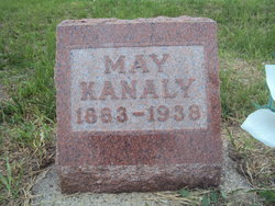
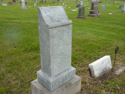
| Birth | : | 11 Jun 1877 Hurley, Turner County, South Dakota, USA |
| Death | : | 21 Feb 1942 Tonasket, Okanogan County, Washington, USA |
| Burial | : | Ellisforde Mission Cemetery, Ellisforde, Okanogan County, USA |
| Coordinate | : | 48.7908300, -119.3972300 |
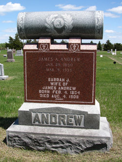
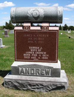
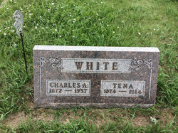
| Description | : | Bernice (Andrew) Hultman White, died in St. Martin’s hospital at the age of 64 years, 8 months, and 10 days. She was the daughter of James Andrew and Sarah Vipond. A resident of Oroville, Washington, she was survived by her second husband Charles A. White. Washington State Death certificate. Bernice married first to Harry J. Hultman on Dec. 29, 1910 in Beadle county, South Dakota. He passed away in 1913. The wife of Charles A. White had died in 1914. Bernice and Charles married and by 1920, they had moved to Washington state. Charles continued living... Read More |
frequently asked questions (FAQ):
-
Where is Bernice Hanna Andrew White's memorial?
Bernice Hanna Andrew White's memorial is located at: Ellisforde Mission Cemetery, Ellisforde, Okanogan County, USA.
-
When did Bernice Hanna Andrew White death?
Bernice Hanna Andrew White death on 21 Feb 1942 in Tonasket, Okanogan County, Washington, USA
-
Where are the coordinates of the Bernice Hanna Andrew White's memorial?
Latitude: 48.7908300
Longitude: -119.3972300
Family Members:
Parent
Spouse
Siblings
Flowers:
Nearby Cemetories:
1. Mountain View Memorial Cemetery
Ellisforde, Okanogan County, USA
Coordinate: 48.8328300, -119.4011300
2. Tonasket Cemetery
Tonasket, Okanogan County, USA
Coordinate: 48.7284400, -119.4328200
3. Old Oroville Cemetery
Okanogan County, USA
Coordinate: 48.8913360, -119.4456230
4. Old Riverview Cemetery
Oroville, Okanogan County, USA
Coordinate: 48.9177800, -119.4466700
5. Oroville Riverview Cemetery
Oroville, Okanogan County, USA
Coordinate: 48.9202700, -119.4458500
6. Immanuel Lutheran Cemetery
Havillah, Okanogan County, USA
Coordinate: 48.8305500, -119.2033500
7. Golden Cemetery
Okanogan County, USA
Coordinate: 48.9014015, -119.5203018
8. Mountain View Cemetery
Loomis, Okanogan County, USA
Coordinate: 48.8152700, -119.6100100
9. Anglin Cemetery
Okanogan County, USA
Coordinate: 48.6627700, -119.2783400
10. Little Chopaka Cemetery
Okanogan County, USA
Coordinate: 48.8272200, -119.6430600
11. Phillip Raux Gravesite
Riverside, Okanogan County, USA
Coordinate: 48.6271800, -119.3308500
12. Cook Place Cemetery
Tonasket, Okanogan County, USA
Coordinate: 48.6083330, -119.3544440
13. Cook Family Cemetery
Carlton, Okanogan County, USA
Coordinate: 48.6083300, -119.3544400
14. Kipling Cemetery
Okanogan County, USA
Coordinate: 48.9080500, -119.1652900
15. Molson Cemetery
Molson, Okanogan County, USA
Coordinate: 48.9657000, -119.2105000
16. South Pine Creek Cemetery
Riverside, Okanogan County, USA
Coordinate: 48.5925900, -119.5663400
17. Wauconda Cemetery
Wauconda, Okanogan County, USA
Coordinate: 48.7408300, -119.0597300
18. Pine Creek Cemetery
Tonasket, Okanogan County, USA
Coordinate: 48.6330560, -119.6502780
19. Sidley-Lawless Cemetery
Sidley, Kootenay Boundary Regional District, Canada
Coordinate: 49.0153330, -119.2234330
20. Chesaw Cemetery
Okanogan County, USA
Coordinate: 48.9299900, -119.0541800
21. Tunk Valley Cemetery
Riverside, Okanogan County, USA
Coordinate: 48.5222015, -119.3242035
22. Thomason Ranch Graves
Okanogan County, USA
Coordinate: 48.7757200, -118.9821900
23. Osoyoos Lakeview Cemetery
Osoyoos, Okanagan-Similkameen Regional District, Canada
Coordinate: 49.0638600, -119.5185500
24. Thorp Cemetery
Chesaw, Okanogan County, USA
Coordinate: 48.9549900, -119.0316700

