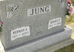
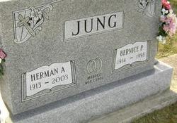
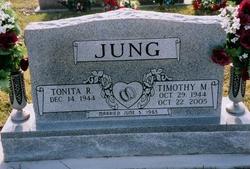
Bernice Pauline Good Jung
| Birth | : | 12 Nov 1914 Hobbs, Tipton County, Indiana, USA |
| Death | : | 12 Dec 1998 Elwood, Madison County, Indiana, USA |
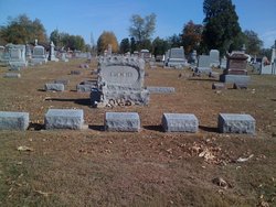
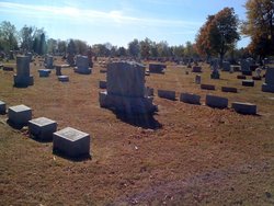
| Burial | : | Williamstown Cemetery, Williamstown, Barossa Council, Australia |
| Coordinate | : | -34.6712876, 138.8851682 |
| Description | : | The Tipton County Tribune (Tipton, Indiana) 14 Dec 1998 Mon Page 2 Bernice Pauline Jung, 84, Elwood,died Saturday at her home. Born Nov 12, 1914, in Hobbs, she was the daughter of Ruel B. and Florence Brown Good. She was married May 1, 1934, to Herman Jung. He survives. She was a member of St. Joseph Catholic Church, N.C.C.W., Tipton County Historical Society, Indiana Historical Society and National Historical Society. She was a volunteer at the Tipton County Public Library where she was instrumental in orchestrating the genealogy card files. Others surviving... Read More |
frequently asked questions (FAQ):
-
Where is Bernice Pauline Good Jung's memorial?
Bernice Pauline Good Jung's memorial is located at: Williamstown Cemetery, Williamstown, Barossa Council, Australia.
-
When did Bernice Pauline Good Jung death?
Bernice Pauline Good Jung death on 12 Dec 1998 in Elwood, Madison County, Indiana, USA
-
Where are the coordinates of the Bernice Pauline Good Jung's memorial?
Latitude: -34.6712876
Longitude: 138.8851682
Family Members:
Parent
Spouse
Children
Flowers:
Nearby Cemetories:
1. Williamstown Cemetery
Williamstown, Barossa Council, Australia
Coordinate: -34.6712876, 138.8851682
2. Hoffnungsthal Lutheran Cemetery
Hoffnungsthal, Barossa Council, Australia
Coordinate: -34.6159080, 138.9133860
3. Mount Crawford United Presbyterian Cemetery
Mount Crawford, Barossa Council, Australia
Coordinate: -34.7014420, 138.9558220
4. Lyndoch Cemetery
Lyndoch, Barossa Council, Australia
Coordinate: -34.6021400, 138.8816400
5. Holy Trinity Anglican Church Cemetery
Lyndoch, Barossa Council, Australia
Coordinate: -34.5989180, 138.8994940
6. Rowland Flat Holy Trinity Lutheran Cemetery
Rowland Flat, Barossa Council, Australia
Coordinate: -34.5877778, 138.9277778
7. Pewsey Vale Cemetery
Pewsey Vale, Barossa Council, Australia
Coordinate: -34.6197650, 138.9795720
8. One Tree Hill Uniting Church Cemetery
One Tree Hill, Playford City, Australia
Coordinate: -34.7185200, 138.7682710
9. Uley Baptist Church Cemetery
Uleybury, Playford City, Australia
Coordinate: -34.6954070, 138.7575960
10. Trinity Lutheran Cemetery
Rosedale, Light Regional Council, Australia
Coordinate: -34.5580000, 138.8464600
11. Concordia Pioneer Cemetery
Concordia, Barossa Council, Australia
Coordinate: -34.5748700, 138.8016100
12. Kersbrook Wesleyan Methodist Cemetery
Kersbrook, Adelaide Hills Council, Australia
Coordinate: -34.7900482, 138.8482557
13. Gawler East Anglican Churchyard
Gawler East, Gawler, Australia
Coordinate: -34.5935650, 138.7637550
14. Krondorf Cemetery
Krondorf, Barossa Council, Australia
Coordinate: -34.5610650, 138.9712520
15. Gomersal Schoenborn Lutheran Cemetery
Gomersal, Light Regional Council, Australia
Coordinate: -34.5401200, 138.9014600
16. Kersbrook Cemetery
Kersbrook, Adelaide Hills Council, Australia
Coordinate: -34.8040693, 138.8486109
17. Gumeracha North Cemetery
Gumeracha, Adelaide Hills Council, Australia
Coordinate: -34.8108700, 138.8913300
18. Birdwood Old Lutheran Cemetery
Birdwood, Adelaide Hills Council, Australia
Coordinate: -34.7942800, 138.9690600
19. Smithfield Memorial Park
Evanston South, Gawler, Australia
Coordinate: -34.6581280, 138.7140465
20. Gomersal Good Shepherd Lutheran Cemetery
Gomersal, Light Regional Council, Australia
Coordinate: -34.5240570, 138.8715950
21. St. John's Lutheran Cemetery
Tanunda, Barossa Council, Australia
Coordinate: -34.5325870, 138.9510190
22. Willaston General Cemetery
Willaston, Gawler, Australia
Coordinate: -34.5779870, 138.7417230
23. Bethany Pioneer Cemetery
Bethany, Barossa Council, Australia
Coordinate: -34.5380780, 138.9717450
24. Birdwood Holy Cross Lutheran Cemetery
Birdwood, Adelaide Hills Council, Australia
Coordinate: -34.8179169, 138.9487534

