
| Birth | : | 11 Aug 1891 Polk County, Iowa, USA |
| Death | : | 1 Mar 1950 USA |
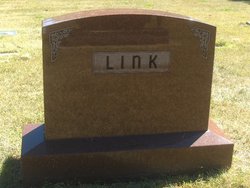
| Burial | : | Northallerton Cemetery, Northallerton, Hambleton District, England |
| Coordinate | : | 54.3410870, -1.4380120 |
| Description | : | Bert Dwight was the twelveth of fourteen children of John George and Christina Guhring Link. He married Amy Mae Beal 16 Jul 1913 and they had one child - Billie Dwight Link. His WWI Draft Card information says he was born in Polk County, Iowa and that he was tall, medium build, blue eyes, hair light colored, that he was farming for himself and that he claimed exemption from the draft - Brethren Church Creed. It also gives the spelling of his middle name oas Dwite and this is the way his signiture appears. |
frequently asked questions (FAQ):
-
Where is Bert Dwight Link's memorial?
Bert Dwight Link's memorial is located at: Northallerton Cemetery, Northallerton, Hambleton District, England.
-
When did Bert Dwight Link death?
Bert Dwight Link death on 1 Mar 1950 in USA
-
Where are the coordinates of the Bert Dwight Link's memorial?
Latitude: 54.3410870
Longitude: -1.4380120
Family Members:
Parent

Spouse
Siblings
Flowers:


Nearby Cemetories:
1. Northallerton Cemetery
Northallerton, Hambleton District, England
Coordinate: 54.3410870, -1.4380120
2. All Saints Churchyard
Northallerton, Hambleton District, England
Coordinate: 54.3420430, -1.4366340
3. St James Churchyard
Romanby, Hambleton District, England
Coordinate: 54.3331660, -1.4474010
4. All Saints Churchyard
Yafforth, Hambleton District, England
Coordinate: 54.3447400, -1.4720100
5. St. Thomas Churchyard
Brompton, Hambleton District, England
Coordinate: 54.3613700, -1.4263900
6. Brompton Cemetery
Northallerton, Hambleton District, England
Coordinate: 54.3614100, -1.4140900
7. St. Helen's Churchyard
Ainderby Steeple, Hambleton District, England
Coordinate: 54.3232200, -1.4870680
8. St Michael and All Angels Churchyard
North Otterington, Hambleton District, England
Coordinate: 54.3017300, -1.4438700
9. Thornton-le-Beans Chapelyard
Thornton-le-Beans, Hambleton District, England
Coordinate: 54.3074250, -1.3934900
10. St Lawrence Churchyard
Kirby Sigston, Hambleton District, England
Coordinate: 54.3458700, -1.3609600
11. Danby Wiske Parish Churchyard
Danby Wiske, Hambleton District, England
Coordinate: 54.3793800, -1.4813060
12. St. Barnabas Church Cemetery
Thornton-le-Moor, Hambleton District, England
Coordinate: 54.2874720, -1.4011833
13. St Andrew Churchyard
South Otterington, Hambleton District, England
Coordinate: 54.2823100, -1.4311300
14. St. Wilfrid Churchyard
Great Langton, Hambleton District, England
Coordinate: 54.3598870, -1.5367380
15. St. Lawrence Churchyard
Hutton Bonville, Hambleton District, England
Coordinate: 54.3958000, -1.4830000
16. St Radegund Churchyard
Scruton, Hambleton District, England
Coordinate: 54.3275320, -1.5398210
17. St Mary the Virgin Churchyard
Leake, Hambleton District, England
Coordinate: 54.3094180, -1.3357310
18. St. Michael and All Angels Churchyard
Maunby, Hambleton District, England
Coordinate: 54.2725530, -1.4606140
19. All Saints Churchyard
Deighton, Hambleton District, England
Coordinate: 54.4099130, -1.4141500
20. St. Oswald Churchyard
East Harlsey, Hambleton District, England
Coordinate: 54.3914290, -1.3451990
21. St Andrew Churchyard
Great Fencote, Hambleton District, England
Coordinate: 54.3366300, -1.5662200
22. St John the Baptist Churchyard
Leeming, Hambleton District, England
Coordinate: 54.2990400, -1.5497100
23. St Mary Churchyard
Kirkby Fleetham, Hambleton District, England
Coordinate: 54.3561750, -1.5691590
24. St Leonard Churchyard
Welbury, Hambleton District, England
Coordinate: 54.4138000, -1.3855600