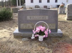
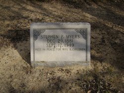
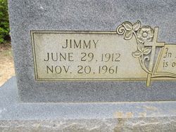
Bertha Marie “Aunt Nig” Myers Williams
| Birth | : | 22 Jul 1916 |
| Death | : | 13 Aug 2005 Orangeburg, Orangeburg County, South Carolina, USA |
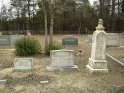
| Burial | : | Pond Street Cemetery, Braintree, Norfolk County, USA |
| Coordinate | : | 42.1996994, -71.0111008 |
| Description | : | Bertha Myers Williams, 89, of Calhoun Convalescent Center, St. Matthews, died Saturday, August 13, 2005, at The Regional Medical Center in Orangeburg after a brief illness. Funeral services will be held at 3 p.m. Tuesday, August 16, at Gerizim United Methodist Church in Vance, with the Rev. Barry Brinson, assisted by the Rev. Melvin Bell. Burial will be in the Gerizim United Methodist Church Cemetery. The casket will be placed in the church at 2 p.m. Active pallbearers will be Roland Moorer, Jerry Hill, V. G. Bell, the Rev. Melvin Bell, W. E. Gray, Charles Smoak, Blaine Shuler and Donnie Wayne Shuler. Ms. Williams... Read More |
frequently asked questions (FAQ):
-
Where is Bertha Marie “Aunt Nig” Myers Williams's memorial?
Bertha Marie “Aunt Nig” Myers Williams's memorial is located at: Pond Street Cemetery, Braintree, Norfolk County, USA.
-
When did Bertha Marie “Aunt Nig” Myers Williams death?
Bertha Marie “Aunt Nig” Myers Williams death on 13 Aug 2005 in Orangeburg, Orangeburg County, South Carolina, USA
-
Where are the coordinates of the Bertha Marie “Aunt Nig” Myers Williams's memorial?
Latitude: 42.1996994
Longitude: -71.0111008
Family Members:
Parent
Spouse
Siblings
Children
Flowers:
Nearby Cemetories:
1. Pond Street Cemetery
Braintree, Norfolk County, USA
Coordinate: 42.1996994, -71.0111008
2. Lakeside Cemetery
Braintree, Norfolk County, USA
Coordinate: 42.2049700, -71.0098000
3. Dyer Hill Cemetery
Braintree, Norfolk County, USA
Coordinate: 42.1924000, -71.0084200
4. Plain Street Cemetery
Braintree, Norfolk County, USA
Coordinate: 42.1976617, -70.9937386
5. Elm Street Cemetery
Braintree, Norfolk County, USA
Coordinate: 42.2209000, -71.0028000
6. Blue Hill Cemetery
Braintree, Norfolk County, USA
Coordinate: 42.2144012, -71.0357971
7. Moses Mendelsohn Memorial Park
Randolph, Norfolk County, USA
Coordinate: 42.1750400, -71.0268600
8. White Cemetery
Braintree, Norfolk County, USA
Coordinate: 42.1925100, -70.9748800
9. Lindwood Memorial Park
Randolph, Norfolk County, USA
Coordinate: 42.1753006, -71.0291977
10. Temple Emanuel Memorial Park
Randolph, Norfolk County, USA
Coordinate: 42.1747800, -71.0288900
11. Central Cemetery
Randolph, Norfolk County, USA
Coordinate: 42.1739006, -71.0333023
12. Pine Hill Cemetery
Quincy, Norfolk County, USA
Coordinate: 42.2269520, -71.0349530
13. Oakland Cemetery
Randolph, Norfolk County, USA
Coordinate: 42.1838989, -71.0511017
14. Saint Marys Cemetery
Randolph, Norfolk County, USA
Coordinate: 42.1705560, -71.0350330
15. Ashwood Cemetery
Weymouth, Norfolk County, USA
Coordinate: 42.2149400, -70.9659300
16. Village Cemetery
Weymouth, Norfolk County, USA
Coordinate: 42.2124138, -70.9613800
17. Reed Cemetery
Weymouth, Norfolk County, USA
Coordinate: 42.1981087, -70.9567184
18. Christ Church Burial Ground
Quincy, Norfolk County, USA
Coordinate: 42.2441500, -71.0021070
19. Union Cemetery
Holbrook, Norfolk County, USA
Coordinate: 42.1535988, -71.0180969
20. Saint Francis Xavier Cemetery
Weymouth, Norfolk County, USA
Coordinate: 42.2033005, -70.9475021
21. Hall Cemetery
Quincy, Norfolk County, USA
Coordinate: 42.2459984, -71.0283127
22. Highland Cemetery
Weymouth, Norfolk County, USA
Coordinate: 42.1742973, -70.9557114
23. Saint Marys Cemetery
Quincy, Norfolk County, USA
Coordinate: 42.2467117, -71.0289230
24. Nash Cemetery
Weymouth, Norfolk County, USA
Coordinate: 42.1810500, -70.9497900

