
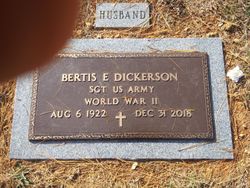
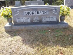

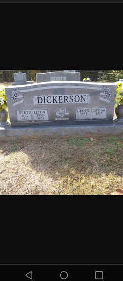
Bertis Elton “Slim” Dickerson
| Birth | : | 6 Aug 1922 Bernie, Stoddard County, Missouri, USA |
| Death | : | 31 Dec 2018 Celina, Clay County, Tennessee, USA |
| Burial | : | Spear Family Cemetery, Moss, Clay County, USA |
| Coordinate | : | 36.5933200, -85.5876500 |
| Description | : | Mr. Bertis “Slim” Elton Dickerson age 96 of Celina, Clay Co., TN went home to be with his Lord and Savior at his residence on Monday evening, December 31, 2018. PERSONAL INFORMATION: Mr. Bertis “Slim” Elton Dickerson was born in Bernie, Stoddard Co., Missouri on August 6, 1922 to the late William and Grace (Cook) Dickerson. He was also a member of the American Legion for 62 years. He served in the Army. He married his sweetheart Georgia Spear on September 28, 1946. SURVIVORS: His wife of 72 years: Georgia Dickerson of Celina, TN; 1 Sister:... Read More |
frequently asked questions (FAQ):
-
Where is Bertis Elton “Slim” Dickerson's memorial?
Bertis Elton “Slim” Dickerson's memorial is located at: Spear Family Cemetery, Moss, Clay County, USA.
-
When did Bertis Elton “Slim” Dickerson death?
Bertis Elton “Slim” Dickerson death on 31 Dec 2018 in Celina, Clay County, Tennessee, USA
-
Where are the coordinates of the Bertis Elton “Slim” Dickerson's memorial?
Latitude: 36.5933200
Longitude: -85.5876500
Family Members:
Parent
Spouse

Flowers:


Nearby Cemetories:
1. Spear Family Cemetery
Moss, Clay County, USA
Coordinate: 36.5933200, -85.5876500
2. Meadows Cemetery
Clay County, USA
Coordinate: 36.5946999, -85.5875015
3. McLerran Cemetery
Moss, Clay County, USA
Coordinate: 36.5790000, -85.5973000
4. Odle Cemetery
Clay County, USA
Coordinate: 36.5966988, -85.6085968
5. New Hope Cemetery
Clay County, USA
Coordinate: 36.6021996, -85.5653000
6. Moss Cemetery
Moss, Clay County, USA
Coordinate: 36.5911210, -85.6214460
7. Strong Family Cemetery
Clay County, USA
Coordinate: 36.5690700, -85.6042600
8. Macedonia Cemetery
Moss, Clay County, USA
Coordinate: 36.5643997, -85.6110992
9. Walker Reecer Cemetery
Celina, Clay County, USA
Coordinate: 36.5746290, -85.5480270
10. Moore Cemetery
Moss, Clay County, USA
Coordinate: 36.6113400, -85.6374980
11. Kendall Cemetery
Moss, Clay County, USA
Coordinate: 36.5672540, -85.6362650
12. Freedom Cemetery #2
Tompkinsville, Monroe County, USA
Coordinate: 36.6284060, -85.6289940
13. Liberty Church Cemetery
Boles, Clay County, USA
Coordinate: 36.6010850, -85.6496830
14. Willhoite-Curtis Cemetery
Tompkinsville, Monroe County, USA
Coordinate: 36.6182208, -85.6442948
15. Plumlee Cemetery
Celina, Clay County, USA
Coordinate: 36.5694280, -85.5282830
16. Dalton Cemetery
Arcott, Clay County, USA
Coordinate: 36.5429540, -85.5546170
17. Eads-Denton Cemetery
Pine Hill, Clay County, USA
Coordinate: 36.5644207, -85.6503187
18. Smith Cemetery
Pine Hill, Clay County, USA
Coordinate: 36.5714930, -85.6568170
19. Bailey Cemetery
Tompkinsville, Monroe County, USA
Coordinate: 36.6530991, -85.5994034
20. Varney Andrews Cemetery
Celina, Clay County, USA
Coordinate: 36.5604650, -85.5209530
21. Stephens Cemetery
Monroe County, USA
Coordinate: 36.6314011, -85.5252991
22. Stone Cemetery
Clay County, USA
Coordinate: 36.5713997, -85.5136032
23. Old Bob Wood Place Cemetery
Boles, Monroe County, USA
Coordinate: 36.6325120, -85.6515600
24. Baxter Cemetery
Hestand, Monroe County, USA
Coordinate: 36.6501460, -85.6264790