
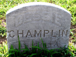
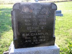
Bessie E. Hogue Champlin
| Birth | : | 16 Oct 1880 Elm Township, Putnam County, Missouri, USA |
| Death | : | 30 Apr 1912 Jamestown, Cloud County, Kansas, USA |
| Burial | : | Edgerton Cemetery, Edgerton, Johnson County, USA |
| Coordinate | : | 38.7524986, -95.0018997 |
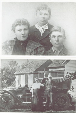
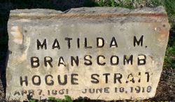
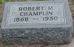
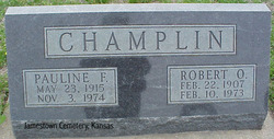
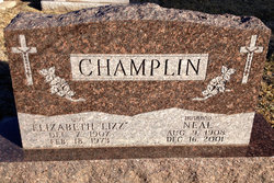
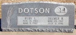
| Description | : | Wife of R.M. Champlin Bessie E Hogue Champlin had children with first Husband Minard "Minor" Doak ( Myrtle Doak, Earl Doak, and Edwin Doak ) Second Husband Robert Melvin Champlin (Robert "Bob" Champlin Jr., Neal Champlin, Ruby Lucille Champlin Dotson) NOTE: contributed by Marsha Dotson |
frequently asked questions (FAQ):
-
Where is Bessie E. Hogue Champlin's memorial?
Bessie E. Hogue Champlin's memorial is located at: Edgerton Cemetery, Edgerton, Johnson County, USA.
-
When did Bessie E. Hogue Champlin death?
Bessie E. Hogue Champlin death on 30 Apr 1912 in Jamestown, Cloud County, Kansas, USA
-
Where are the coordinates of the Bessie E. Hogue Champlin's memorial?
Latitude: 38.7524986
Longitude: -95.0018997
Family Members:
Parent
Spouse

Children
Flowers:


Nearby Cemetories:
1. Edgerton Cemetery
Edgerton, Johnson County, USA
Coordinate: 38.7524986, -95.0018997
2. Saint Columbine Cemetery
Edgerton, Johnson County, USA
Coordinate: 38.7569008, -94.9916992
3. Chilton Family Cemetery
Edgerton, Johnson County, USA
Coordinate: 38.7236800, -94.9819300
4. Rock Creek Cemetery
Antioch, Miami County, USA
Coordinate: 38.7099991, -95.0156021
5. Antioch Cemetery
Antioch, Miami County, USA
Coordinate: 38.7161700, -94.9452800
6. Gardner Cemetery
Gardner, Johnson County, USA
Coordinate: 38.8048096, -94.9372635
7. Four Corners Cemetery
Gardner, Johnson County, USA
Coordinate: 38.8314018, -94.9728012
8. Wellsville Cemetery
Wellsville, Franklin County, USA
Coordinate: 38.7174988, -95.1025009
9. Old Black Jack Cemetery
Black Jack, Douglas County, USA
Coordinate: 38.7536150, -95.1124620
10. Black Jack Cemetery
Douglas County, USA
Coordinate: 38.7660400, -95.1159400
11. Fuller Cemetery
Gardner, Johnson County, USA
Coordinate: 38.7750100, -94.8900300
12. Pleasant Valley Cemetery
Gardner, Johnson County, USA
Coordinate: 38.8480377, -95.0360489
13. Walnut Creek Cemetery
Franklin County, USA
Coordinate: 38.6733017, -95.0832977
14. Clearfield Cemetery
Clearfield, Douglas County, USA
Coordinate: 38.8260002, -95.0930023
15. Adams Burial Ground
Gardner, Johnson County, USA
Coordinate: 38.8579483, -95.0384140
16. Scott Valley Cemetery
Paola, Miami County, USA
Coordinate: 38.6521400, -94.9374200
17. Saint Columbia Cemetery
Gardner, Johnson County, USA
Coordinate: 38.8405991, -94.9092026
18. Deay Cemetery
Eudora, Douglas County, USA
Coordinate: 38.8546486, -95.0749435
19. Old Marysville Cemetery
Hillsdale, Miami County, USA
Coordinate: 38.6731500, -94.8897600
20. Springhill Cemetery
Spring Hill, Johnson County, USA
Coordinate: 38.7466393, -94.8360214
21. Pleasant Valley Cemetery
Stanton, Miami County, USA
Coordinate: 38.6222000, -95.0428009
22. Home Holding Cemetery
Hillsdale, Miami County, USA
Coordinate: 38.6508400, -94.8829000
23. Prairie Center Cemetery
De Soto, Johnson County, USA
Coordinate: 38.8925018, -95.0286026
24. Oakwood Cemetery
Baldwin City, Douglas County, USA
Coordinate: 38.7694016, -95.1825027