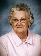
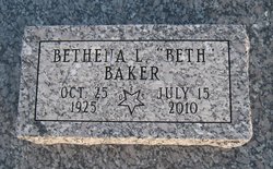
Bethena “Beth” Fowler Baker
| Birth | : | 25 Oct 1925 Moran, Allen County, Kansas, USA |
| Death | : | 15 Jul 2010 Garnett, Anderson County, Kansas, USA |
| Burial | : | Tillsonburg Cemetery, Tillsonburg, Oxford County Municipality, Canada |
| Coordinate | : | 42.8559265, -80.7041931 |
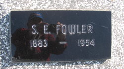
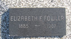
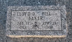
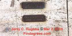
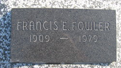
| Description | : | ********************** Published July 16, 2010 - Garnett, KS Bethena Baker, age 84, of Garnett, Kansas, died on Thursday, July 15, 2010 at Golden Heights Living Center, Garnett, Kansas. Beth was born in Moran, Kansas on October 25, 1925, the daughter of Samuel Ernest and Elizabeth (Boggs) Fowler. She graduated from Moran High School and attended college at Allen County and Neosho County Community Colleges. Beth married L.D."Bill" Baker in August of 1944 at Iola, Kansas. He preceded her in death in 1989. They moved to Wichita, KS, and she worked as an office manager for an oil company, she was also a Girl Scout... Read More |
frequently asked questions (FAQ):
-
Where is Bethena “Beth” Fowler Baker's memorial?
Bethena “Beth” Fowler Baker's memorial is located at: Tillsonburg Cemetery, Tillsonburg, Oxford County Municipality, Canada.
-
When did Bethena “Beth” Fowler Baker death?
Bethena “Beth” Fowler Baker death on 15 Jul 2010 in Garnett, Anderson County, Kansas, USA
-
Where are the coordinates of the Bethena “Beth” Fowler Baker's memorial?
Latitude: 42.8559265
Longitude: -80.7041931
Family Members:
Parent
Spouse
Siblings
Flowers:
Nearby Cemetories:
1. Tillsonburg Cemetery
Tillsonburg, Oxford County Municipality, Canada
Coordinate: 42.8559265, -80.7041931
2. Saint Mary's Roman Catholic Cemetery
Tillsonburg, Oxford County Municipality, Canada
Coordinate: 42.8552200, -80.7072600
3. Tillsonburg Pioneer Cemetery
Tillsonburg, Oxford County Municipality, Canada
Coordinate: 42.8597300, -80.7154500
4. Rosanna Cemetery
Rock's Mills, Oxford County Municipality, Canada
Coordinate: 42.8867683, -80.6898270
5. New Road Cemetery
Rock's Mills, Oxford County Municipality, Canada
Coordinate: 42.8870300, -80.6899700
6. Courtland Fellowship Baptist Cemetery
Courtland, Norfolk County, Canada
Coordinate: 42.8361700, -80.6361000
7. Courtland United Cemetery
Courtland, Norfolk County, Canada
Coordinate: 42.8387000, -80.6341100
8. Saint Charles Anglican Cemetery
Tillsonburg, Oxford County Municipality, Canada
Coordinate: 42.9089127, -80.7220459
9. Saint Ladislaus Roman Catholic Church Cemetery
Courtland, Norfolk County, Canada
Coordinate: 42.8358900, -80.6331400
10. Jackson Cemetery
Norfolk County, Canada
Coordinate: 42.8157130, -80.6512090
11. Eden Cemetery
Eden, Elgin County, Canada
Coordinate: 42.8345448, -80.7845962
12. North Middleton Baptist Acacia Cemetery
Norfolk County, Canada
Coordinate: 42.7908760, -80.7037660
13. Bethel Methodist Episcopal Cemetery
Norfolk County, Canada
Coordinate: 42.7942670, -80.6692280
14. New Delmer Cemetery
Delmer, Oxford County Municipality, Canada
Coordinate: 42.8668600, -80.7941200
15. Old Delmer Cemetery
Delmer, Oxford County Municipality, Canada
Coordinate: 42.8697900, -80.7966000
16. Dobbie Cemetery
Bayham, Elgin County, Canada
Coordinate: 42.7938257, -80.7532762
17. Old Eden Cemetery
Eden, Elgin County, Canada
Coordinate: 42.7846900, -80.7455500
18. Sandy Ridge Pet Cemetery
Eden, Elgin County, Canada
Coordinate: 42.7843400, -80.7476900
19. Springford Community Cemetery
Springford, Oxford County Municipality, Canada
Coordinate: 42.9207090, -80.6433210
20. Tillsonburg Old Colony Mennonite Cemetery
Tillsonburg, Oxford County Municipality, Canada
Coordinate: 42.7748290, -80.6918560
21. Best Cemetery
Corinth, Elgin County, Canada
Coordinate: 42.8208389, -80.8180084
22. Erbtown Cemetery
Otterville, Oxford County Municipality, Canada
Coordinate: 42.9232445, -80.6193924
23. Pine Street Burying Ground
Otterville, Oxford County Municipality, Canada
Coordinate: 42.9235458, -80.6128235
24. South Middleton Baptist Cemetery
Glen Meyer, Norfolk County, Canada
Coordinate: 42.7704600, -80.6461890

