
| Birth | : | 20 Sep 1936 Lead, Lawrence County, South Dakota, USA |
| Death | : | 15 Mar 2008 Huron, Beadle County, South Dakota, USA |
| Burial | : | Pinehill Cemetery, River Bennet, Victoria County, Canada |
| Coordinate | : | 46.3308100, -60.5373700 |
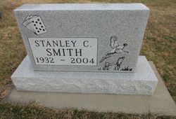
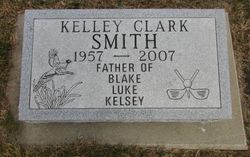
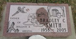
| Description | : | Beverly Olson, age 71, of Huron, died Saturday, March 15, 2008, at her residence. Beverly Olson was born September 20, 1936, to Bill and Blanche (Auwerter) Jewell in Lead, South Dakota. The family lived on a farm at Claremont, Minnesota from 1942 to 1947, before moving to Dallas, South Dakota. Bev attended grade school and three years of high school in Dallas and graduated from high school in Gregory in 1954. She married Stan Smith in 1956. They lived in Winner, where their sons, Kelley and Brad were born. In 1957, she began... Read More |
frequently asked questions (FAQ):
-
Where is Beverly Jewell Olson's memorial?
Beverly Jewell Olson's memorial is located at: Pinehill Cemetery, River Bennet, Victoria County, Canada.
-
When did Beverly Jewell Olson death?
Beverly Jewell Olson death on 15 Mar 2008 in Huron, Beadle County, South Dakota, USA
-
Where are the coordinates of the Beverly Jewell Olson's memorial?
Latitude: 46.3308100
Longitude: -60.5373700
Family Members:
Parent

Spouse
Children
Flowers:


Nearby Cemetories:
1. Pinehill Cemetery
River Bennet, Victoria County, Canada
Coordinate: 46.3308100, -60.5373700
2. Bay View Cemetery
Englishtown, Victoria County, Canada
Coordinate: 46.2884500, -60.5385300
3. The Auld Cemetery
Cape Breton, Cape Breton County, Canada
Coordinate: 46.2881300, -60.5394100
4. MacAskill Family Cemetery
North Shore, Victoria County, Canada
Coordinate: 46.2866974, -60.5408478
5. Indian Brook Cemetery
Indian Brook, Victoria County, Canada
Coordinate: 46.3770180, -60.5226517
6. North River Bridge Pioneer Cemetery
Saint-Anns, Victoria County, Canada
Coordinate: 46.2996500, -60.6195100
7. Riverview Cemetery
North River Bridge, Victoria County, Canada
Coordinate: 46.2940700, -60.6157400
8. River Side Cemetery
North River Bridge, Victoria County, Canada
Coordinate: 46.2940500, -60.6158500
9. Goose Cove cemetery
Harbourview, Victoria County, Canada
Coordinate: 46.2686900, -60.6161600
10. Saint James Presbyterian Cemetery
Big Bras d'Or, Victoria County, Canada
Coordinate: 46.2726191, -60.4269444
11. New Harris Cemetery
New Harris Settlement, Victoria County, Canada
Coordinate: 46.2322700, -60.5049500
12. MacLeod Pioneer Cemetery
MacLeods Point, Victoria County, Canada
Coordinate: 46.2359900, -60.6029700
13. Black Rock Cemetery
Black Rock, Victoria County, Canada
Coordinate: 46.3108940, -60.3822327
14. Harbourview Cemetery
South Haven, Victoria County, Canada
Coordinate: 46.2077500, -60.5948600
15. MacDonald Memorial Cemetery
Indian Brook, Victoria County, Canada
Coordinate: 46.4505400, -60.4643200
16. North Gut Cemetery
Saint-Anns, Victoria County, Canada
Coordinate: 46.2094444, -60.6216667
17. Breton Cove Cemetery
Breton Cove, Victoria County, Canada
Coordinate: 46.4561300, -60.4585800
18. McMillian Cemetery
Big Glen, Victoria County, Canada
Coordinate: 46.2288367, -60.6930524
19. Man O War Point Cemetery
Boularderie, Victoria County, Canada
Coordinate: 46.1795400, -60.5547100
20. Point Aconi Cemetery
Point Aconi, Cape Breton County, Canada
Coordinate: 46.3046100, -60.2893200
21. Church of Saint Anne - Alder Point
Cape Breton County, Canada
Coordinate: 46.2890850, -60.2853710
22. Saint Joachims Roman Catholic Church Cemetery
Southside Boularderie, Cape Breton County, Canada
Coordinate: 46.1493950, -60.5278015
23. Chapel Point Cemetery
Little Bras d'Or, Cape Breton County, Canada
Coordinate: 46.2418833, -60.2996667
24. MacDonald Cemetery
Ross Ferry, Victoria County, Canada
Coordinate: 46.1455879, -60.5830765