
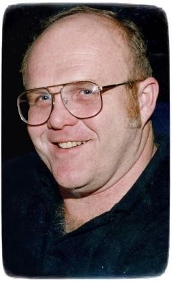
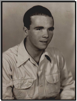
Bill Leroy “Big Red” Quist
| Birth | : | 27 Jun 1951 Spencer, Clay County, Iowa, USA |
| Death | : | 14 Jan 2018 Spencer, Clay County, Iowa, USA |
| Burial | : | North Lawn Cemetery, Spencer, Clay County, USA |
| Coordinate | : | 43.1600000, -95.1470000 |
| Description | : | Bill Leroy Quist, A.K.A Big Red to some of his childhood cohorts, was born June 27, 1951. Bill grew up in Spencer Iowa with his brother Roger, sister Nancy, and cousins Tammy (Faulkner) Nighswonger and Jerry Faulkner. Growing up, Bill ensured Carrol’s Bakery’s success by eating a lot of “Oh Boy’s!” Bill made sure people read the news by delivering the Des Moines Register. In High School, he was a short order cook at the North Y, and Thurston’s, while pursuing a 2 year career as a High School wrestler. |
frequently asked questions (FAQ):
-
Where is Bill Leroy “Big Red” Quist's memorial?
Bill Leroy “Big Red” Quist's memorial is located at: North Lawn Cemetery, Spencer, Clay County, USA.
-
When did Bill Leroy “Big Red” Quist death?
Bill Leroy “Big Red” Quist death on 14 Jan 2018 in Spencer, Clay County, Iowa, USA
-
Where are the coordinates of the Bill Leroy “Big Red” Quist's memorial?
Latitude: 43.1600000
Longitude: -95.1470000
Family Members:
Parent
Siblings
Children
Flowers:


Nearby Cemetories:
1. North Lawn Cemetery
Spencer, Clay County, USA
Coordinate: 43.1600000, -95.1470000
2. Dewey Readmore Books Memorial
Spencer, Clay County, USA
Coordinate: 43.1403999, -95.1443024
3. Riverside Cemetery
Spencer, Clay County, USA
Coordinate: 43.1441994, -95.1671982
4. Fairview Cemetery
Clay County, USA
Coordinate: 43.1899986, -95.0800018
5. Evergreen Cemetery
Clay County, USA
Coordinate: 43.2052994, -95.2086029
6. Dickens Cemetery
Dickens, Clay County, USA
Coordinate: 43.1280000, -95.0155000
7. Swedish Lutheran Cemetery
Royal, Clay County, USA
Coordinate: 43.0683000, -95.2350000
8. Little Sioux Lutheran Cemetery
Milford, Dickinson County, USA
Coordinate: 43.2702065, -95.2109528
9. Rosehill Cemetery
Clay County, USA
Coordinate: 43.0368996, -95.0919037
10. First Reformed Cemetery
Clay County, USA
Coordinate: 43.2399500, -95.2889000
11. Lone Tree Cemetery
Everly, Clay County, USA
Coordinate: 43.1411018, -95.3347015
12. Milford Cemetery
Milford, Dickinson County, USA
Coordinate: 43.3092003, -95.1481018
13. Lincoln Cemetery
Rossie, Clay County, USA
Coordinate: 43.0111008, -95.2313995
14. Calvary Cemetery
Milford, Dickinson County, USA
Coordinate: 43.3213997, -95.1688995
15. Logan Township Cemetery
Clay County, USA
Coordinate: 43.0489006, -94.9747009
16. Liberty Cemetery
Greenville, Clay County, USA
Coordinate: 42.9897003, -95.1417007
17. Willow Creek Cemetery
Royal, Clay County, USA
Coordinate: 43.0214005, -95.2885971
18. Clay Center Cemetery
Royal, Clay County, USA
Coordinate: 43.0410995, -95.3272018
19. TriMello Cemetery
Royal, Clay County, USA
Coordinate: 43.0682983, -95.3728027
20. Crown Hill Cemetery
Ruthven, Palo Alto County, USA
Coordinate: 43.1328011, -94.8878021
21. Calvary Cemetery
Ruthven, Palo Alto County, USA
Coordinate: 43.1314011, -94.8869019
22. Zion Methodist Cemetery
Clay County, USA
Coordinate: 42.9808006, -95.2497025
23. Westport Cemetery
Dickinson County, USA
Coordinate: 43.3130989, -95.3289032
24. Okoboji Cemetery
Arnolds Park, Dickinson County, USA
Coordinate: 43.3649406, -95.1303558