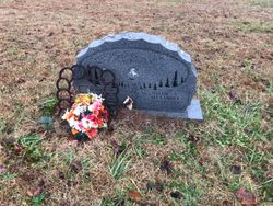
Bobby Henry O'Dell
| Birth | : | 25 Aug 1938 Jonesville, Union County, South Carolina, USA |
| Death | : | 24 Aug 2005 Spartanburg, Spartanburg County, South Carolina, USA |
| Burial | : | Alford Cemetery, Alford, East Lindsey District, England |
| Coordinate | : | 53.2556490, 0.1844330 |
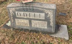
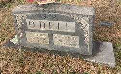
| Description | : | Bobby Henry O'Dell, 66, husband of Nellie Alexander, of Roebuck, SC died at Spartanburg Regional Medical Center Wednesday, August 24, 2005 after a brief illness. Born in Jonesville, SC, August 25, 1938, he was the son of the late William Henry O'Dell and Winnie Gertrude (Harvey) O'Dell. He was a retired independent truck driver having last worked with Spartan Express and previously with Standard Trucking. Mr. ODell was a former member of the South Carolina National Guard, Jonesville Unit, a member of the Prudence Masonic Lodge of Jonesville and a member of Gilead Baptist Church. He was an avid horseman, loving... Read More |
frequently asked questions (FAQ):
-
Where is Bobby Henry O'Dell's memorial?
Bobby Henry O'Dell's memorial is located at: Alford Cemetery, Alford, East Lindsey District, England.
-
When did Bobby Henry O'Dell death?
Bobby Henry O'Dell death on 24 Aug 2005 in Spartanburg, Spartanburg County, South Carolina, USA
-
Where are the coordinates of the Bobby Henry O'Dell's memorial?
Latitude: 53.2556490
Longitude: 0.1844330
Family Members:
Parent
Siblings
Flowers:
Nearby Cemetories:
1. Alford Cemetery
Alford, East Lindsey District, England
Coordinate: 53.2556490, 0.1844330
2. Alford Crematorium
Alford, East Lindsey District, England
Coordinate: 53.2549840, 0.1614430
3. Holy Trinity Church
Bilsby, East Lindsey District, England
Coordinate: 53.2671510, 0.1973680
4. St Andrew's Church
Claxby, East Lindsey District, England
Coordinate: 53.2205190, 0.1746680
5. Birdsong Green Burial Site
Alford, East Lindsey District, England
Coordinate: 53.2184710, 0.2142330
6. St Andrews Churchyard
Beesby, East Lindsey District, England
Coordinate: 53.2986467, 0.1954404
7. St. Margaret's Churchyard
Huttoft, East Lindsey District, England
Coordinate: 53.2632240, 0.2647340
8. St. Andrew's Churchyard
Hannah, East Lindsey District, England
Coordinate: 53.2907200, 0.2485900
9. St John the Baptist Churchyard
Belleau, East Lindsey District, England
Coordinate: 53.2853831, 0.1004803
10. St. Lawrence & Bishop Edward King Churchyard
Dalby, East Lindsey District, England
Coordinate: 53.2090803, 0.1090854
11. St. Benedict's Churchyard
Candlesby, East Lindsey District, England
Coordinate: 53.1832400, 0.1770310
12. St. Mary's Churchyard
Hogsthorpe, East Lindsey District, England
Coordinate: 53.2242270, 0.2962020
13. Hogsthorpe Cemetery
Hogsthorpe, East Lindsey District, England
Coordinate: 53.2240360, 0.2963346
14. SS Peter and Paul Church
Langton, East Lindsey District, England
Coordinate: 53.2124740, 0.0798920
15. St. Peter & St. Paul Churchyard
Langton by Spilsby, East Lindsey District, England
Coordinate: 53.2125100, 0.0798500
16. St. Phillip's Churchyard
Brinkhill, East Lindsey District, England
Coordinate: 53.2428810, 0.0549180
17. St Georges Churchyard
Gayton le Marsh, East Lindsey District, England
Coordinate: 53.3349200, 0.1386000
18. St. Helen and St. Peter Churchyard
Aswardby, East Lindsey District, England
Coordinate: 53.2112300, 0.0594900
19. St. Leonard's Churchyard
Chapel St Leonards, East Lindsey District, England
Coordinate: 53.2226020, 0.3238550
20. St. Peter and St. Paul's Churchyard
Bratoft, East Lindsey District, England
Coordinate: 53.1618990, 0.2041540
21. St. Andrew's Churchyard
Halton Holegate, East Lindsey District, England
Coordinate: 53.1641800, 0.1196100
22. St. Michael's Churchyard
Burwell, East Lindsey District, England
Coordinate: 53.2968800, 0.0325800
23. St. Nicholas' Churchyard
Addlethorpe, East Lindsey District, England
Coordinate: 53.1962740, 0.3202340
24. St. Peter and St. Paul's Churchyard
Burgh le Marsh, East Lindsey District, England
Coordinate: 53.1610370, 0.2433510

