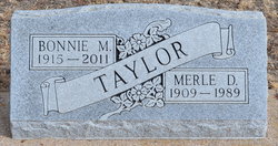
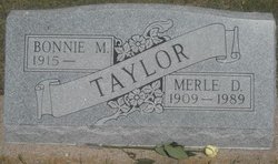
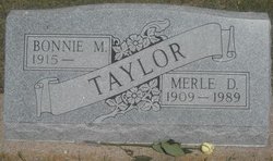
Bonnie Marie Smith Taylor
| Birth | : | 10 Aug 1915 Chase County, Nebraska, USA |
| Death | : | 28 Mar 2011 |
| Burial | : | Pleasant View Cemetery, Crete, Chase County, USA |
| Coordinate | : | 40.4375000, -101.8557968 |
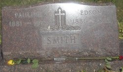
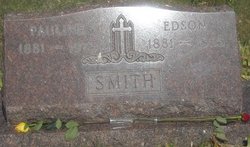
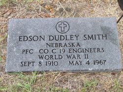
| Description | : | Bonnie Marie (Smith) Taylor, is the daughter of, Edson and Pauline Smith. Bonnie Marie Smith married Merle Dennis Taylor on April 7, 1837 in Holyoke, Phillips, Colorado. Married by Rev. J. G. Bell a Presbyterian Minister performed the ceremony at Holyoke. Information contributed by: Jackie Holifield. According to Bonnie Taylor's obituary dated March 30, 2011 posted in "The Wray Gazette, she passed away on March 28, 2011. |
frequently asked questions (FAQ):
-
Where is Bonnie Marie Smith Taylor's memorial?
Bonnie Marie Smith Taylor's memorial is located at: Pleasant View Cemetery, Crete, Chase County, USA.
-
When did Bonnie Marie Smith Taylor death?
Bonnie Marie Smith Taylor death on 28 Mar 2011 in
-
Where are the coordinates of the Bonnie Marie Smith Taylor's memorial?
Latitude: 40.4375000
Longitude: -101.8557968
Family Members:
Parent
Spouse
Siblings
Flowers:
Nearby Cemetories:
1. Pleasant View Cemetery
Crete, Chase County, USA
Coordinate: 40.4375000, -101.8557968
2. Lake View Cemetery
Champion, Chase County, USA
Coordinate: 40.4571991, -101.7705994
3. Chase Cemetery
Chase, Chase County, USA
Coordinate: 40.5525017, -101.8078003
4. Greenlawn Cemetery
Lamar, Chase County, USA
Coordinate: 40.5231018, -101.9783020
5. Mount Hope Cemetery
Imperial, Chase County, USA
Coordinate: 40.5297012, -101.6607971
6. Hughes Cemetery
Dundy County, USA
Coordinate: 40.3224983, -102.0500031
7. Hiawatha Cemetery
Dundy County, USA
Coordinate: 40.3293991, -101.6532974
8. Pleasant Valley Cemetery
Phillips County, USA
Coordinate: 40.5494003, -102.0899963
9. Pleasant Valley Cemetery
Yuma, Yuma County, USA
Coordinate: 40.5498000, -102.0909000
10. Sleepy Hollow Cemetery
Dundy County, USA
Coordinate: 40.3149986, -101.5678024
11. Saint Pauls Lutheran Cemetery
Dundy County, USA
Coordinate: 40.3490300, -101.5222500
12. Johnson Cemetery
Wauneta, Yuma County, USA
Coordinate: 40.3072960, -102.1701590
13. Ough Cemetery
Ough, Dundy County, USA
Coordinate: 40.3213997, -101.5214005
14. Dunkard Cemetery
Amherst, Phillips County, USA
Coordinate: 40.6438000, -102.1356400
15. Venango Cemetery
Venango, Perkins County, USA
Coordinate: 40.7416992, -102.0175018
16. Pleasant Valley Cemetery
Benkelman, Dundy County, USA
Coordinate: 40.1483600, -101.6295700
17. Mount Zion Cemetery
Benkelman, Dundy County, USA
Coordinate: 40.3143997, -101.4366989
18. Riverside Cemetery
Wauneta, Chase County, USA
Coordinate: 40.4188995, -101.3985977
19. Parks Cemetery
Dundy County, USA
Coordinate: 40.0978012, -101.7397003
20. Holyoke Memorial Park
Holyoke, Phillips County, USA
Coordinate: 40.5736744, -102.2816420
21. Amherst Cemetery
Phillips County, USA
Coordinate: 40.7056007, -102.1603012
22. Lakeview Cemetery
Laird, Yuma County, USA
Coordinate: 40.0905000, -102.0567000
23. Highland Cemetery
Dundy County, USA
Coordinate: 40.2056007, -101.4357986
24. Blanche Cemetery
Chase County, USA
Coordinate: 40.6841900, -101.4390900

