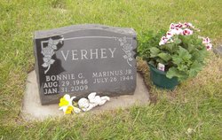
Bonnie Williams Verhey
| Birth | : | 29 Aug 1946 Webster, Day County, South Dakota, USA |
| Death | : | 31 Jan 2009 Arlington, Kingsbury County, South Dakota, USA |
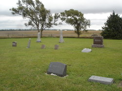
| Burial | : | Pleasant Hill Cemetery, Miner County, USA |
| Coordinate | : | 43.9248800, -97.4092650 |
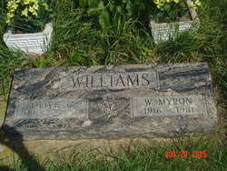
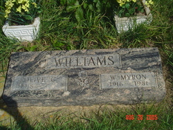
| Description | : | Bonnie Verhey, 62, Arlington, died on Jan. 31, 2009, at her residence. Bonnie Williams was born on Aug. 29, 1946, at Webster to Myron and Olive (Elliott) Williams. She was preceded in death by her father, Myron Williams. She grew up in Clear Lake, where she graduated from high school in 1964. She married Marinus Verhey Jr. on July 18, 1966, at DeSmet. They lived on a farm just outside of Lake Preston until 1972. They moved to Hetland and then to Arlington in 1988. She worked at Kingsbury Memorial Manor in Lake Preston as a cook and then... Read More |
frequently asked questions (FAQ):
-
Where is Bonnie Williams Verhey's memorial?
Bonnie Williams Verhey's memorial is located at: Pleasant Hill Cemetery, Miner County, USA.
-
When did Bonnie Williams Verhey death?
Bonnie Williams Verhey death on 31 Jan 2009 in Arlington, Kingsbury County, South Dakota, USA
-
Where are the coordinates of the Bonnie Williams Verhey's memorial?
Latitude: 43.9248800
Longitude: -97.4092650
Family Members:
Parent
Flowers:
Nearby Cemetories:
1. Pleasant Hill Cemetery
Miner County, USA
Coordinate: 43.9248800, -97.4092650
2. Canova Cemetery
Canova, Miner County, USA
Coordinate: 43.8925018, -97.4888992
3. Sun Prairie Baptist Cemetery
Salem, McCook County, USA
Coordinate: 43.8466988, -97.4080963
4. Winfred Cemetery
Winfred, Lake County, USA
Coordinate: 44.0078011, -97.3606033
5. Gracevale Colony Cemetery
Winfred, Lake County, USA
Coordinate: 43.9260500, -97.2814600
6. Salem Lutheran Cemetery
Salem, McCook County, USA
Coordinate: 43.8334348, -97.3479809
7. Salem Lutheran Cemetery
Salem, McCook County, USA
Coordinate: 43.8333015, -97.3480988
8. Erik Olson Cemetery
Salem, McCook County, USA
Coordinate: 43.8189011, -97.4278030
9. Saint Josephs Cemetery
Howard, Miner County, USA
Coordinate: 44.0092010, -97.5105972
10. Saint Johns Lutheran Cemetery
Howard, Miner County, USA
Coordinate: 44.0106010, -97.5105972
11. Graceland Cemetery
Howard, Miner County, USA
Coordinate: 44.0003014, -97.5289001
12. Our Savior Danish Evangelical Lutheran Cemetery
Howard, Miner County, USA
Coordinate: 43.9426537, -97.5663223
13. Olson Cemetery
Junius, Lake County, USA
Coordinate: 43.9785720, -97.2683500
14. Unityville Cemetery
McCook County, USA
Coordinate: 43.8182900, -97.4693900
15. Immanuel Lutheran Church Cemetery
McCook County, USA
Coordinate: 43.8338100, -97.5092500
16. Saint Pauls Cemetery
Miner County, USA
Coordinate: 43.8774986, -97.5691986
17. Ramsey Baptist Church Cemetery
Montrose, McCook County, USA
Coordinate: 43.8333015, -97.2410965
18. Ramsey Pioneer Cemetery
McCook County, USA
Coordinate: 43.8428001, -97.2166977
19. IOOF Cemetery
Vilas, Miner County, USA
Coordinate: 44.0225067, -97.5940399
20. Pleasant Hill Cemetery
McCook County, USA
Coordinate: 43.8044014, -97.5702972
21. Saint Peter Lutheran Cemetery
Orland, Lake County, USA
Coordinate: 43.8611200, -97.1694800
22. Orland Colony Cemetery
Montrose, McCook County, USA
Coordinate: 43.8189730, -97.1970890
23. Saint Johns Evangelical Lutheran Cemetery
Ramona, Lake County, USA
Coordinate: 44.0950012, -97.2977982
24. Prairie Village Cemetery
Madison, Lake County, USA
Coordinate: 44.0064000, -97.1691000

