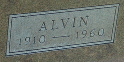
| Birth | : | 6 Aug 1926 Galva, McPherson County, Kansas, USA |
| Death | : | 3 May 1999 Tonganoxie, Leavenworth County, Kansas, USA |
| Burial | : | Pleasant View Cemetery, Springfield, Sullivan County, USA |
| Coordinate | : | 43.4967370, -72.0414710 |
| Description | : | Services for B. J. Wedel, 72, Tonganoxie, will be at 11 a.m. Thursday at the United Methodist Church. Burial will be in Reno Cemetery, Reno. Mr. Wedel died Monday, May 3, 1999, in Tonganoxie. He was born Aug. 6, 1926, in Galva, the son of Jacob B. and Susie Buller Wedel. He moved to Tonganoxie in 1948 from Newton. He was a dairy farmer. He was a Happy Helpers 4-H Dairy Leader, and had served on the Leavenworth County Health Department board, Leavenworth County Extension Council, Leavenworth County Kansas Farm Bureau board, the Rural Water District No. 13 board and the Leavenworth County Fair... Read More |
frequently asked questions (FAQ):
-
Where is Brinton J Wedel's memorial?
Brinton J Wedel's memorial is located at: Pleasant View Cemetery, Springfield, Sullivan County, USA.
-
When did Brinton J Wedel death?
Brinton J Wedel death on 3 May 1999 in Tonganoxie, Leavenworth County, Kansas, USA
-
Where are the coordinates of the Brinton J Wedel's memorial?
Latitude: 43.4967370
Longitude: -72.0414710
Family Members:
Parent
Spouse
Siblings
Flowers:
Nearby Cemetories:
1. Pleasant View Cemetery
Springfield, Sullivan County, USA
Coordinate: 43.4967370, -72.0414710
2. Davis Cemetery
Springfield, Sullivan County, USA
Coordinate: 43.4588900, -72.0409600
3. Messer Cemetery
Springfield, Sullivan County, USA
Coordinate: 43.4500000, -72.0433330
4. West Springfield Cemetery
Springfield, Sullivan County, USA
Coordinate: 43.4511110, -72.0563890
5. Perley Cemetery
Springfield, Sullivan County, USA
Coordinate: 43.4511110, -72.0247220
6. Hardy Hill Cemetery
Grafton, Grafton County, USA
Coordinate: 43.5504600, -72.0465200
7. Hill Dale Cemetery
East Grantham, Sullivan County, USA
Coordinate: 43.4785000, -72.1124000
8. Fowler Cemetery
Springfield, Sullivan County, USA
Coordinate: 43.4975000, -71.9652780
9. Prescott Hill Cemetery
Grafton, Grafton County, USA
Coordinate: 43.5351856, -71.9747934
10. Adams Cemetery
Enfield, Grafton County, USA
Coordinate: 43.5532500, -72.0833200
11. Grantham Memorial Cemetery
Grantham, Sullivan County, USA
Coordinate: 43.4915900, -72.1328500
12. Georges Mills Cemetery
Georges Mills, Sullivan County, USA
Coordinate: 43.4311450, -72.0694070
13. George Mills Cemetery
Sunapee, Sullivan County, USA
Coordinate: 43.4308500, -72.0691170
14. Burpee Hill Cemetery
Grantham, Sullivan County, USA
Coordinate: 43.5216100, -72.1325500
15. Hastings Cemetery
Grantham, Sullivan County, USA
Coordinate: 43.5228300, -72.1342800
16. Huntley Cemetery
Grafton County, USA
Coordinate: 43.5697220, -72.0488890
17. Tewksbury Cemetery
Wilmot, Merrimack County, USA
Coordinate: 43.4917669, -71.9407331
18. Tewksbury Hill Cemetery
North Wilmot, Merrimack County, USA
Coordinate: 43.4917550, -71.9406830
19. Choate Cemetery
Enfield Center, Grafton County, USA
Coordinate: 43.5665700, -72.0763900
20. Stearns Cemetery
Wilmot, Merrimack County, USA
Coordinate: 43.4827780, -71.9408330
21. Dunbar Hill Cemetery
Grantham, Sullivan County, USA
Coordinate: 43.4892500, -72.1489100
22. Whites Pond Cemetery
Wilmot, Merrimack County, USA
Coordinate: 43.4877610, -71.9290520
23. Winter Hill Cemetery
Croydon, Sullivan County, USA
Coordinate: 43.4513640, -72.1374900
24. North Road Cemetery
Wilmot, Merrimack County, USA
Coordinate: 43.5104870, -71.9268630


