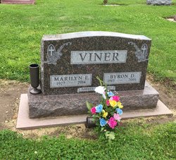
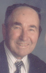
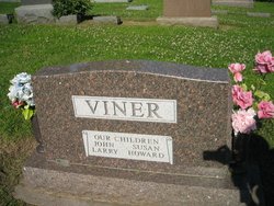
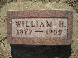
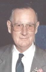
Byron Dale Viner
| Birth | : | 5 Aug 1913 Wales, Montgomery County, Iowa, USA |
| Death | : | 23 Oct 2001 Red Oak, Montgomery County, Iowa, USA |
| Burial | : | Burgessville Baptist Cemetery, Burgessville, Oxford County Municipality, Canada |
| Coordinate | : | 43.0223500, -80.6601600 |
| Plot | : | 1st Addition #115 |
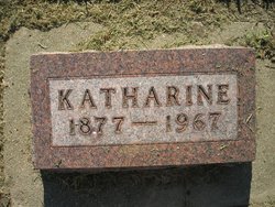
| Description | : | Byron Viner, age 88, of Emerson, Iowa passed away Tuesday, October 23, 2001 at the Good Samaritan Care Center in Red Oak after an extended illness. Byron Dale Viner, a child of God, son of William and Katherine (Steiner) Viner was born on the family farm near Wales, Iowa on August 5, 1913. He graduated from the Wales High School and began farming, living all of his life on the same farm that he was born. He was united in marriage to Marilyn Triplett on April 2, 1947 in Shenandoah, Iowa. Byron trusted Christ as his Savior early in his... Read More |
frequently asked questions (FAQ):
-
Where is Byron Dale Viner's memorial?
Byron Dale Viner's memorial is located at: Burgessville Baptist Cemetery, Burgessville, Oxford County Municipality, Canada.
-
When did Byron Dale Viner death?
Byron Dale Viner death on 23 Oct 2001 in Red Oak, Montgomery County, Iowa, USA
-
Where are the coordinates of the Byron Dale Viner's memorial?
Latitude: 43.0223500
Longitude: -80.6601600
Family Members:
Parent
Spouse
Siblings
Children
Flowers:
Nearby Cemetories:
1. Quaker Street Friends Cemetery
Norwich, Oxford County Municipality, Canada
Coordinate: 43.0001900, -80.6155300
2. North Norwich Pioneer Cemetery
Norwich, Oxford County Municipality, Canada
Coordinate: 43.0016975, -80.6069489
3. Zion Oriel Cemetery
Oriel, Oxford County Municipality, Canada
Coordinate: 43.0650630, -80.6425670
4. Newark District Community Cemetery
Newark, Oxford County Municipality, Canada
Coordinate: 42.9701580, -80.6853440
5. Norwich Village Cemetery
Norwich, Oxford County Municipality, Canada
Coordinate: 42.9840000, -80.6041800
6. Pleasant View Cemetery
Curries, Oxford County Municipality, Canada
Coordinate: 43.0716390, -80.7196470
7. New Durham Cemetery
Oxford County Municipality, Canada
Coordinate: 43.0418091, -80.5674210
8. St. Peter's Roman Cathlolic Cemetery
Norwich, Oxford County Municipality, Canada
Coordinate: 42.9566270, -80.7072350
9. Oxford Centre Christ Church Anglican Cemetery
Oxford Centre, Oxford County Municipality, Canada
Coordinate: 43.0996310, -80.6814490
10. East Oxford Pioneer Cemetery
Oxford Centre, Oxford County Municipality, Canada
Coordinate: 43.0999370, -80.6804350
11. Norwich Gore Cemetery
Norwich, Oxford County Municipality, Canada
Coordinate: 42.9999400, -80.5564000
12. Sweaburg Union Cemetery
Sweaburg, Oxford County Municipality, Canada
Coordinate: 43.0690800, -80.7623200
13. Waggoner Pioneer Cemetery
South-West Oxford, Oxford County Municipality, Canada
Coordinate: 42.9772970, -80.7665850
14. White Cemetery
Harley, Brant County Municipality, Canada
Coordinate: 43.0494000, -80.5377000
15. Milldale Burial Grounds
Milldale, Oxford County Municipality, Canada
Coordinate: 42.9452515, -80.5852966
16. African Methodist Episcopal Cemetery
Otterville, Oxford County Municipality, Canada
Coordinate: 42.9313940, -80.6082310
17. Hatchley Cemetery
Hatchley, Brant County Municipality, Canada
Coordinate: 43.0247000, -80.5253000
18. St. John's Anglican Cemetery
Oxford County Municipality, Canada
Coordinate: 42.9290830, -80.6072860
19. Otterville Cemetery
Otterville, Oxford County Municipality, Canada
Coordinate: 42.9285800, -80.6073870
20. Springford Community Cemetery
Springford, Oxford County Municipality, Canada
Coordinate: 42.9207090, -80.6433210
21. Erbtown Cemetery
Otterville, Oxford County Municipality, Canada
Coordinate: 42.9232445, -80.6193924
22. Pine Street Burying Ground
Otterville, Oxford County Municipality, Canada
Coordinate: 42.9235458, -80.6128235
23. Mount Elgin Cemetery
Mount Elgin, Oxford County Municipality, Canada
Coordinate: 42.9581400, -80.7961000
24. Saint Johns Anglican Cemetery
Eastwood, Oxford County Municipality, Canada
Coordinate: 43.1443080, -80.6575850

