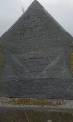
| Birth | : | 27 Dec 1907 Buffalo County, South Dakota, USA |
| Death | : | Jan 1987 Miller, Hand County, South Dakota, USA |
| Burial | : | Hittle Grove Cemetery, Armington, Tazewell County, USA |
| Coordinate | : | 40.3608017, -89.3589020 |
| Plot | : | Blk 47 Lot 11 Grave 3 |
| Description | : | Daughter of Charles H. & Alma (Cilley) Gilchrist of Buffalo Co., South Dakota. Married 1933 to J. Harold "Dutch" Campbell, son of Orville Clark & Sarah Elizabeth (Ferris) Campbell. They resided for a time in Mondamin Twp., Hand Co., SD. They later lived on a ranch in Arlington Twp., Buffalo Co., SD. Upon retirement, they moved to Miller, Hand Co., SD. They were the parents of son, Ronald and daughter, Karen. |
frequently asked questions (FAQ):
-
Where is C. Anita Gilchrist Campbell's memorial?
C. Anita Gilchrist Campbell's memorial is located at: Hittle Grove Cemetery, Armington, Tazewell County, USA.
-
When did C. Anita Gilchrist Campbell death?
C. Anita Gilchrist Campbell death on Jan 1987 in Miller, Hand County, South Dakota, USA
-
Where are the coordinates of the C. Anita Gilchrist Campbell's memorial?
Latitude: 40.3608017
Longitude: -89.3589020
Family Members:
Parent
Spouse
Siblings
Flowers:
Nearby Cemetories:
1. Hittle Grove Cemetery
Armington, Tazewell County, USA
Coordinate: 40.3608017, -89.3589020
2. Oakview Cemetery
Armington, Tazewell County, USA
Coordinate: 40.3367004, -89.3339005
3. Freeman Cemetery
Tazewell County, USA
Coordinate: 40.3816986, -89.3917007
4. Miller-Hasenmeyer Cemetery
Lincoln, Logan County, USA
Coordinate: 40.3133011, -89.3533020
5. Broadway Cemetery
Minier, Tazewell County, USA
Coordinate: 40.4055400, -89.3030000
6. Thompson Cemetery
Logan County, USA
Coordinate: 40.3086014, -89.3099976
7. Mountjoy Cemetery
Atlanta, Logan County, USA
Coordinate: 40.3128014, -89.2983017
8. Hieronymus Cemetery
Armington, Tazewell County, USA
Coordinate: 40.3706970, -89.2676086
9. Bethel Cemetery
Emden, Logan County, USA
Coordinate: 40.2942490, -89.3925230
10. Union Station Cemetery
Union, Logan County, USA
Coordinate: 40.2888985, -89.3665009
11. Orendorff Cemetery
Hopedale, Tazewell County, USA
Coordinate: 40.4035988, -89.4413986
12. Kampf Cemetery
Stanford, McLean County, USA
Coordinate: 40.3842010, -89.2628021
13. Briggs Cemetery
Minier, Tazewell County, USA
Coordinate: 40.4399986, -89.3780975
14. Griesemer Cemetery
Hopedale, Tazewell County, USA
Coordinate: 40.4286003, -89.4180984
15. Morgan Cemetery
Logan County, USA
Coordinate: 40.2817001, -89.3253021
16. Minier Cemetery
Minier, Tazewell County, USA
Coordinate: 40.4346008, -89.3035889
17. Hopedale Mennonite Cemetery
Hopedale, Tazewell County, USA
Coordinate: 40.4238892, -89.4347229
18. Shiloh Cemetery
Hopedale, Tazewell County, USA
Coordinate: 40.4441986, -89.3989029
19. Sparrow Cemetery
Hopedale, Tazewell County, USA
Coordinate: 40.4328003, -89.4368973
20. Carlock Cemetery
Logan County, USA
Coordinate: 40.2696991, -89.3127975
21. Bever Cemetery
Tazewell County, USA
Coordinate: 40.4049988, -89.4749985
22. Longworth Cemetery
McLean, McLean County, USA
Coordinate: 40.3237300, -89.2371600
23. Gaines Cemetery
Minier, Tazewell County, USA
Coordinate: 40.4625015, -89.3522034
24. Niblick Cemetery
Atlanta, Logan County, USA
Coordinate: 40.2597008, -89.3352966


