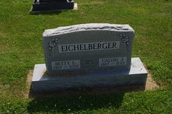
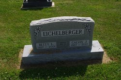
Calvin John “Cal” Eichelberger
| Birth | : | 1 Jan 1927 Wayland, Henry County, Iowa, USA |
| Death | : | 1 Mar 2012 Wayland, Henry County, Iowa, USA |
| Burial | : | Sugar Creek Cemetery, Wayland, Henry County, USA |
| Coordinate | : | 41.1347008, -91.6343994 |
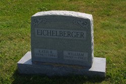
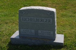
| Description | : | Calvin "Cal" John Eichelberger, 85, of Wayland died Thursday, March 1, 2012, at Parkview Home in Wayland. Born Jan. 1, 1927, near Wayland, he was the son of William and Katie Graber Eichelberger. On March 20, 1949, he married Betty L. Johnston of Crawfordsville. She died March 11, 2001. On March 1, 2003, he married Anna Driver. Mr. Eichelberger farmed near Wayland for years and managed Wayland Sale Barn and later Waco Livestock Market near Olds. He retired, and he and his first wife wintered in Sarasota, Fla. He attended Eicher School, graduated from Wayland High School in 1945, trained in dairy testing... Read More |
frequently asked questions (FAQ):
-
Where is Calvin John “Cal” Eichelberger's memorial?
Calvin John “Cal” Eichelberger's memorial is located at: Sugar Creek Cemetery, Wayland, Henry County, USA.
-
When did Calvin John “Cal” Eichelberger death?
Calvin John “Cal” Eichelberger death on 1 Mar 2012 in Wayland, Henry County, Iowa, USA
-
Where are the coordinates of the Calvin John “Cal” Eichelberger's memorial?
Latitude: 41.1347008
Longitude: -91.6343994
Family Members:
Parent
Spouse
Flowers:
Nearby Cemetories:
1. Sugar Creek Cemetery
Wayland, Henry County, USA
Coordinate: 41.1347008, -91.6343994
2. Wayland Methodist Church Cemetery
Wayland, Henry County, USA
Coordinate: 41.1480000, -91.6585000
3. Old Baptist Cemetery
Wayland, Henry County, USA
Coordinate: 41.1045000, -91.6209000
4. Center Cemetery
Wayland, Henry County, USA
Coordinate: 41.1567000, -91.6013000
5. North Hill Cemetery
Washington County, USA
Coordinate: 41.1666985, -91.6592026
6. Eicher Cemetery
Washington County, USA
Coordinate: 41.1782990, -91.6260986
7. Finley Cemetery
Henry County, USA
Coordinate: 41.0913800, -91.6202800
8. Pioneer Shively-Neff Cemetery
Wayland, Henry County, USA
Coordinate: 41.1420950, -91.7027100
9. Rumble Cemetery
Washington County, USA
Coordinate: 41.1857500, -91.6150500
10. Cottonwood Cemetery
Coppock, Henry County, USA
Coordinate: 41.1488991, -91.7024994
11. Haynes Cemetery
Wayland, Henry County, USA
Coordinate: 41.1441000, -91.7074000
12. Kurtz Cemetery
Wayland, Henry County, USA
Coordinate: 41.1470000, -91.7071000
13. Sommers Cemetery
Washington County, USA
Coordinate: 41.1927986, -91.6505966
14. Fern Cliff Evangelic Cemetery
Washington County, USA
Coordinate: 41.1937000, -91.6122000
15. Nelson Plot
Jefferson County, USA
Coordinate: 41.1243890, -91.7185420
16. Bethel Mennonite Church Cemetery
Washington County, USA
Coordinate: 41.1963997, -91.6596985
17. Green Mound Cemetery
Henry County, USA
Coordinate: 41.0696983, -91.6652985
18. Martin Cemetery
Marion Township, Washington County, USA
Coordinate: 41.2000194, -91.6668323
19. North Wayne Cemetery
Olds, Henry County, USA
Coordinate: 41.1422000, -91.5422000
20. Swedesburg Cemetery
Swedesburg, Henry County, USA
Coordinate: 41.1060000, -91.5456000
21. Custer Cemetery
Washington County, USA
Coordinate: 41.1921500, -91.7125900
22. Asbury Cemetery
Olds, Henry County, USA
Coordinate: 41.1570000, -91.5253000
23. Armstrong Cemetery
Jefferson County, USA
Coordinate: 41.1547012, -91.7444000
24. Dallner Cemetery
Jefferson County, USA
Coordinate: 41.1047000, -91.7458000


