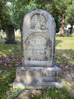
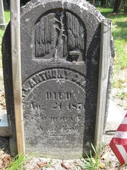
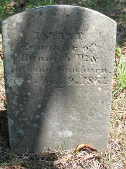
Capt Anthony King Camburn
| Birth | : | 8 Mar 1820 Ocean County, New Jersey, USA |
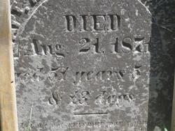
| Death | : | 21 Aug 1871 Forked River, Ocean County, New Jersey, USA |
| Burial | : | Morehead Cemetery, Morehead, Neosho County, USA |
| Coordinate | : | 37.3849983, -95.5246964 |
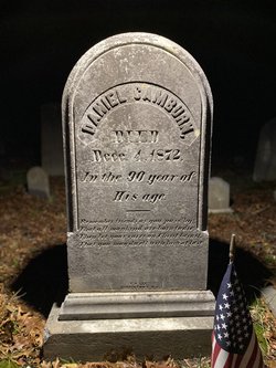
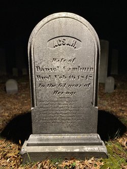
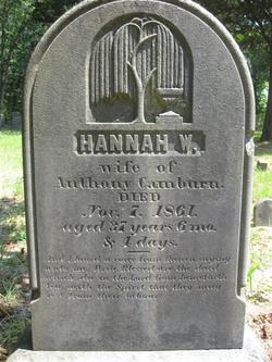
| Description | : | Date of birth calculated based on age at date of death. Anthony died at age 51 years, 5 months, 13 days. From another source: ("Anthony King Camburn was born on March 8, 1820 to Daniel Camburn & Acsah King in the State of New Jersey.") Anthony married Hannah W. Lippincott on February 9, 1845. A source lists seven children for Anthony and Hannah: Woodburn T. Camburn, Rebecca Lippincott Camburn, John W. Camburn, Maria Louisa Camburn, Deborah Irene Camburn, Kate Ann Camburn, Harvey Camburn, Hannah W. Camburn and a boy which was not named. The 1850 Census for Union Township, NJ lists the following... Read More |
frequently asked questions (FAQ):
-
Where is Capt Anthony King Camburn's memorial?
Capt Anthony King Camburn's memorial is located at: Morehead Cemetery, Morehead, Neosho County, USA.
-
When did Capt Anthony King Camburn death?
Capt Anthony King Camburn death on 21 Aug 1871 in Forked River, Ocean County, New Jersey, USA
-
Where are the coordinates of the Capt Anthony King Camburn's memorial?
Latitude: 37.3849983
Longitude: -95.5246964
Family Members:
Parent
Spouse
Siblings
Children
Flowers:
Nearby Cemetories:
1. Morehead Cemetery
Morehead, Neosho County, USA
Coordinate: 37.3849983, -95.5246964
2. South Center Cemetery
Thayer, Neosho County, USA
Coordinate: 37.4305992, -95.4713974
3. Hiltz Cemetery
Montgomery County, USA
Coordinate: 37.3549995, -95.5939026
4. Plainfield Cemetery
Neosho County, USA
Coordinate: 37.4525108, -95.5061264
5. Harmony Grove Cemetery
Dennis, Labette County, USA
Coordinate: 37.3255997, -95.4580994
6. Pleasant Dale Cemetery
Cherryvale, Montgomery County, USA
Coordinate: 37.3139700, -95.5860700
7. Spindletop Cemetery
Cherryvale, Montgomery County, USA
Coordinate: 37.2958400, -95.5570700
8. Thayer Cemetery
Thayer, Neosho County, USA
Coordinate: 37.4794006, -95.4757996
9. Fairview Cemetery
Cherryvale, Montgomery County, USA
Coordinate: 37.2722015, -95.5344009
10. Pleasant Hill Cemetery
Dennis, Labette County, USA
Coordinate: 37.3185997, -95.3957977
11. Saint Francis Xavier Cemetery
Cherryvale, Montgomery County, USA
Coordinate: 37.2633018, -95.5753021
12. Choteau Cemetery
Independence, Montgomery County, USA
Coordinate: 37.3194700, -95.6746700
13. Valley Cemetery
Galesburg, Neosho County, USA
Coordinate: 37.3986500, -95.3522400
14. Griffith Cemetery
Labette County, USA
Coordinate: 37.2463989, -95.4981003
15. Post Cemetery
Neosho County, USA
Coordinate: 37.5242958, -95.4797745
16. Bethel Cemetery
Independence, Montgomery County, USA
Coordinate: 37.2761002, -95.6457977
17. Centennial Cemetery
Cherryvale, Montgomery County, USA
Coordinate: 37.2296982, -95.5466995
18. Mount Hope Cemetery
Galesburg, Neosho County, USA
Coordinate: 37.4592018, -95.3514023
19. Harmony Cemetery
Cherryvale, Montgomery County, USA
Coordinate: 37.2324982, -95.5950012
20. Ladore Cemetery
Ladore Township, Neosho County, USA
Coordinate: 37.4059000, -95.3169500
21. Saint Andrews Cemetery
Independence, Montgomery County, USA
Coordinate: 37.2566986, -95.6658020
22. Hopewell Cemetery
Mound Valley, Labette County, USA
Coordinate: 37.2453003, -95.3741989
23. Pratt Cemetery
Montgomery County, USA
Coordinate: 37.2324982, -95.6557999
24. Krone Cemetery
Montgomery County, USA
Coordinate: 37.3302400, -95.7494600

