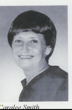
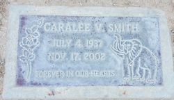
Caralee Virginia Steele Smith
| Birth | : | 4 Jul 1937 Virginia, USA |
| Death | : | 17 Nov 2002 Ridgecrest, Kern County, California, USA |
| Burial | : | South Mineral Cemetery, Onslow, Jones County, USA |
| Coordinate | : | 42.1211300, -90.9768800 |
| Description | : | Ms. Smith was born in Santon, Virginia. In life Ms. Smith had worked at Albertsons, where she retired and then took a job in Customer Management Service for Wal-Mart. She was also a member of the American Legion Auxiliary, the Moose Lodge Ladies Auxiliary and the Retails Clerks Association. Ms. Smith is survived by her sons, Jeffery L. and Michael L. Breeden of Ridgecrest; daughter, Sondra G. Schafer of Hesperia; sister, Doris Payton of Bakersfield; and brothers, Denim and Frank Vaughn of Bakersfield. |
frequently asked questions (FAQ):
-
Where is Caralee Virginia Steele Smith's memorial?
Caralee Virginia Steele Smith's memorial is located at: South Mineral Cemetery, Onslow, Jones County, USA.
-
When did Caralee Virginia Steele Smith death?
Caralee Virginia Steele Smith death on 17 Nov 2002 in Ridgecrest, Kern County, California, USA
-
Where are the coordinates of the Caralee Virginia Steele Smith's memorial?
Latitude: 42.1211300
Longitude: -90.9768800
Family Members:
Parent
Flowers:
Nearby Cemetories:
1. South Mineral Cemetery
Onslow, Jones County, USA
Coordinate: 42.1211300, -90.9768800
2. North Mineral Cemetery
Onslow, Jones County, USA
Coordinate: 42.1281100, -90.9764090
3. Bear Creek Cemetery
Center Junction, Jones County, USA
Coordinate: 42.0972500, -90.9858100
4. Cady Cemetery
Wyoming Township, Jones County, USA
Coordinate: 42.0830400, -90.9659200
5. Johnsontown Cemetery
Onslow, Jones County, USA
Coordinate: 42.1458015, -91.0346985
6. Clay Cemetery
Onslow, Jones County, USA
Coordinate: 42.1721992, -90.9800034
7. Wyoming Cemetery
Wyoming, Jones County, USA
Coordinate: 42.0642014, -91.0149994
8. North Madison Pioneers Cemetery
Center Junction, Jones County, USA
Coordinate: 42.1099790, -91.0640000
9. Canton Cemetery
Canton, Jones County, USA
Coordinate: 42.1647072, -90.9020386
10. Scotch Grove Cemetery
Jones County, USA
Coordinate: 42.1657982, -91.0635986
11. Madison Center Cemetery
Center Junction, Jones County, USA
Coordinate: 42.0778008, -91.0755997
12. Monmouth Cemetery
Monmouth, Jackson County, USA
Coordinate: 42.0679300, -90.8798400
13. Reel Cemetery
Baldwin, Jackson County, USA
Coordinate: 42.1049995, -90.8510971
14. Hickory Grove Cemetery
Emeline, Jackson County, USA
Coordinate: 42.1719017, -90.8600006
15. Saint Peters Cemetery
Temple Hill, Jones County, USA
Coordinate: 42.2245500, -90.9754100
16. Madison Village Cemetery
Jones County, USA
Coordinate: 42.0693900, -91.1030500
17. Hutton Cemetery
Anamosa, Jones County, USA
Coordinate: 42.2294920, -90.9663420
18. Holy Trinity Catholic Cemetery
Baldwin, Jackson County, USA
Coordinate: 42.0770000, -90.8420000
19. Hershberger Cemetery
Baldwin, Jackson County, USA
Coordinate: 42.0772309, -90.8418011
20. Ozark Cemetery
Ozark, Jackson County, USA
Coordinate: 42.2005000, -90.8735000
21. Edinburg Cemetery
Jones County, USA
Coordinate: 42.1342010, -91.1374969
22. Four Horn Cemetery
Scotch Grove, Jones County, USA
Coordinate: 42.1594009, -91.1307983
23. Hale Cemetery
Jones County, USA
Coordinate: 42.0167007, -91.0599976
24. Mayflower Cemetery
Oxford Junction, Jones County, USA
Coordinate: 41.9935989, -90.9494019


