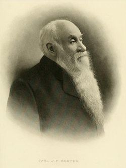
Carl Johann Friedrich Kester
| Birth | : | 23 Apr 1838 Plau am See, Landkreis Ludwigslust-Parchim, Mecklenburg-Vorpommern, Germany |
| Death | : | 18 Feb 1912 Clinton, Clinton County, Iowa, USA |
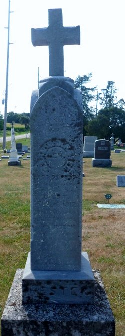
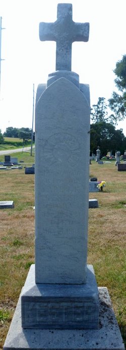
| Burial | : | Mellösa Kyrkogård, Mellosa, Flens kommun, Sweden |
| Coordinate | : | 59.1000073, 16.5500845 |
| Description | : | From Wolfe's History of Clinton County, Iowa, 1911: "One of the venerable and much liked citizens of Clinton, Iowa is Carl John Frederick Kester, a man of such superior ability in his chosen line and of such high attributes of character that to know him is to be his friend. Like many of the best citizens of this county, he is a native of Germany, having been born at Plau, on April 23, 1838. He was the son of Wilhelm and Gazina (Von Schwarneval) Kester. The father was a sturdy German, a cabinetmaker by trade, and taught... Read More |
frequently asked questions (FAQ):
-
Where is Carl Johann Friedrich Kester's memorial?
Carl Johann Friedrich Kester's memorial is located at: Mellösa Kyrkogård, Mellosa, Flens kommun, Sweden.
-
When did Carl Johann Friedrich Kester death?
Carl Johann Friedrich Kester death on 18 Feb 1912 in Clinton, Clinton County, Iowa, USA
-
Where are the coordinates of the Carl Johann Friedrich Kester's memorial?
Latitude: 59.1000073
Longitude: 16.5500845
Family Members:
Spouse
Children
Flowers:
Nearby Cemetories:
1. Mellösa Kyrkogård
Mellosa, Flens kommun, Sweden
Coordinate: 59.1000073, 16.5500845
2. Mellösa Församling Kvarter 3
Halleforsnas, Flens kommun, Sweden
Coordinate: 59.1518570, 16.4938092
3. Lilla Malma gamla kyrkogård
Malmkoping, Flens kommun, Sweden
Coordinate: 59.1349594, 16.7263983
4. Vadsbro Kyrka
Vadsbro, Flens kommun, Sweden
Coordinate: 58.9773068, 16.5663294
5. Dunker Church Cemetery
Dunker, Flens kommun, Sweden
Coordinate: 59.1663160, 16.7819595
6. Blacksta Church Cemetery
Blacksta, Gnesta kommun, Sweden
Coordinate: 58.9582100, 16.6340809
7. Ådala Kyrkogård
Bettna, Flens kommun, Sweden
Coordinate: 58.9939522, 16.8291178
8. Skogskyrkogården
Katrineholms kommun, Sweden
Coordinate: 58.9816400, 16.2290490
9. Katrineholm Kyrkogård
Katrineholm, Katrineholms kommun, Sweden
Coordinate: 58.9919670, 16.1948670
10. Husby-Rekarne kyrkogård
Eskilstuna kommun, Sweden
Coordinate: 59.3142240, 16.4520100
11. Husby-Oppunda kyrkogård
Vrena, Nyköpings kommun, Sweden
Coordinate: 58.9087626, 16.8041195
12. Halla kyrkogård
Vrena, Nyköpings kommun, Sweden
Coordinate: 58.8593901, 16.6252792
13. Julita gård
Strängnäs kommun, Sweden
Coordinate: 59.1483600, 16.0449400
14. Öja kyrka
Öja, Eskilstuna kommun, Sweden
Coordinate: 59.2865367, 16.1595214
15. Länna kyrkogård
Strängnäs, Strängnäs kommun, Sweden
Coordinate: 59.2814570, 16.9839330
16. Mikaelikyrkan
Västerås, Västerås kommun, Sweden
Coordinate: 59.3619490, 16.3149200
17. Kjula Kyrka
Eskilstuna, Eskilstuna kommun, Sweden
Coordinate: 59.3970139, 16.6746663
18. Hammarby Kyrka
Hammarby, Eskilstuna kommun, Sweden
Coordinate: 59.4059215, 16.5946144
19. Västermo kyrkogård
Eskilstuna kommun, Sweden
Coordinate: 59.2910527, 16.0797507
20. Jäders kyrka
Eskilstuna, Eskilstuna kommun, Sweden
Coordinate: 59.4096640, 16.6910280
21. Vallby Kyrka
Vallby, Eskilstuna kommun, Sweden
Coordinate: 59.4217961, 16.5652439
22. Sundby kyrka
Eskilstuna kommun, Sweden
Coordinate: 59.4337788, 16.6338627
23. Vingaker Kyrkogård
Vingaker, Vingåkers kommun, Sweden
Coordinate: 59.0531448, 15.8784793
24. Strängnäs södra kyrkogård
Strängnäs, Strängnäs kommun, Sweden
Coordinate: 59.3556780, 17.0148080


