
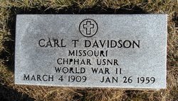
Carl Theodore Davidson
| Birth | : | 4 Mar 1909 Great Falls, Cascade County, Montana, USA |
| Death | : | 26 Jan 1959 Adair County, Missouri, USA |
| Burial | : | Saint John Cemetery, Rapidan, Blue Earth County, USA |
| Coordinate | : | 44.0731010, -94.0689011 |
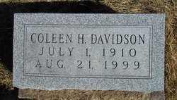
| Description | : | US Navy WWII married, son of Carl O. Davidson and Erie Johnson, husband of Coleen Davidson d. cert 4357 indicates burial at Arni Memorial Cemetery but name and dates match those found in the IOOF Lancaster transcript |
frequently asked questions (FAQ):
-
Where is Carl Theodore Davidson's memorial?
Carl Theodore Davidson's memorial is located at: Saint John Cemetery, Rapidan, Blue Earth County, USA.
-
When did Carl Theodore Davidson death?
Carl Theodore Davidson death on 26 Jan 1959 in Adair County, Missouri, USA
-
Where are the coordinates of the Carl Theodore Davidson's memorial?
Latitude: 44.0731010
Longitude: -94.0689011
Family Members:
Parent

Spouse
Siblings
Flowers:


Nearby Cemetories:
1. Saint John Cemetery
Rapidan, Blue Earth County, USA
Coordinate: 44.0731010, -94.0689011
2. Calvary Lutheran Cemetery
Rapidan, Blue Earth County, USA
Coordinate: 44.0931015, -94.1044006
3. Rapidan Holberg Cemetery
Rapidan, Blue Earth County, USA
Coordinate: 44.1027985, -94.0391998
4. Barnard Valley View Cemetery
Blue Earth County, USA
Coordinate: 44.0381012, -94.0974503
5. Stratton Family Cemetery
Blue Earth County, USA
Coordinate: 44.0503654, -94.0090027
6. Spring Island Cemetery
Blue Earth County, USA
Coordinate: 44.1234016, -94.0895462
7. Lyra Cemetery
Good Thunder, Blue Earth County, USA
Coordinate: 44.0093994, -94.0681000
8. Memorial Park Cemetery
Good Thunder, Blue Earth County, USA
Coordinate: 44.0008011, -94.0560989
9. Saint John Lutheran Cemetery
Good Thunder, Blue Earth County, USA
Coordinate: 43.9998894, -94.0560989
10. Calvary Cemetery
Good Thunder, Blue Earth County, USA
Coordinate: 43.9994011, -94.0567017
11. Garden City Cemetery
Garden City, Blue Earth County, USA
Coordinate: 44.0424995, -94.1644363
12. Woodland Hills Memorial Park
Mankato, Blue Earth County, USA
Coordinate: 44.1460991, -94.0271988
13. Minneopa Cemetery
Mankato, Blue Earth County, USA
Coordinate: 44.1509132, -94.0891647
14. Decoria Cemetery
Blue Earth County, USA
Coordinate: 44.0614014, -93.9589005
15. Prenzlow Family Cemetery
Blue Earth County, USA
Coordinate: 43.9794197, -94.0280228
16. Mount Olivet Cemetery
Mankato, Blue Earth County, USA
Coordinate: 44.1561317, -93.9897385
17. Glenwood Cemetery
Mankato, Blue Earth County, USA
Coordinate: 44.1556015, -93.9816971
18. Dakota Sioux Memorial - 1862
Mankato, Blue Earth County, USA
Coordinate: 44.1677300, -94.0031000
19. Beauford Oak Hill Cemetery
Beauford, Blue Earth County, USA
Coordinate: 44.0020599, -93.9591293
20. Lake Crystal Cemetery
Lake Crystal, Blue Earth County, USA
Coordinate: 44.1116714, -94.2102814
21. Kerns Oak Grove Cemetery
Kerns, Nicollet County, USA
Coordinate: 44.1840057, -94.1077499
22. Pioneer Memorial Park Cemetery
Mankato, Blue Earth County, USA
Coordinate: 44.1768200, -93.9840000
23. Calvary Cemetery
Mankato, Blue Earth County, USA
Coordinate: 44.1758003, -93.9764023
24. Saint Matthews Cemetery
Vernon Center, Blue Earth County, USA
Coordinate: 43.9617004, -94.1549988