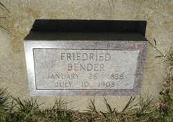
| Birth | : | 17 Mar 1865 Velykokomarivka, Odeska, Ukraine |
| Death | : | 19 May 1951 McClusky, Sheridan County, North Dakota, USA |
| Burial | : | Saint James Reformed Cemetery, Lovettsville, Loudoun County, USA |
| Coordinate | : | 39.2702713, -77.6296844 |
| Description | : | Carolina BENDER born 17 March 1865 in Kassel, Glueckstal, Odessa, South Russia was the daughter of Friedrich BENDER and Katherina WANNER. Carolina with her parents and 5 siblings immigrated to America via the Port of Hamburg, Germany aboard the SS "Rugia" and arrived at the Port of New York, New York on the 28th April 1885. Carolina married John Friedrich WAHL on the 26 of November 1886 in Emery, Hanson County, South Dakota. The couple was blessed with no less that 14 children. Bio by DG Bender |
frequently asked questions (FAQ):
-
Where is Carolina Bender Wahl's memorial?
Carolina Bender Wahl's memorial is located at: Saint James Reformed Cemetery, Lovettsville, Loudoun County, USA.
-
When did Carolina Bender Wahl death?
Carolina Bender Wahl death on 19 May 1951 in McClusky, Sheridan County, North Dakota, USA
-
Where are the coordinates of the Carolina Bender Wahl's memorial?
Latitude: 39.2702713
Longitude: -77.6296844
Family Members:
Parent
Spouse
Siblings
Children
Flowers:
Nearby Cemetories:
1. Saint James Reformed Cemetery
Lovettsville, Loudoun County, USA
Coordinate: 39.2702713, -77.6296844
2. Old Presbyterian Cemetery
Lovettsville, Loudoun County, USA
Coordinate: 39.2734299, -77.6394119
3. African Methodist Episcopal Church Cemetery
Lovettsville, Loudoun County, USA
Coordinate: 39.2759705, -77.6389542
4. Lovettsville Union Cemetery
Lovettsville, Loudoun County, USA
Coordinate: 39.2583400, -77.6395800
5. New Jerusalem Lutheran Church Cemetery
Lovettsville, Loudoun County, USA
Coordinate: 39.2573624, -77.6389084
6. Mount Olivet United Methodist Church Cemetery
Lovettsville, Loudoun County, USA
Coordinate: 39.2811317, -77.6757278
7. Grace Episcopal Church Columbarium
Brunswick, Frederick County, USA
Coordinate: 39.3127200, -77.6244000
8. Old Berlin Cemetery
Brunswick, Frederick County, USA
Coordinate: 39.3144500, -77.6301900
9. Rehobeth United Methodist Church Cemetery
Lovettsville, Loudoun County, USA
Coordinate: 39.2270355, -77.6489182
10. Park Heights Cemetery
Brunswick, Frederick County, USA
Coordinate: 39.3177900, -77.6138000
11. Mount Pleasant United Methodist Church Cemetery
Taylorstown, Loudoun County, USA
Coordinate: 39.2483330, -77.5669403
12. Mount Sinai Free Will Baptist Cemetery
Britain, Loudoun County, USA
Coordinate: 39.2543490, -77.6959099
13. Knoxville Reformed Cemetery
Knoxville, Frederick County, USA
Coordinate: 39.3288994, -77.6647034
14. Old Ebenezer Methodist Episcopal Cemetery
Neersville, Loudoun County, USA
Coordinate: 39.2900543, -77.7141190
15. Furnace Mountain Presbyterian Cemetery
Lucketts, Loudoun County, USA
Coordinate: 39.2563896, -77.5430527
16. Garrott Family Cemetery
Knoxville, Frederick County, USA
Coordinate: 39.3395100, -77.6539500
17. Mount Pleasant Baptist Church Cemetery
Lucketts, Loudoun County, USA
Coordinate: 39.2219746, -77.5581165
18. Ebenezer United Methodist Episcopal Church Cemeter
Neersville, Loudoun County, USA
Coordinate: 39.2957878, -77.7196045
19. Knoxville Mountain Cemetery
Knoxville, Frederick County, USA
Coordinate: 39.3395000, -77.6649000
20. Point of Rocks Colored Cemetery
Point of Rocks, Frederick County, USA
Coordinate: 39.2816800, -77.5344000
21. Saint Pauls Lutheran Church Cemetery
Neersville, Loudoun County, USA
Coordinate: 39.2675018, -77.7261124
22. Union Bethel African Methodist Episcopal Cemetery
Petersville, Frederick County, USA
Coordinate: 39.3477402, -77.6133728
23. Saint Marys Cemetery
Petersville, Frederick County, USA
Coordinate: 39.3483009, -77.6160965
24. Virts Farm Cemetery
Sandy Hook, Washington County, USA
Coordinate: 39.3299675, -77.6966705


