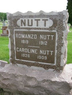
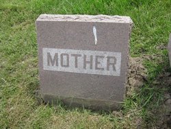
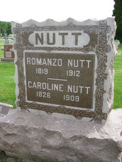
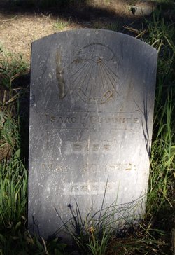
Caroline Goodenow Nutt
| Birth | : | 4 Feb 1826 Vestal, Broome County, New York, USA |
| Death | : | 2 Oct 1909 Tama County, Iowa, USA |
| Burial | : | Grove Road Cemetery, Harrogate, Harrogate Borough, England |
| Coordinate | : | 53.9996400, -1.5356000 |
| Plot | : | Block 8 Lot 56 |
| Description | : | Caroline is a daughter of Luther and Martha Goodenow. Sometimes Caroline's maiden name is seen as Goodnow or Goodnoe. In 1842 Caroline married Romanzo Nutt, a son of David Barnett Nutt and Susanna Bell. Their 66+ year marriage produced six children. In 1844 Romanzo and Caroline went west and located at Chicago, Illinois, where they remained two years. They then returned to New York and settled in the Town of Vestal, Broome county, where they resided for approximately 17 or 18 years. In March 1864 Romanzo Nutt and his family once again headed west, this time settling in Eagle township, Black Hawk county,... Read More |
frequently asked questions (FAQ):
-
Where is Caroline Goodenow Nutt's memorial?
Caroline Goodenow Nutt's memorial is located at: Grove Road Cemetery, Harrogate, Harrogate Borough, England.
-
When did Caroline Goodenow Nutt death?
Caroline Goodenow Nutt death on 2 Oct 1909 in Tama County, Iowa, USA
-
Where are the coordinates of the Caroline Goodenow Nutt's memorial?
Latitude: 53.9996400
Longitude: -1.5356000
Family Members:
Parent
Spouse
Siblings
Children
Flowers:
Nearby Cemetories:
1. Grove Road Cemetery
Harrogate, Harrogate Borough, England
Coordinate: 53.9996400, -1.5356000
2. St Peter Church War Memorial
Harrogate, Harrogate Borough, England
Coordinate: 53.9931340, -1.5412160
3. Harrogate War Memorial
Harrogate, Harrogate Borough, England
Coordinate: 53.9926370, -1.5419270
4. Christ Churchyard
Harrogate, Harrogate Borough, England
Coordinate: 53.9938540, -1.5261070
5. St John the Evangelist Churchyard
Bilton, Harrogate Borough, England
Coordinate: 54.0080790, -1.5373560
6. Harlow Hill Cemetery
Harrogate, Harrogate Borough, England
Coordinate: 53.9803290, -1.5646610
7. Stonefall Cemetery and Crematorium
Harrogate, Harrogate Borough, England
Coordinate: 53.9854830, -1.4953260
8. St Thomas the Apostle Churchyard
Killinghall, Harrogate Borough, England
Coordinate: 54.0206880, -1.5669210
9. St Thomas Churchyard
Scotton, Harrogate Borough, England
Coordinate: 54.0296020, -1.5037280
10. Mother Shiptons Cave
Knaresborough, Harrogate Borough, England
Coordinate: 54.0086910, -1.4747050
11. Friends Burial Ground
Scotton, Harrogate Borough, England
Coordinate: 54.0312900, -1.5029300
12. St John the Baptist Churchyard
Knaresborough, Harrogate Borough, England
Coordinate: 54.0097850, -1.4718200
13. St. Robert of Knaresborough Churchyard
Pannal, Harrogate Borough, England
Coordinate: 53.9604110, -1.5344860
14. Holy Trinity Churchyard
Knaresborough, Harrogate Borough, England
Coordinate: 54.0057800, -1.4659670
15. St Paul and St Margaret Churchyard
Nidd, Harrogate Borough, England
Coordinate: 54.0423920, -1.5417480
16. All Saints Churchyard
Ripley, Harrogate Borough, England
Coordinate: 54.0397200, -1.5687800
17. St Joseph and St James Churchyard
Follifoot, Harrogate Borough, England
Coordinate: 53.9690940, -1.4788570
18. Knaresborough Cemetery
Knaresborough, Harrogate Borough, England
Coordinate: 54.0051260, -1.4585390
19. St John the Baptist Churchyard
Brearton, Harrogate Borough, England
Coordinate: 54.0442190, -1.5074460
20. St Thomas Becket Churchyard
Hampsthwaite, Harrogate Borough, England
Coordinate: 54.0267170, -1.6054560
21. St Oswald Churchyard
Farnham, Harrogate Borough, England
Coordinate: 54.0398420, -1.4698910
22. Kirkby Overblow Cemetery
Kirkby Overblow, Harrogate Borough, England
Coordinate: 53.9429700, -1.5097500
23. All Saints Churchyard
Kirkby Overblow, Harrogate Borough, England
Coordinate: 53.9379000, -1.5067000
24. St Wilfrid Churchyard
South Stainley, Harrogate Borough, England
Coordinate: 54.0636650, -1.5327810

