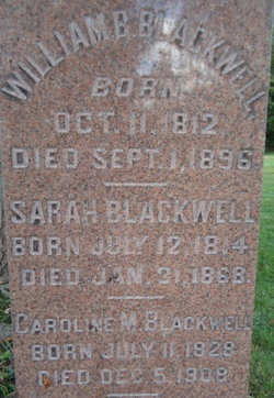
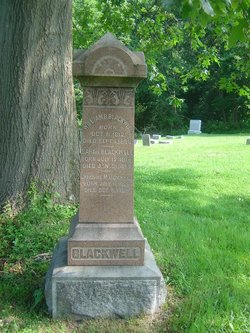
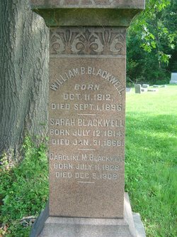
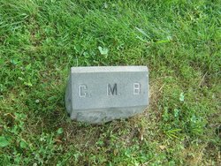
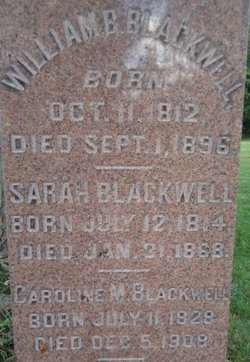
Caroline M. “Carrie” Davis Blackwell
| Birth | : | 11 Jul 1828 |
| Death | : | 5 Dec 1908 |
| Burial | : | Goodwill Cemetery, Goodwill, Worcester County, USA |
| Coordinate | : | 38.0667000, -75.5000000 |
| Description | : | Trenton Evening Times Monday,December 07,1908 Mrs. Carrie E. Blackwell-widow of William B. Blackwell, of Titusville, died suddenly at her home Saturday noon of heart trouble. Mrs. Blackwell arose Saturday morning in good health and had breakfast, after which she attended to some house duties and went to her bed for a rest. Later she was found dead by members of the family. Mrs. Blackwell was a sister of the Rev. J.B. Davis, pastor of the Presbyterian Church, Titusville, and step mother of C.E. Blackwell, whose brother in law, Professor A.H. Hartwell, died Friday night. |
frequently asked questions (FAQ):
-
Where is Caroline M. “Carrie” Davis Blackwell's memorial?
Caroline M. “Carrie” Davis Blackwell's memorial is located at: Goodwill Cemetery, Goodwill, Worcester County, USA.
-
When did Caroline M. “Carrie” Davis Blackwell death?
Caroline M. “Carrie” Davis Blackwell death on 5 Dec 1908 in
-
Where are the coordinates of the Caroline M. “Carrie” Davis Blackwell's memorial?
Latitude: 38.0667000
Longitude: -75.5000000
Family Members:
Spouse
Flowers:
Nearby Cemetories:
1. Goodwill Cemetery
Goodwill, Worcester County, USA
Coordinate: 38.0667000, -75.5000000
2. Georgetown Baptist Church Cemetery
Snow Hill, Worcester County, USA
Coordinate: 38.0915580, -75.5160020
3. Hancock Cemetery
Worcester County, USA
Coordinate: 38.0783005, -75.4599991
4. Shiloh Cemetery
Worcester County, USA
Coordinate: 38.0974998, -75.4760971
5. Mount Zion United Methodist Church Cemetery
Pocomoke City, Worcester County, USA
Coordinate: 38.0762850, -75.5464160
6. First Baptist Cemetery
Pocomoke City, Worcester County, USA
Coordinate: 38.0774220, -75.5471510
7. Old Shiloh Cemetery
Worcester County, USA
Coordinate: 38.1044006, -75.4882965
8. Old Shiloh Cemetery
Pocomoke City, Worcester County, USA
Coordinate: 38.1044960, -75.4878110
9. Holy Name of Jesus Churchyard
Pocomoke City, Worcester County, USA
Coordinate: 38.0626898, -75.5521236
10. Saint Marks Cemetery
Worcester County, USA
Coordinate: 38.0430984, -75.4569016
11. Saint Lukes Cemetery
Worcester County, USA
Coordinate: 38.0960999, -75.4531021
12. Remson United Methodist Church Cemetery
Pocomoke City, Worcester County, USA
Coordinate: 38.0219002, -75.4713974
13. Bethany United Methodist Church Cemetery
Pocomoke City, Worcester County, USA
Coordinate: 38.0754420, -75.5655290
14. Saint Marys Cemetery
Pocomoke City, Worcester County, USA
Coordinate: 38.0744019, -75.5661011
15. Pitts Creek Presbyterian Cemetery
Pocomoke City, Worcester County, USA
Coordinate: 38.0793686, -75.5653076
16. Betheden Cemetery
Worcester County, USA
Coordinate: 38.1114006, -75.4608002
17. Bratten Family Plot
Cokesbury, Somerset County, USA
Coordinate: 38.1051500, -75.5504100
18. Beth Eden - Tilghman Hill Cemetery
Worcester County, USA
Coordinate: 38.1150017, -75.4621964
19. Mount Hope Cemetery
Stockton, Worcester County, USA
Coordinate: 38.0217018, -75.4550018
20. Tindleys Chapel Community and Memorial Park
West Pocomoke, Somerset County, USA
Coordinate: 38.0971781, -75.5663652
21. Mount Sinai Cemetery
Pocomoke City, Worcester County, USA
Coordinate: 38.0060997, -75.5030975
22. Salem Methodist Church Cemetery
Pocomoke City, Worcester County, USA
Coordinate: 38.0663986, -75.5802994
23. Home Beneficial Cemetery
Stockton, Worcester County, USA
Coordinate: 38.0542500, -75.4175827
24. Church Street Cemetery
Worcester County, USA
Coordinate: 38.0560989, -75.4169006

