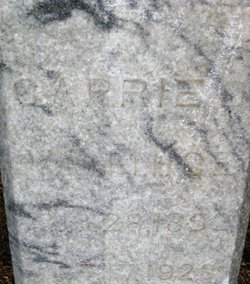
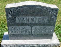
Carrie Duret Chapin Van Nice
| Birth | : | 28 Aug 1852 Indiana, USA |
| Death | : | 17 Oct 1928 Benton County, Iowa, USA |
| Burial | : | Big Grove Cemetery, Benton County, USA |
| Coordinate | : | 42.1088982, -92.0867004 |
| Description | : | Daughter of James Wright Chapin and Mary Ann (Duret) Chapin. Her mother died when Carrie was an infant. (Note - Her mother's maiden name was spelled various ways (i.e. Durrette, Durette, Durett . ) Known children: Glenn Chapin VanNice, Anna R. Van Nickle 1860 Census - listed as Carrie D. Chapin, with father "J.W. Chapin" in Kokomo, Howard, Indiana. 1870 Census - listed as Carrie B. Chapin with father "Jasth Chapin" in Vinton, Benton, Iowa 1880 Census - listed as Carrie D. Vannice with husband and daughter Anna, age 2 in Big Grove,... Read More |
frequently asked questions (FAQ):
-
Where is Carrie Duret Chapin Van Nice's memorial?
Carrie Duret Chapin Van Nice's memorial is located at: Big Grove Cemetery, Benton County, USA.
-
When did Carrie Duret Chapin Van Nice death?
Carrie Duret Chapin Van Nice death on 17 Oct 1928 in Benton County, Iowa, USA
-
Where are the coordinates of the Carrie Duret Chapin Van Nice's memorial?
Latitude: 42.1088982
Longitude: -92.0867004
Family Members:
Parent
Spouse
Children
Flowers:
Nearby Cemetories:
1. Big Grove Cemetery
Benton County, USA
Coordinate: 42.1088982, -92.0867004
2. Indian Cemetery
Garrison, Benton County, USA
Coordinate: 42.0999956, -92.1168495
3. Bellar-Eden Cemetery
Vinton, Benton County, USA
Coordinate: 42.0803000, -92.0470500
4. Garrison Cemetery
Garrison, Benton County, USA
Coordinate: 42.1369019, -92.1483002
5. Saint Marys Cemetery
Vinton, Benton County, USA
Coordinate: 42.1683006, -92.0475006
6. LaRue Cemetery
Benton County, USA
Coordinate: 42.0574989, -92.1438980
7. Maplewood Cemetery
Vinton, Benton County, USA
Coordinate: 42.1699982, -92.0490036
8. Big Grove-Homer Cemetery
Benton County, USA
Coordinate: 42.0867004, -92.1821976
9. Carlisle Grove Cemetery
Garrison, Benton County, USA
Coordinate: 42.1730995, -92.1386032
10. East-Eden Cemetery
Eden, Benton County, USA
Coordinate: 42.1091995, -91.9841995
11. Evergreen Cemetery
Vinton, Benton County, USA
Coordinate: 42.1610985, -92.0089035
12. Prairie United Brethren Cemetery
Vinton, Benton County, USA
Coordinate: 42.1239700, -91.9744600
13. Bender Cemetery
Keystone, Benton County, USA
Coordinate: 42.0363998, -92.1536026
14. Kirchner Cemetery
Benton County, USA
Coordinate: 42.0727300, -92.2027400
15. Plum Grove Cemetery
Vinton, Benton County, USA
Coordinate: 42.1410870, -91.9651870
16. Pettit Hill Cemetery
Vinton, Benton County, USA
Coordinate: 42.1916900, -91.9974000
17. Pratt Creek Cemetery
Vinton, Benton County, USA
Coordinate: 42.2104000, -92.1307400
18. Greenwalt Cemetery
Mount Auburn, Benton County, USA
Coordinate: 42.2256012, -92.1038971
19. Gnagy Cemetery
Benton County, USA
Coordinate: 42.1418991, -92.2416992
20. Salem Cemetery
Van Horne, Benton County, USA
Coordinate: 41.9928017, -92.0421982
21. Urmy Cemetery
Benton County, USA
Coordinate: 42.1719017, -92.2281036
22. Saint Johns Lutheran Cemetery
Newhall, Benton County, USA
Coordinate: 41.9933014, -92.0093994
23. Holy Cross Cemetery
Keystone, Benton County, USA
Coordinate: 41.9961014, -92.1825027
24. Fairview Cemetery
Benton County, USA
Coordinate: 42.2141991, -92.2007980

