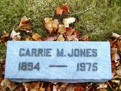
Carrie Marie Kellerhals Jones
| Birth | : | 6 Jun 1894 Callaway County, Missouri, USA |
| Death | : | 22 Feb 1975 Jefferson City, Cole County, Missouri, USA |
| Burial | : | Old Spoon Creek Primitive Baptist Church Cemetery, Critz, Patrick County, USA |
| Coordinate | : | 36.6120220, -80.1120370 |
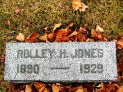
| Description | : | Mrs. Carrie Marie Jones, 80, of 2301 Idlewood Rd., died Saturday at Charles E. Still Hospital. Mrs. Jones was born June 6, 1894, in Callaway County, the daughter of Joseph and Mary Brockmeier Kellerhals. In 1914, she was married at St. Charles to Rolley Hayden Jones, who died in 1929. She attended parochial schools at St. Charles. She had lived in Jefferson City since 1938, when she moved from St. Charles. She was a member of the Trinity Lutheran Church and a charter member of the Trinity Missionary Society, the Trinity Evening Guild and the Memorial Hospital Auxiliary. |
frequently asked questions (FAQ):
-
Where is Carrie Marie Kellerhals Jones's memorial?
Carrie Marie Kellerhals Jones's memorial is located at: Old Spoon Creek Primitive Baptist Church Cemetery, Critz, Patrick County, USA.
-
When did Carrie Marie Kellerhals Jones death?
Carrie Marie Kellerhals Jones death on 22 Feb 1975 in Jefferson City, Cole County, Missouri, USA
-
Where are the coordinates of the Carrie Marie Kellerhals Jones's memorial?
Latitude: 36.6120220
Longitude: -80.1120370
Family Members:
Spouse
Children
Flowers:
Nearby Cemetories:
1. Old Spoon Creek Primitive Baptist Church Cemetery
Critz, Patrick County, USA
Coordinate: 36.6120220, -80.1120370
2. Carter - Boles - Tudor Cemetery
Critz, Patrick County, USA
Coordinate: 36.6177425, -80.0936564
3. Spoon Creek Primitive Baptist Church Cemetery
Critz, Patrick County, USA
Coordinate: 36.6250150, -80.1441710
4. Critz Baptist Church Cemetery
Critz, Patrick County, USA
Coordinate: 36.6296997, -80.1513977
5. Reynolds Homestead Cemetery
Critz, Patrick County, USA
Coordinate: 36.6441000, -80.1484130
6. Burnette, Handy, Mabe, Stone Cemetery
Patrick County, USA
Coordinate: 36.6735000, -80.1259000
7. Branch Cemetery
Critz, Patrick County, USA
Coordinate: 36.6817540, -80.1117210
8. Joyce Cemetery
Stokes County, USA
Coordinate: 36.5286960, -80.1357950
9. Koger Family Cemetery
Bassett, Henry County, USA
Coordinate: 36.6849780, -80.0479780
10. Coleman Cemetery
Henry County, USA
Coordinate: 36.6757851, -80.0250168
11. Amos Cemetery
Stokes County, USA
Coordinate: 36.5247520, -80.0472010
12. Dillon Cemetery
Henry County, USA
Coordinate: 36.6770240, -79.9976560
13. Fair Haven Memorial Park
Horse Pasture, Henry County, USA
Coordinate: 36.6249500, -79.9709300
14. Ward Cemetery
Horse Pasture, Henry County, USA
Coordinate: 36.6367370, -79.9688780
15. Blackberry Baptist Church Cemetery
Bassett, Henry County, USA
Coordinate: 36.7147300, -80.0404700
16. Martin Family Cemetery
Bassett, Henry County, USA
Coordinate: 36.7244480, -80.0587550
17. Horsepasture Christian Church Cemetery
Horse Pasture, Henry County, USA
Coordinate: 36.6092200, -79.9545400
18. Amos Cemetery on Hwy 770
Stokes County, USA
Coordinate: 36.4946040, -80.0454850
19. Buffalo Cemetery
Buffalo, Stokes County, USA
Coordinate: 36.4904510, -80.0566110
20. Mayo Missionary Baptist Church Cemetery
Horse Pasture, Henry County, USA
Coordinate: 36.5794601, -79.9510727
21. Meadow Christian Church Cemetery
Fieldale, Henry County, USA
Coordinate: 36.6571520, -79.9556040
22. Victor Hill Pentecostal Holiness Church
Mayodan, Rockingham County, USA
Coordinate: 36.4983900, -80.0241570
23. Harris Cemetery
Rockingham County, USA
Coordinate: 36.5022011, -80.0164032
24. Manning Family Cemetery
Bassett, Henry County, USA
Coordinate: 36.7431430, -80.0759880


