

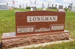
Carrie May Hall Longman
| Birth | : | 7 Jan 1882 Warren County, Ohio, USA |
| Death | : | 16 Dec 1969 Omaha, Douglas County, Nebraska, USA |
| Burial | : | Willow Cemetery, Greene County, USA |
| Coordinate | : | 41.9067001, -94.5730972 |
| Description | : | Carrie was the daughter of Oliver Hall and Mary Jane Holdridge. She moved in with her uncle, Lewis Holdridge, between 1895 and 1900. She married William Longman on 29 October 1902 in Guthrie Co, Iowa. They were the parents of Edna (1905 IA) and Mildred (1907 IA). THE BAYARD NEWS - December 18th, 1969 - Mrs Will Longman, 87, died Tuesday evening in an Omaha hospital where she had been a patient for several weeks. The Longman family formerly lived in Bayard and Mrs Longman attended the Bayard schools. Final rites are scheduled at the United Methodist church in Bayard Saturday at... Read More |
frequently asked questions (FAQ):
-
Where is Carrie May Hall Longman's memorial?
Carrie May Hall Longman's memorial is located at: Willow Cemetery, Greene County, USA.
-
When did Carrie May Hall Longman death?
Carrie May Hall Longman death on 16 Dec 1969 in Omaha, Douglas County, Nebraska, USA
-
Where are the coordinates of the Carrie May Hall Longman's memorial?
Latitude: 41.9067001
Longitude: -94.5730972
Family Members:
Spouse
Flowers:


Nearby Cemetories:
1. Willow Cemetery
Greene County, USA
Coordinate: 41.9067001, -94.5730972
2. Union Township Cemetery
Coon Rapids, Carroll County, USA
Coordinate: 41.8781013, -94.6389008
3. Coon Rapids Cemetery
Coon Rapids, Carroll County, USA
Coordinate: 41.8778000, -94.6678009
4. Highland Cemetery
Bayard, Guthrie County, USA
Coordinate: 41.8241997, -94.5717010
5. Oak Hill Cemetery
Coon Rapids, Carroll County, USA
Coordinate: 41.9053001, -94.7200012
6. Greenbrier Cemetery
Cooper, Greene County, USA
Coordinate: 41.9063988, -94.4218979
7. Dodge Center Cemetery
Bagley, Guthrie County, USA
Coordinate: 41.8194008, -94.4697037
8. Orange Township Cemetery
Guthrie County, USA
Coordinate: 41.8163986, -94.6844025
9. Scranton Township Cemetery
Scranton, Greene County, USA
Coordinate: 42.0306015, -94.5783005
10. Old Carrollton Cemetery
Carrollton, Carroll County, USA
Coordinate: 41.9233017, -94.7403030
11. Headley Cemetery
Jefferson, Greene County, USA
Coordinate: 42.0041504, -94.4335815
12. German Cemetery
Greene County, USA
Coordinate: 41.9136009, -94.3778000
13. Tuttles Grove Cemetery
Guthrie County, USA
Coordinate: 41.8130989, -94.7228012
14. McCurdy Cemetery
Carroll County, USA
Coordinate: 41.9403000, -94.7649994
15. Gibson-Fleck-Thompson Cemetery
Scranton, Greene County, USA
Coordinate: 42.0428870, -94.4988800
16. Wright Cemetery
Jefferson, Greene County, USA
Coordinate: 42.0228004, -94.4477997
17. Fair Oaks Cemetery
Scranton, Greene County, USA
Coordinate: 42.0355988, -94.4460983
18. Moffit Grove Cemetery
Yale, Guthrie County, USA
Coordinate: 41.7668991, -94.4539032
19. Richland Memorial Cemetery
Herndon, Guthrie County, USA
Coordinate: 41.8353004, -94.3657990
20. Franklin Township Cemetery
Cooper, Greene County, USA
Coordinate: 41.9268990, -94.3388977
21. Dillavou Cemetery
Kendrick Township, Greene County, USA
Coordinate: 42.0802994, -94.6138992
22. Seeley Township Cemetery
Guthrie County, USA
Coordinate: 41.7318993, -94.6147003
23. Saint Josephs Cemetery
Dedham, Carroll County, USA
Coordinate: 41.8993988, -94.8210983
24. Dedham Cemetery
Dedham, Carroll County, USA
Coordinate: 41.8993988, -94.8225021