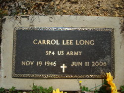
Carrol Lee Long
| Birth | : | 19 Nov 1946 Bunker, Reynolds County, Missouri, USA |
| Death | : | 11 Jun 2008 Black, Reynolds County, Missouri, USA |
| Burial | : | Corridon-Reynolds Memorial Park, Reynolds County, USA |
| Coordinate | : | 37.3885994, -91.0736008 |
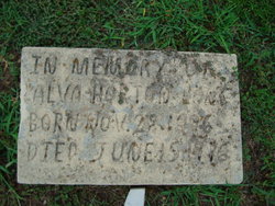
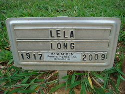
| Description | : | Carrol Lee Long, 61, died June 11, 2008, at his home in Black, Mo. He was born Nov. 19,1946, in Bunker, Mo., son of Lela(Palmer) Long, who survives and resides in Piedmont, and the late Alva Long. Mr. Long attended Little Vine United Baptist Church in Bunker. He enjoyed working on cars, fishing, raising rabbits and dogs, and spending time outdoors. In addition to his mother, he is survived by two sisters, Susie Kucera, Glendale, Ariz., Edna Salsman, Piedmont; four stepchildren, Scott Hart, Ellington, Matt Hart, Black, Berniece Hart, Van Buren, Tess Robertson, Mt. View; eight step-grandchildren. The funeral was held June 15 at... Read More |
frequently asked questions (FAQ):
-
Where is Carrol Lee Long's memorial?
Carrol Lee Long's memorial is located at: Corridon-Reynolds Memorial Park, Reynolds County, USA.
-
When did Carrol Lee Long death?
Carrol Lee Long death on 11 Jun 2008 in Black, Reynolds County, Missouri, USA
-
Where are the coordinates of the Carrol Lee Long's memorial?
Latitude: 37.3885994
Longitude: -91.0736008
Family Members:
Parent
Spouse
Flowers:
Nearby Cemetories:
1. Corridon-Reynolds Memorial Park
Reynolds County, USA
Coordinate: 37.3885994, -91.0736008
2. Tarvid Cemetery
Reynolds County, USA
Coordinate: 37.3755989, -91.0477982
3. Sutterfield Cemetery
Reynolds, Reynolds County, USA
Coordinate: 37.3628006, -91.1243973
4. Polk Memorial Cemetery
Ellington, Reynolds County, USA
Coordinate: 37.3661400, -91.1281400
5. Luretta Johnson grave
Centerville, Reynolds County, USA
Coordinate: 37.4056400, -91.0145000
6. Weible Cemetery
Corridon, Reynolds County, USA
Coordinate: 37.4407997, -91.0781021
7. Davis Cemetery
Reynolds County, USA
Coordinate: 37.4514008, -91.1175003
8. Santhuff Cemetery
Ellington, Reynolds County, USA
Coordinate: 37.3307991, -91.0139008
9. Pleasant Hill Cemetery
Ellington, Reynolds County, USA
Coordinate: 37.3536800, -90.9733800
10. Pyles Cemetery
Reynolds County, USA
Coordinate: 37.3280983, -90.9910965
11. Burnett Cemetery
Rat, Shannon County, USA
Coordinate: 37.3829340, -91.1944630
12. Little Radford Cemetery
Reynolds County, USA
Coordinate: 37.4869003, -91.0594025
13. R.L.D.S. Cemetery
Ellington, Reynolds County, USA
Coordinate: 37.2987700, -91.1262200
14. Turner Cemetery
Shannondale, Shannon County, USA
Coordinate: 37.3781013, -91.2007980
15. West Fork Cemetery
West Fork, Reynolds County, USA
Coordinate: 37.4925003, -91.1022034
16. Howell Cemetery
Centerville, Reynolds County, USA
Coordinate: 37.4597015, -90.9736023
17. Knuckles Cemetery
Dagonia, Reynolds County, USA
Coordinate: 37.2868996, -91.1247025
18. Estep Cemetery
Reynolds County, USA
Coordinate: 37.4803009, -91.1541977
19. Johnson Cemetery
Centerville, Reynolds County, USA
Coordinate: 37.4519005, -90.9567032
20. Mayes Cemetery
Reynolds County, USA
Coordinate: 37.2863100, -91.0104600
21. Neely Cemetery
Dagonia, Reynolds County, USA
Coordinate: 37.2759570, -91.1176120
22. Huda Chitwood Cemetery
Ellington, Reynolds County, USA
Coordinate: 37.2738991, -91.1119003
23. Counts Cemetery
Reynolds County, USA
Coordinate: 37.2783730, -91.1327290
24. Lower Bee Fork Cemetery
Bunker, Reynolds County, USA
Coordinate: 37.4544180, -91.2024880


