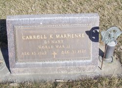
Carroll Kay “Bill” Marhenke
| Birth | : | 13 Dec 1925 Republic County, Kansas, USA |
| Death | : | 31 Dec 1976 Omaha, Douglas County, Nebraska, USA |
| Burial | : | Cozad Cemetery, Cozad, Dawson County, USA |
| Coordinate | : | 40.8605995, -99.9475021 |
| Plot | : | Sec 9 Lot 23 Sp 4 |
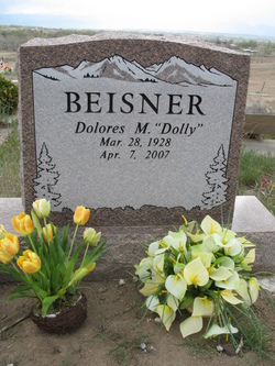
| Description | : | Age 51y Second marriage to Kay Vivian Stapp, married 2 July 1968 in Cozad, NE. Had daughter with Dolores Thompson: Marianne Marhenke. |
frequently asked questions (FAQ):
-
Where is Carroll Kay “Bill” Marhenke's memorial?
Carroll Kay “Bill” Marhenke's memorial is located at: Cozad Cemetery, Cozad, Dawson County, USA.
-
When did Carroll Kay “Bill” Marhenke death?
Carroll Kay “Bill” Marhenke death on 31 Dec 1976 in Omaha, Douglas County, Nebraska, USA
-
Where are the coordinates of the Carroll Kay “Bill” Marhenke's memorial?
Latitude: 40.8605995
Longitude: -99.9475021
Family Members:
Parent
Spouse
Siblings
Flowers:
Nearby Cemetories:
1. Cozad Cemetery
Cozad, Dawson County, USA
Coordinate: 40.8605995, -99.9475021
2. Grace Cemetery
Cozad, Dawson County, USA
Coordinate: 40.8602982, -99.8644028
3. Cottonwood Cemetery
Dawson County, USA
Coordinate: 40.9322014, -99.9197006
4. Saint Johns Lutheran Cemetery
Lexington, Dawson County, USA
Coordinate: 40.9019012, -99.8458023
5. Buffalo Grove Presbyterian Church Cemetery
Buffalo, Dawson County, USA
Coordinate: 40.8721000, -99.8270000
6. Fairview Cemetery
Dawson County, USA
Coordinate: 40.7719002, -99.9955978
7. Rhinehart Cemetery
Cozad, Dawson County, USA
Coordinate: 40.9599000, -99.9105000
8. Willow Island Cemetery
Cozad, Dawson County, USA
Coordinate: 40.9016991, -100.0755997
9. Walnut Grove Cemetery
Cozad, Dawson County, USA
Coordinate: 40.9763985, -99.9944000
10. Block Cemetery
Cozad, Dawson County, USA
Coordinate: 40.9753000, -100.0085000
11. Hillside Cemetery
Dawson County, USA
Coordinate: 40.8946991, -99.7869034
12. Hewitt Cemetery
Lexington, Dawson County, USA
Coordinate: 40.8588982, -99.7769012
13. Pleasant View Cemetery
Dawson County, USA
Coordinate: 40.8293991, -100.1132965
14. Grand View Cemetery
Gothenburg, Dawson County, USA
Coordinate: 40.9474983, -100.0907974
15. Rose Hill Cemetery
Dawson County, USA
Coordinate: 40.9888992, -99.8442001
16. Gothenburg Cemetery
Gothenburg, Dawson County, USA
Coordinate: 40.9458008, -100.1397018
17. Christ Lutheran Church Cemetery
Gothenburg, Dawson County, USA
Coordinate: 40.9623000, -100.1287000
18. First United Methodist Church Columbarium
Lexington, Dawson County, USA
Coordinate: 40.7810000, -99.7397000
19. Greenwood Cemetery
Lexington, Dawson County, USA
Coordinate: 40.7956467, -99.7286682
20. Buffalo First Lutheran Cemetery Old
Buffalo, Dawson County, USA
Coordinate: 41.0100000, -99.8152000
21. Buffalo First Lutheran Cemetery New
Buffalo, Dawson County, USA
Coordinate: 41.0127000, -99.8150000
22. Salem Cemetery
Dawson County, USA
Coordinate: 40.9961014, -100.1268997
23. Saint Anns Cemetery
Lexington, Dawson County, USA
Coordinate: 40.7789001, -99.7114029
24. Eustis East Cemetery
Eustis, Frontier County, USA
Coordinate: 40.6714100, -100.0199780


