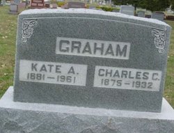
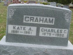
Catherine Alzada “Kate” Ward Graham
| Birth | : | 1881 |
| Death | : | 1961 |
| Burial | : | Quincy Cemetery, Quincy, Plumas County, USA |
| Coordinate | : | 39.9361000, -120.9297028 |
frequently asked questions (FAQ):
-
Where is Catherine Alzada “Kate” Ward Graham's memorial?
Catherine Alzada “Kate” Ward Graham's memorial is located at: Quincy Cemetery, Quincy, Plumas County, USA.
-
When did Catherine Alzada “Kate” Ward Graham death?
Catherine Alzada “Kate” Ward Graham death on 1961 in
-
Where are the coordinates of the Catherine Alzada “Kate” Ward Graham's memorial?
Latitude: 39.9361000
Longitude: -120.9297028
Family Members:
Parent
Spouse
Siblings
Children
Flowers:
Nearby Cemetories:
1. Quincy Chinese Cemetery
Quincy, Plumas County, USA
Coordinate: 39.9357770, -120.9247350
2. Plumas County Cemetery
Quincy, Plumas County, USA
Coordinate: 39.9486008, -120.9417038
3. East Lawn Cemetery
Quincy, Plumas County, USA
Coordinate: 39.9336014, -120.9088974
4. Stiver Cemetery
Quincy, Plumas County, USA
Coordinate: 39.9747009, -120.9300003
5. George Schmidt Burial Ground
Keddie, Plumas County, USA
Coordinate: 39.9873046, -120.9768519
6. Meadow Valley Cemetery
Meadow Valley, Plumas County, USA
Coordinate: 39.9307050, -121.0591870
7. Andrew J Brineger Gravesite
Quincy, Plumas County, USA
Coordinate: 39.8380230, -120.8486450
8. Taylorsville District Cemetery
Taylorsville, Plumas County, USA
Coordinate: 40.0740820, -120.8367200
9. Taylorsville Indian Burial Grounds
Taylorsville, Plumas County, USA
Coordinate: 40.0748050, -120.8359420
10. Shims Flat Indian Burial Ground
Taylorsville, Plumas County, USA
Coordinate: 40.0499992, -120.7780991
11. Crescent Mills Cemetery
Crescent Mills, Plumas County, USA
Coordinate: 40.0998890, -120.9095640
12. Stampfli Cemetery
Crescent Mills, Plumas County, USA
Coordinate: 40.1059860, -120.9109360
13. Gorbet Ranch Cemetery
Greenville, Plumas County, USA
Coordinate: 40.1179100, -120.8909300
14. Whiskey Diggings Cemetery
Sierra County, USA
Coordinate: 39.7504200, -120.8868700
15. Gibsonville Cemetery
Gibsonville, Sierra County, USA
Coordinate: 39.7448700, -120.9097100
16. Cromberg Cemetery
Cromberg, Plumas County, USA
Coordinate: 39.8535995, -120.6947021
17. Greenville District Cemetery
Greenville, Plumas County, USA
Coordinate: 40.1378400, -120.9417000
18. North Valley Indian Burial Grounds
Greenville, Plumas County, USA
Coordinate: 40.1455200, -120.8695700
19. Big Flat Cemetery
Seneca, Plumas County, USA
Coordinate: 40.1077995, -121.0982971
20. Rich Bar Cemetery
Plumas County, USA
Coordinate: 40.0074260, -121.1959470
21. Pine Grove Cemetery
Sierra County, USA
Coordinate: 39.7174988, -120.8983002
22. Howland Flat Cemetery
Howland Flat, Sierra County, USA
Coordinate: 39.7152500, -120.8821900
23. Davis Family Cemetery
Genesee, Plumas County, USA
Coordinate: 40.0648010, -120.6877290
24. Grizzly Creek Grave
Plumas County, USA
Coordinate: 39.8642900, -121.2269500

