
| Birth | : | 6 Mar 1933 Rulo, Richardson County, Nebraska, USA |
| Death | : | 24 Nov 2009 Kansas City, Jackson County, Missouri, USA |
| Burial | : | Edenhope Cemetery, Edenhope, West Wimmera Shire, Australia |
| Coordinate | : | -37.0421400, 141.3039580 |
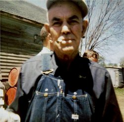
| Description | : | Catherine A. Rowell, 76, of Kansas City, MO, passed away November 24, 2009 at Kansas City. She was born March 6, 1933 at Rulo, NE to the late Ralph and Hazel (Miller) Liberty. On December 31, 1949 she married LaVern Rowell at Auburn, NE. He passed away June 13, 2003. Catherine was raised at Rulo. When married, the couple established their home in Kansas City and she has continued to live there. She was a homemaker her entire life. Catherine is survived by her sons, Dennis and Kerry both of Kansas City, Michael and his wife Mindy of Robinson, KS, brothers, Richard and... Read More |
frequently asked questions (FAQ):
-
Where is Catherine Arminta Liberty Rowell's memorial?
Catherine Arminta Liberty Rowell's memorial is located at: Edenhope Cemetery, Edenhope, West Wimmera Shire, Australia.
-
When did Catherine Arminta Liberty Rowell death?
Catherine Arminta Liberty Rowell death on 24 Nov 2009 in Kansas City, Jackson County, Missouri, USA
-
Where are the coordinates of the Catherine Arminta Liberty Rowell's memorial?
Latitude: -37.0421400
Longitude: 141.3039580
Family Members:

Flowers:


Nearby Cemetories:
1. Edenhope Cemetery
Edenhope, West Wimmera Shire, Australia
Coordinate: -37.0421400, 141.3039580
2. Apsley Cemetery
Apsley, West Wimmera Shire, Australia
Coordinate: -36.9589380, 141.0837570
3. Chetwynd Cemetery
Chetwynd, West Wimmera Shire, Australia
Coordinate: -37.2791510, 141.3951660
4. Karnak Cemetery
Karnak, West Wimmera Shire, Australia
Coordinate: -36.8234670, 141.4826510
5. Harrow Cemetery
Harrow, Southern Grampians Shire, Australia
Coordinate: -37.1566380, 141.6217120
6. Dergholm Cemetery
Dergholm, West Wimmera Shire, Australia
Coordinate: -37.3717520, 141.2253000
7. Minimay Cemetery
Minimay, West Wimmera Shire, Australia
Coordinate: -36.7228070, 141.1613810
8. Kybybolite Cemetery
Kybybolite, Naracoorte Lucindale Council, Australia
Coordinate: -36.8815610, 140.9291740
9. Tarrayoukyan Cemetery
Tarrayoukyan, Southern Grampians Shire, Australia
Coordinate: -37.3253840, 141.5809310
10. Goroke Public Cemetery
Goroke, West Wimmera Shire, Australia
Coordinate: -36.7137300, 141.4900600
11. Hynam Cemetery
Naracoorte Lucindale Council, Australia
Coordinate: -36.9393410, 140.8490120
12. Frances Cemetery
Frances, Naracoorte Lucindale Council, Australia
Coordinate: -36.7032530, 140.9614290
13. Tooan Cemetery
Mitre, Horsham Rural City, Australia
Coordinate: -36.7705300, 141.7524300
14. Clear Lake Cemetery
Clear Lake, Horsham Rural City, Australia
Coordinate: -36.9204860, 141.8578130
15. Naracoorte Cemetery
Naracoorte, Naracoorte Lucindale Council, Australia
Coordinate: -36.9460270, 140.7302250
16. Balmoral Cemetery
Balmoral, Southern Grampians Shire, Australia
Coordinate: -37.2754100, 141.8308440
17. Penola Old Cemetery
Penola, Wattle Range Council, Australia
Coordinate: -37.3670740, 140.8412400
18. Moyhall Homestead
Naracoorte Lucindale Council, Australia
Coordinate: -37.0585750, 140.6699470
19. Penola Cemetery
Penola, Wattle Range Council, Australia
Coordinate: -37.4009210, 140.8362800
20. Heathfield Cemetery
Lake Mundi, Glenelg Shire, Australia
Coordinate: -37.5713233, 141.1436213
21. Casterton Old Cemetery
Casterton, Glenelg Shire, Australia
Coordinate: -37.5948850, 141.3700380
22. Noradjuha Cemetery
Noradjuha, Horsham Rural City, Australia
Coordinate: -36.8183160, 141.9431350
23. Casterton Cemetery
Casterton, Glenelg Shire, Australia
Coordinate: -37.5992440, 141.4088270
24. Burnside Cemetery
Naracoorte, Naracoorte Lucindale Council, Australia
Coordinate: -36.7925600, 140.6600300