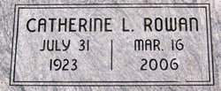
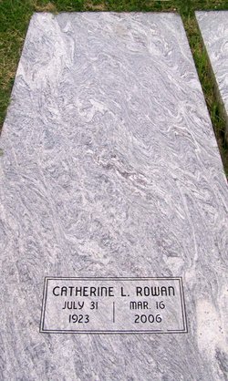
Catherine Louise Wiles Rowan
| Birth | : | 31 Jul 1923 Wilson County, Kansas, USA |
| Death | : | 16 Mar 2006 Chanute, Neosho County, Kansas, USA |
| Burial | : | Circle Hill Cemetery, Sneads, Jackson County, USA |
| Coordinate | : | 30.8838330, -84.9946330 |
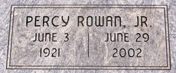
| Description | : | ******************************* Published Mar. 17, 2006 - Chanute, KS Catherine L. Rowan, 82, Chanute, Kansas, died Thursday, March 16, 2006, at Neosho Memorial Regional Medical Center, Chanute, Kansas. She was born July 31, 1923, in rural Altoona, Kansas, the daughter of Roy S. and Gladys (McDonald) Wiles. She grew up in the Altoona and Benedict areas, graduating from Benedict High School in 1940. On July 11, 1942, she married Percy Rowan Jr. He died June 29, 2002. She worked at the ASCS office in Fredonia, then was a homemaker and cashier at Olson's Grocery Store. |
frequently asked questions (FAQ):
-
Where is Catherine Louise Wiles Rowan's memorial?
Catherine Louise Wiles Rowan's memorial is located at: Circle Hill Cemetery, Sneads, Jackson County, USA.
-
When did Catherine Louise Wiles Rowan death?
Catherine Louise Wiles Rowan death on 16 Mar 2006 in Chanute, Neosho County, Kansas, USA
-
Where are the coordinates of the Catherine Louise Wiles Rowan's memorial?
Latitude: 30.8838330
Longitude: -84.9946330
Family Members:
Parent
Spouse
Siblings
Children
Flowers:
Nearby Cemetories:
1. Circle Hill Cemetery
Sneads, Jackson County, USA
Coordinate: 30.8838330, -84.9946330
2. Oak Grove Cemetery
Jackson County, USA
Coordinate: 30.8704780, -84.9922940
3. Bazzell Cemetery
Jackson County, USA
Coordinate: 30.8808002, -85.0289001
4. Macedonia Missionary Baptist Church Cemetery
Haynes, Jackson County, USA
Coordinate: 30.9185900, -84.9875720
5. Perkins
Two Egg, Jackson County, USA
Coordinate: 30.8832710, -85.0397280
6. Owens-Bellview Cemetery
Jackson County, USA
Coordinate: 30.8620540, -84.9567660
7. Lovedale Baptist Cemetery
Jackson County, USA
Coordinate: 30.8793180, -85.0436210
8. New Hope Freewill Baptist Church Cemetery
Jackson County, USA
Coordinate: 30.8505400, -85.0364400
9. Mathis Memorial Gardens
Grand Ridge, Jackson County, USA
Coordinate: 30.8338000, -85.0271500
10. Welcome Assembly Cemetery
Dellwood, Jackson County, USA
Coordinate: 30.8322850, -85.0273110
11. Cedar Grove Cemetery
Jackson County, USA
Coordinate: 30.9123500, -85.0553700
12. Sand Ridge Cemetery
Jackson County, USA
Coordinate: 30.8183002, -84.9916992
13. Northside Baptist Church Cemetery
Dellwood, Jackson County, USA
Coordinate: 30.8312300, -85.0524700
14. Gethsemane Church of Christ Written in Heaven
Greenwood, Jackson County, USA
Coordinate: 30.8982900, -85.0776300
15. Whiddon Cemetery
Jackson County, USA
Coordinate: 30.8174992, -84.9580994
16. Tipton Cemetery
Greenwood, Jackson County, USA
Coordinate: 30.8793000, -85.0802600
17. New Hope Missionary Baptist Church Cemetery
Two Egg, Jackson County, USA
Coordinate: 30.8553844, -85.0768306
18. Dellwood Methodist Church Cemetery
Jackson County, USA
Coordinate: 30.8242430, -85.0513830
19. Messer Cemetery
Dellwood, Jackson County, USA
Coordinate: 30.8241265, -85.0515140
20. Boone Family Cemetery
Hornsville, Jackson County, USA
Coordinate: 30.9623666, -85.0138330
21. Neel – Minchin Family Cemetery
Greenwood, Jackson County, USA
Coordinate: 30.8792330, -85.0895170
22. Dellwood Baptist Church Cemetery
Jackson County, USA
Coordinate: 30.8217690, -85.0570110
23. Cow Pen Pond Cemetery
Grand Ridge, Jackson County, USA
Coordinate: 30.7992001, -85.0119019
24. Cloud Cemetery
Dellwood, Jackson County, USA
Coordinate: 30.7981790, -85.0306610

