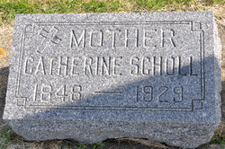
Catherine Stuermer Scholl
| Birth | : | 8 Oct 1848 Potosi, Grant County, Wisconsin, USA |
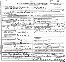
| Death | : | 12 Jan 1929 Rockwell, Cerro Gordo County, Iowa, USA |
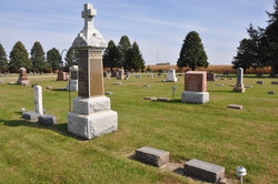
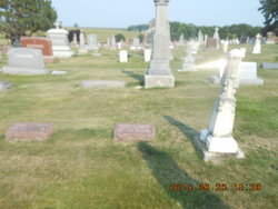
| Burial | : | Sacred Heart Cemetery, Rockwell, Cerro Gordo County, USA |
| Coordinate | : | 42.9592018, -93.1913986 |
| Description | : | Dau of Peter and Mary (Hull) Stuermer |
frequently asked questions (FAQ):
-
Where is Catherine Stuermer Scholl's memorial?
Catherine Stuermer Scholl's memorial is located at: Sacred Heart Cemetery, Rockwell, Cerro Gordo County, USA.
-
When did Catherine Stuermer Scholl death?
Catherine Stuermer Scholl death on 12 Jan 1929 in Rockwell, Cerro Gordo County, Iowa, USA
-
Where are the coordinates of the Catherine Stuermer Scholl's memorial?
Latitude: 42.9592018
Longitude: -93.1913986
Family Members:
Parent
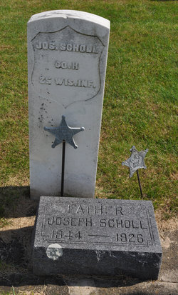
Spouse
Siblings
Children
Flowers:
Nearby Cemetories:
1. Sacred Heart Cemetery
Rockwell, Cerro Gordo County, USA
Coordinate: 42.9592018, -93.1913986
2. Rockwell Cemetery
Rockwell, Cerro Gordo County, USA
Coordinate: 42.9786000, -93.1919000
3. Hillside Cemetery
Sheffield, Franklin County, USA
Coordinate: 42.9006004, -93.2007980
4. Saint John Zion Cemetery
Sheffield, Franklin County, USA
Coordinate: 42.8969002, -93.1472015
5. Shobes Grove Cemetery
Franklin County, USA
Coordinate: 42.9000015, -93.2722168
6. Pleasant Valley Township Cemetery
Swaledale, Cerro Gordo County, USA
Coordinate: 42.9505615, -93.3216705
7. West Fork Cemetery
Franklin County, USA
Coordinate: 42.8918991, -93.0836029
8. Mount Vernon Cemetery
Mount Vernon Township, Cerro Gordo County, USA
Coordinate: 43.0374985, -93.3181000
9. Saint Patricks Catholic Cemetery
Dougherty, Cerro Gordo County, USA
Coordinate: 42.9227791, -93.0294418
10. Way Side Cemetery
Chapin, Franklin County, USA
Coordinate: 42.8293991, -93.2225037
11. Owens Grove Cemetery
Cerro Gordo County, USA
Coordinate: 43.0825005, -93.1144180
12. Richland Lutheran Cemetery
Thornton, Cerro Gordo County, USA
Coordinate: 42.9086113, -93.3683319
13. Pleasant View Cemetery
Thornton, Cerro Gordo County, USA
Coordinate: 42.9524994, -93.3897018
14. Old Chapin Cemetery
Chapin, Franklin County, USA
Coordinate: 42.8232994, -93.2624969
15. Zion Reformed Church Cemetery
Franklin County, USA
Coordinate: 42.8413887, -93.3188934
16. IOOF Cemetery
Mason City, Cerro Gordo County, USA
Coordinate: 43.1336975, -93.2139130
17. Elmwood Saint Joseph Cemetery
Mason City, Cerro Gordo County, USA
Coordinate: 43.1399994, -93.2067032
18. Saint Johns Episcopal Church Columbarium
Mason City, Cerro Gordo County, USA
Coordinate: 43.1528900, -93.1980730
19. First Congregational UCC Columbarium
Mason City, Cerro Gordo County, USA
Coordinate: 43.1529720, -93.1990410
20. Trinity Lutheran Cemetery
Hampton, Franklin County, USA
Coordinate: 42.7667007, -93.2518997
21. Memorial Park Cemetery
Mason City, Cerro Gordo County, USA
Coordinate: 43.1469002, -93.2936020
22. Hansell Cemetery
Franklin County, USA
Coordinate: 42.7666702, -93.1047211
23. Riverside Cemetery
Rockford, Floyd County, USA
Coordinate: 43.0578003, -92.9464035
24. Marion Center Cemetery
Latimer, Franklin County, USA
Coordinate: 42.7738991, -93.3178024

