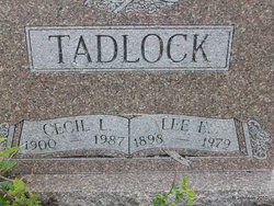
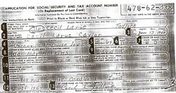
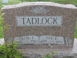
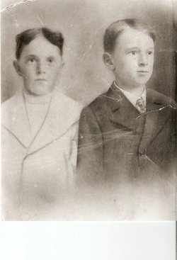
Cecil Larue Caylor Tadlock
| Birth | : | 13 Jan 1900 Unionville, Appanoose County, Iowa, USA |
| Death | : | 11 Aug 1987 Moravia, Appanoose County, Iowa, USA |
| Burial | : | Saint Wenceslaus Cemetery, Milladore, Wood County, USA |
| Coordinate | : | 44.6119003, -89.8550034 |
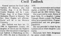
| Description | : | The Ad-Express Iowegian Wednesday, August 19, 1987 page 2a DEATHS Cecil Tadlock MORAVIA - Cecil LaRue Tadlock, 87, Sunset Village apt. 9, Moravia, died Aug. 11 at the Monroe County Hospital in Albia. She was born Jan. 13, 1900 near Unionville, Iowa to David and Ida May Hopkins Caylor. She married Lee Tadlock on Oct. 25, 1923 and he preceded her in death in 1979. She was a housewife and a school teacher. She is survived by one daughter, Lorene Tubaugh, Mystic; one son, Kenney Tadlock, Rock Falls, Ill.; seven grandchildren; ten great-grandchildren; one great-great grandchild and a sister, Osa Wood, Albia. Preceding her in death were her parents,... Read More |
frequently asked questions (FAQ):
-
Where is Cecil Larue Caylor Tadlock's memorial?
Cecil Larue Caylor Tadlock's memorial is located at: Saint Wenceslaus Cemetery, Milladore, Wood County, USA.
-
When did Cecil Larue Caylor Tadlock death?
Cecil Larue Caylor Tadlock death on 11 Aug 1987 in Moravia, Appanoose County, Iowa, USA
-
Where are the coordinates of the Cecil Larue Caylor Tadlock's memorial?
Latitude: 44.6119003
Longitude: -89.8550034
Family Members:
Flowers:
Nearby Cemetories:
1. Saint Wenceslaus Cemetery
Milladore, Wood County, USA
Coordinate: 44.6119003, -89.8550034
2. Union Cemetery
Milladore, Wood County, USA
Coordinate: 44.6091995, -89.8535995
3. Saint Kilian Cemetery
Blenker, Wood County, USA
Coordinate: 44.6140251, -89.9150467
4. Fairview Cemetery
Sherry, Wood County, USA
Coordinate: 44.5807991, -89.9250031
5. Saint Michael Cemetery
Junction City, Portage County, USA
Coordinate: 44.5943985, -89.7675018
6. Runkel Cemetery
Junction City, Portage County, USA
Coordinate: 44.6316986, -89.7613983
7. Buelow Cemetery
Junction City, Portage County, USA
Coordinate: 44.5987015, -89.7338028
8. Pierce-Grover Plot
Junction City, Portage County, USA
Coordinate: 44.5584400, -89.7421900
9. Greenwood Cemetery
Auburndale, Wood County, USA
Coordinate: 44.6232986, -90.0038986
10. Pioneers of Saint Marys Cemetery
Auburndale, Wood County, USA
Coordinate: 44.6413910, -90.0046480
11. Christian Reformed Cemetery
Vesper, Wood County, USA
Coordinate: 44.5113983, -89.9300003
12. Saint Marys Catholic Cemetery
Auburndale, Wood County, USA
Coordinate: 44.6292076, -90.0136871
13. Sacred Ground Cemetery
Dancy, Marathon County, USA
Coordinate: 44.7044000, -89.7572000
14. Bethany Lutheran Cemetery
Wisconsin Rapids, Wood County, USA
Coordinate: 44.4961900, -89.8842920
15. All Souls Cemetery
Rudolph, Wood County, USA
Coordinate: 44.5005074, -89.8009186
16. Saint Philip Catholic Cemetery
Rudolph, Wood County, USA
Coordinate: 44.4886017, -89.8285980
17. Saint Johns Lutheran Cemetery
Dancy, Marathon County, USA
Coordinate: 44.6928400, -89.7157900
18. North Arpin Cemetery
Arpin, Wood County, USA
Coordinate: 44.5691299, -90.0307465
19. North Auburndale Cemetery
Auburndale, Wood County, USA
Coordinate: 44.6678009, -90.0243988
20. Grace Lutheran Cemetery
Mosinee, Marathon County, USA
Coordinate: 44.7431300, -89.9072000
21. Auburndale Cemetery
Auburndale, Wood County, USA
Coordinate: 44.6335983, -90.0453033
22. Holy Rosary Cemetery
Wisconsin Rapids, Wood County, USA
Coordinate: 44.4706001, -89.8683014
23. Saint Bartholomew Church Cemetery
Stevens Point, Portage County, USA
Coordinate: 44.5393982, -89.6820984
24. First English Lutheran Cemetery
Wisconsin Rapids, Wood County, USA
Coordinate: 44.4635582, -89.8542557

