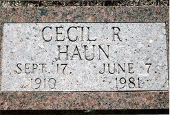
Cecil Ray Haun
| Birth | : | 17 Sep 1910 Springview, Keya Paha County, Nebraska, USA |
| Death | : | 7 Jun 1981 Ainsworth, Brown County, Nebraska, USA |
| Burial | : | Peace Lutheran Cemetery, Timken, Rush County, USA |
| Coordinate | : | 38.3837600, -99.0330750 |
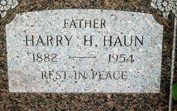
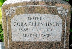
| Description | : | Cecil Ray Haun was born September 17, 1910, at Springview, Nebraska, the oldest son of Harry and Cora Emry Haun, and died suddenly on June 7, 1981. He received his education in the rural schools of Keya Paha County and grew to manhood working on the family far with his father and brothers. He was married to Mary Larsen, March 12, 1932 at White River, South Dakota, and to them three children were born. He moved with his family to the west coast in the 1940’s and worked in the logging industry in California and Oregon. On retirement he worked... Read More |
frequently asked questions (FAQ):
-
Where is Cecil Ray Haun's memorial?
Cecil Ray Haun's memorial is located at: Peace Lutheran Cemetery, Timken, Rush County, USA.
-
When did Cecil Ray Haun death?
Cecil Ray Haun death on 7 Jun 1981 in Ainsworth, Brown County, Nebraska, USA
-
Where are the coordinates of the Cecil Ray Haun's memorial?
Latitude: 38.3837600
Longitude: -99.0330750
Family Members:
Parent
Spouse
Siblings
Flowers:
Nearby Cemetories:
1. Peace Lutheran Cemetery
Timken, Rush County, USA
Coordinate: 38.3837600, -99.0330750
2. Saint Pauls Lutheran Cemetery
Albert, Barton County, USA
Coordinate: 38.3770000, -99.0005900
3. Patterson Cemetery
Barton County, USA
Coordinate: 38.4019012, -98.9963989
4. Albert Cemetery
Rush County, USA
Coordinate: 38.4213982, -99.0342026
5. Pioneer Cemetery
Rush County, USA
Coordinate: 38.4643160, -99.0680520
6. Clarence Township Cemetery
Heizer, Barton County, USA
Coordinate: 38.4052590, -98.9230600
7. Bergthal Mennonite Cemetery
Pawnee Rock, Barton County, USA
Coordinate: 38.3053017, -98.9772034
8. Everett Cemetery
Barton County, USA
Coordinate: 38.3767014, -98.9092026
9. Pawnee Rock Cemetery
Pawnee Rock, Barton County, USA
Coordinate: 38.2771988, -98.9858017
10. Pawnee Rock State Historic Site
Pawnee Rock, Barton County, USA
Coordinate: 38.2721800, -98.9815300
11. Saint Anthony Cemetery
Albert, Barton County, USA
Coordinate: 38.4996986, -98.9981003
12. Holy Cross Cemetery
Timken, Rush County, USA
Coordinate: 38.4603004, -99.1791992
13. Svatopluk Cemetery
Olmitz, Barton County, USA
Coordinate: 38.5221200, -99.0214100
14. Dundee Valley Cemetery
Great Bend, Barton County, USA
Coordinate: 38.3125130, -98.8778980
15. Bohemian Cemetery
Timken, Rush County, USA
Coordinate: 38.4441986, -99.1967010
16. Lutheran Cemetery
Otis, Rush County, USA
Coordinate: 38.5293999, -99.0699997
17. Otis Methodist Cemetery
Otis, Rush County, USA
Coordinate: 38.5367750, -99.0590490
18. Seventh Day Adventist Cemetery
Otis, Rush County, USA
Coordinate: 38.5224991, -99.1252975
19. Saint Anns Cemetery
Olmitz, Barton County, USA
Coordinate: 38.5224991, -98.9392014
20. Walnut Valley Cemetery
Barton County, USA
Coordinate: 38.4846992, -98.8675003
21. Ash Valley Cemetery
Pawnee County, USA
Coordinate: 38.2905998, -99.2174988
22. Otis Cemetery North
Otis, Rush County, USA
Coordinate: 38.5581910, -99.0514940
23. Baptist Cemetery
Bison, Rush County, USA
Coordinate: 38.5368996, -99.1521988
24. Great Bend Cemetery North
Barton County, USA
Coordinate: 38.3761800, -98.8019840


