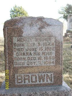
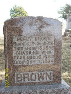
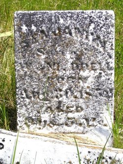
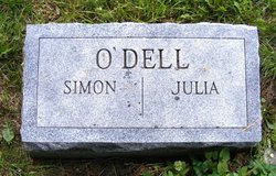
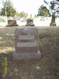
Chana O'Dell Brown
| Birth | : | 18 Dec 1846 Ray County, Missouri, USA |
| Death | : | 7 Oct 1894 Ray County, Missouri, USA |
| Burial | : | Shiloh Cemetery, Bowman, Orangeburg County, USA |
| Coordinate | : | 33.3982560, -80.7088270 |
frequently asked questions (FAQ):
-
Where is Chana O'Dell Brown's memorial?
Chana O'Dell Brown's memorial is located at: Shiloh Cemetery, Bowman, Orangeburg County, USA.
-
When did Chana O'Dell Brown death?
Chana O'Dell Brown death on 7 Oct 1894 in Ray County, Missouri, USA
-
Where are the coordinates of the Chana O'Dell Brown's memorial?
Latitude: 33.3982560
Longitude: -80.7088270
Family Members:
Parent
Spouse
Siblings
Children
Flowers:
Nearby Cemetories:
1. Shiloh Cemetery
Bowman, Orangeburg County, USA
Coordinate: 33.3982560, -80.7088270
2. Pineville Cemetery
Orangeburg County, USA
Coordinate: 33.4028015, -80.7110977
3. Shuler-Frederick Cemetery
Bowman, Orangeburg County, USA
Coordinate: 33.3839630, -80.7270120
4. Fair-Moorer Family Cemetery
Bowman, Orangeburg County, USA
Coordinate: 33.4026670, -80.6724670
5. Bowman Memorial Cemetery
Bowman, Orangeburg County, USA
Coordinate: 33.3631480, -80.6905160
6. Ruple Family Cemetery
Orangeburg, Orangeburg County, USA
Coordinate: 33.4221490, -80.7506650
7. Bethel United Methodist Church Cemetery
Bowman, Orangeburg County, USA
Coordinate: 33.4222920, -80.7576440
8. Forest Chapel United Methodist Church Cemetery
Orangeburg, Orangeburg County, USA
Coordinate: 33.4211770, -80.7585440
9. Shuler Cemetery
Four Holes, Orangeburg County, USA
Coordinate: 33.3832390, -80.6495220
10. New Mount Zion Cemetery
Bowman, Orangeburg County, USA
Coordinate: 33.3824997, -80.6493988
11. Mount Zion Baptist Churchyard
Bowman, Orangeburg County, USA
Coordinate: 33.3842590, -80.6389510
12. White House Methodist Church Cemetery
Orangeburg, Orangeburg County, USA
Coordinate: 33.4596000, -80.7178690
13. Pearson-Cain Family
Orangeburg, Orangeburg County, USA
Coordinate: 33.4579040, -80.7366370
14. Prospect United Methodist Church Cemetery
Rowesville, Orangeburg County, USA
Coordinate: 33.3437030, -80.7564130
15. Stroman Cemetery
Orangeburg, Orangeburg County, USA
Coordinate: 33.4605130, -80.7426100
16. Andrew Chapel Baptist Church Cemetery
Orangeburg, Orangeburg County, USA
Coordinate: 33.4671490, -80.7128550
17. Walnut Grove Baptist Church Cemetery
Orangeburg, Orangeburg County, USA
Coordinate: 33.4086720, -80.6266580
18. Hurger Family Cemetery
Bowman, Orangeburg County, USA
Coordinate: 33.3416340, -80.6596960
19. Sandel Cemetery
Orangeburg, Orangeburg County, USA
Coordinate: 33.4312750, -80.7828070
20. Pitthan V Cemetery
Bowman, Orangeburg County, USA
Coordinate: 33.4428690, -80.6426190
21. Myers Cemetery
Bowman, Orangeburg County, USA
Coordinate: 33.3829580, -80.6245540
22. Easterling Cemetery
Bowman, Orangeburg County, USA
Coordinate: 33.3537830, -80.6383910
23. Bowman Family Cemetery
Bowman, Orangeburg County, USA
Coordinate: 33.3265540, -80.6767090
24. Antioch Baptist Church Cemetery #1
Bowman, Orangeburg County, USA
Coordinate: 33.3308260, -80.6649660

