| Birth | : | 10 May 1885 Portland, Traill County, North Dakota, USA |
| Death | : | 1 Jul 1977 Custer County, Montana, USA |
| Burial | : | Boyes Cemetery, Carter County, USA |
| Coordinate | : | 45.3069000, -105.0025024 |
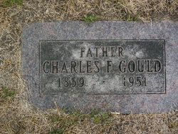
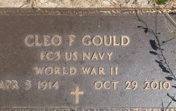
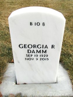
| Description | : | Charles Abner Gould was the son of Charles Francis Gould and Harriet Alzina "Hattie" Arnold. Charles married Mattie Emma Candill 15 Jan 1923 at Broadus, Powder River County, Montana. Charles and Mattie had children named Montana Belle, Francis Lorraine, Virginia, Daniel William, Georgia R., and Myrtle Jeanette, plus 3 others. |
frequently asked questions (FAQ):
-
Where is Charles Abner Gould's memorial?
Charles Abner Gould's memorial is located at: Boyes Cemetery, Carter County, USA.
-
When did Charles Abner Gould death?
Charles Abner Gould death on 1 Jul 1977 in Custer County, Montana, USA
-
Where are the coordinates of the Charles Abner Gould's memorial?
Latitude: 45.3069000
Longitude: -105.0025024
Family Members:
Parent
Spouse
Siblings
Children
Flowers:
Nearby Cemetories:
1. Boyes Cemetery
Carter County, USA
Coordinate: 45.3069000, -105.0025024
2. Drane Cemetery
Ridge, Carter County, USA
Coordinate: 45.0493990, -105.0167710
3. Ridge Cemetery
Carter County, USA
Coordinate: 45.0261002, -105.0346985
4. Ranch Creek Cemetery
Powder River County, USA
Coordinate: 45.0466995, -105.1782990
5. Valley View Cemetery
Broadus, Powder River County, USA
Coordinate: 45.4505997, -105.4011002
6. Rockypoint Cemetery
Rockypoint, Campbell County, USA
Coordinate: 44.9153000, -105.0859000
7. Ewalt Cemetery
Ridgeway, Carter County, USA
Coordinate: 45.4908333, -104.4786111
8. Broaddus Family Cemetery
Powder River County, USA
Coordinate: 45.2839849, -105.5906104
9. Powder River Memorial Cemetery
Broadus, Powder River County, USA
Coordinate: 45.2532799, -105.6266420
10. Boothill Cemetery
Powder River County, USA
Coordinate: 45.7592010, -105.1239014
11. Yarger Cemetery
Powder River County, USA
Coordinate: 45.2531013, -105.6691971
12. Trenk Family Plot
Ekalaka, Carter County, USA
Coordinate: 45.7325000, -104.7083333
13. Alzada Cemetery
Alzada, Carter County, USA
Coordinate: 45.0341988, -104.4182968
14. Twin Pine Cemetery
Sonnette, Powder River County, USA
Coordinate: 45.3665600, -105.8292100
15. New Haven Cemetery
New Haven, Crook County, USA
Coordinate: 44.7256012, -104.8242035
16. Moore Hill Cemetery
Crook County, USA
Coordinate: 44.7235985, -104.6731033
17. Keith Massey Gravesite
Crook County, USA
Coordinate: 44.8269900, -104.4208900
18. Powder River Battlefield Soldiers Monument
Powder River County, USA
Coordinate: 45.0977403, -105.8544210
19. Russell Cemetery
Carter County, USA
Coordinate: 45.8292007, -104.4681015
20. Little Missouri Lutheran Cemetery
Carter County, USA
Coordinate: 45.4186000, -104.0820000
21. Beaver Lodge Cemetery
Ekalaka, Carter County, USA
Coordinate: 45.8847008, -104.5522003
22. Pioneer Cemetery
Carter County, USA
Coordinate: 45.5859560, -104.1484850
23. Hulett Cemetery
Hulett, Crook County, USA
Coordinate: 44.6955986, -104.5867004
24. Capitol Cemetery
Capitol, Carter County, USA
Coordinate: 45.4294014, -104.0513992


