| Birth | : | 1 Oct 1913 Winneshiek County, Iowa, USA |
| Death | : | 27 Sep 1968 Madison, Dane County, Wisconsin, USA |
| Burial | : | Tongala Civil Cemetery, Tongala, Campaspe Shire, Australia |
| Coordinate | : | -36.2762850, 144.9658770 |
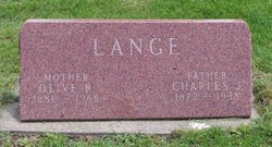
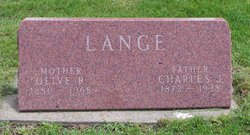
| Description | : | He died at University Hospital in Madison, after being injured in a gas explosion in Marquette. Name: Charles B. Lang Event Type: Birth Event Date: 01 Oct 1913 Event Place: Winneshiek, Iowa, United States Gender: Male Father's Name: Charles J. Lang Mother's Name: Olive R. Mapson Certificate Number: GS Film Number: 1026656 Digital Folder Number: 004284485 Image Number: 00519 |
frequently asked questions (FAQ):
-
Where is Charles Bernard Lange's memorial?
Charles Bernard Lange's memorial is located at: Tongala Civil Cemetery, Tongala, Campaspe Shire, Australia.
-
When did Charles Bernard Lange death?
Charles Bernard Lange death on 27 Sep 1968 in Madison, Dane County, Wisconsin, USA
-
Where are the coordinates of the Charles Bernard Lange's memorial?
Latitude: -36.2762850
Longitude: 144.9658770
Family Members:
Parent
Spouse
Siblings
Children
Flowers:
Nearby Cemetories:
1. Kyabram Cemetery
Kyabram, Campaspe Shire, Australia
Coordinate: -36.3143910, 145.0932750
2. Rochester Civil Cemetery
Rochester, Campaspe Shire, Australia
Coordinate: -36.3649180, 144.7241420
3. Echuca Cemetery
Echuca, Campaspe Shire, Australia
Coordinate: -36.1238400, 144.7352300
4. Moama Cemetery
Moama, Murray River Council, Australia
Coordinate: -36.1066320, 144.7480160
5. Tatura German Military Cemetery
Tatura, Greater Shepparton City, Australia
Coordinate: -36.4296960, 145.2045970
6. Tatura Cemetery
Tatura, Greater Shepparton City, Australia
Coordinate: -36.4305690, 145.2051850
7. Corop Cemetery
Corop, Campaspe Shire, Australia
Coordinate: -36.4540050, 144.7490280
8. Charlton Cemetery
Charlton, Buloke Shire, Australia
Coordinate: -36.3112971, 144.6592187
9. Wycheproof Lawn Cemetery
Wycheproof, Buloke Shire, Australia
Coordinate: -36.3112916, 144.6591560
10. Barmah Cemetery
Barmah, Moira Shire, Australia
Coordinate: -36.0084977, 144.9740604
11. Nathalia Public Cemetery
Nathalia, Moira Shire, Australia
Coordinate: -36.0632090, 145.2131510
12. Rushworth Cemetery
Rushworth, Campaspe Shire, Australia
Coordinate: -36.5839090, 145.0165020
13. Mooroopna Cemetery
Mooroopna, Greater Shepparton City, Australia
Coordinate: -36.3588380, 145.3404660
14. Old Rushworth Cemetery
Rushworth, Campaspe Shire, Australia
Coordinate: -36.5957800, 145.0208000
15. Shepparton War Cemetery
Shepparton, Greater Shepparton City, Australia
Coordinate: -36.3595810, 145.3673096
16. Shepparton Public Cemetery
Shepparton, Greater Shepparton City, Australia
Coordinate: -36.3590010, 145.3690740
17. Colbinabbin Cemetery
Colbinabbin, Campaspe Shire, Australia
Coordinate: -36.5951690, 144.8009210
18. Elmore Cemetery
Elmore, Greater Bendigo City, Australia
Coordinate: -36.4873470, 144.6016260
19. Toolamba Cemetery
Toolamba, Greater Shepparton City, Australia
Coordinate: -36.5156120, 145.3096740
20. Runnymede Cemetery
Bendigo, Greater Bendigo City, Australia
Coordinate: -36.5386890, 144.6283520
21. Whroo Cemetery
Whroo, Campaspe Shire, Australia
Coordinate: -36.6528100, 145.0270800
22. Wunghnu Civil Cemetery
Wunghnu, Moira Shire, Australia
Coordinate: -36.1593600, 145.4242200
23. Kialla West Cemetery
Kialla West, Strathbogie Shire, Australia
Coordinate: -36.4655440, 145.3917340
24. Murchison Cemetery
Murchison, Greater Shepparton City, Australia
Coordinate: -36.6267319, 145.2230377


