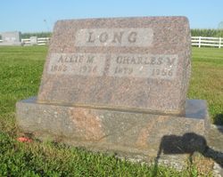
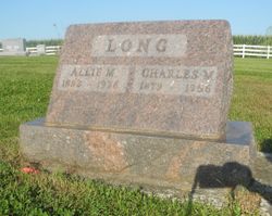
Charles Marion Long
| Birth | : | 29 Sep 1879 Nodaway County, Missouri, USA |
| Death | : | 7 Mar 1956 Nodaway County, Missouri, USA |
| Burial | : | Pine Grove Cemetery, Chatham, Alger County, USA |
| Coordinate | : | 46.3544006, -86.8871994 |
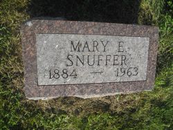
| Description | : | Son of Almoreen Long and Jennie Elizabeth Ward. Married to Allie Snuffer. |
frequently asked questions (FAQ):
-
Where is Charles Marion Long's memorial?
Charles Marion Long's memorial is located at: Pine Grove Cemetery, Chatham, Alger County, USA.
-
When did Charles Marion Long death?
Charles Marion Long death on 7 Mar 1956 in Nodaway County, Missouri, USA
-
Where are the coordinates of the Charles Marion Long's memorial?
Latitude: 46.3544006
Longitude: -86.8871994
Family Members:
Parent
Spouse
Siblings
Children
Nearby Cemetories:
1. Pine Grove Cemetery
Chatham, Alger County, USA
Coordinate: 46.3544006, -86.8871994
2. Au Train Township Cemetery
Au Train, Alger County, USA
Coordinate: 46.4322014, -86.8442001
3. Limestone Township Cemetery
Limestone, Alger County, USA
Coordinate: 46.2603570, -86.9283130
4. Trudell Burial Plot
Rock River, Alger County, USA
Coordinate: 46.4602000, -86.9373000
5. Mathias Township Cemetery
Trenary, Alger County, USA
Coordinate: 46.2019005, -86.9708023
6. Deerton Cemetery
Deerton, Alger County, USA
Coordinate: 46.4822006, -87.0428009
7. Maple Grove Cemetery
Munising, Alger County, USA
Coordinate: 46.3960991, -86.6339035
8. Riley Babies Burial Site
Munising, Alger County, USA
Coordinate: 46.3960700, -86.6311900
9. Munising Township Cemetery
Wetmore, Alger County, USA
Coordinate: 46.3758330, -86.6154380
10. Grand Island Cemetery
Grand Island Township, Alger County, USA
Coordinate: 46.4716060, -86.6567340
11. Indian Cemetery
Munising, Alger County, USA
Coordinate: 46.4724913, -86.6569384
12. Emanuel Lutheran Church Cemetery
Skandia, Marquette County, USA
Coordinate: 46.3530560, -87.2208330
13. Haglund Cemetery
Skandia Township, Marquette County, USA
Coordinate: 46.3857994, -87.2303009
14. United Methodist Church Cemetery
Skandia, Marquette County, USA
Coordinate: 46.3788872, -87.2408371
15. West Branch Township Cemetery
Marquette, Marquette County, USA
Coordinate: 46.3622017, -87.2782974
16. Saint Pauls Lutheran Cemetery
Green Garden, Marquette County, USA
Coordinate: 46.4350014, -87.2733002
17. Hillview Cemetery
McFarland, Marquette County, USA
Coordinate: 46.1803017, -87.2228012
18. Lathrop Cemetery
Maple Ridge Township, Delta County, USA
Coordinate: 46.1486110, -87.2252770
19. Riverside Seventh-day Adventist Church Cemetery
Rapid River, Delta County, USA
Coordinate: 46.0432535, -86.9953443
20. Dutch Mill Cemetery
Rapid River, Delta County, USA
Coordinate: 46.0431930, -86.9953650
21. Prince of Peace Lutheran Church Memorial Garden
Harvey, Marquette County, USA
Coordinate: 46.4898600, -87.3244940
22. Rock Cemetery
Maple Ridge Township, Delta County, USA
Coordinate: 46.0694440, -87.1836110
23. Maple Ridge Cemetery
Rock, Delta County, USA
Coordinate: 46.0638889, -87.1722222
24. Sands Township Cemetery
Sands, Marquette County, USA
Coordinate: 46.4233040, -87.4037080

