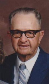
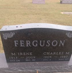
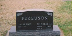
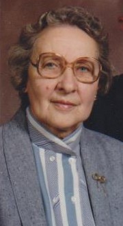
Charles Marvin Ferguson
| Birth | : | 4 Aug 1908 Adaza, Greene County, Iowa, USA |
| Death | : | 10 Mar 1987 Palmdale, Los Angeles County, California, USA |
| Burial | : | Highland Township Cemetery, Churdan, Greene County, USA |
| Coordinate | : | 42.1518310, -94.4699120 |
| Description | : | Charles Marvin Ferguson's family history starts with: "Elijah Ferguson migrated from Kentucky, spent some time in Illinois, then to Jones County Iowa, and Greene County in the Dana area. In 1890 he bought land one mile north of Adaza. This 120 acres was originally a grant to a drummer boy (Charles) who served in the Civil War. (pg 47) ... Charles Ferguson is featured in photo taken May 30, 1929 as one of the last four Civil War Veterans (pg 260). Charles married Sarah Weeks; had Carrie, who married Albert Beckwith, and Wilbur R. Charles Ferguson died... Read More |
frequently asked questions (FAQ):
-
Where is Charles Marvin Ferguson's memorial?
Charles Marvin Ferguson's memorial is located at: Highland Township Cemetery, Churdan, Greene County, USA.
-
When did Charles Marvin Ferguson death?
Charles Marvin Ferguson death on 10 Mar 1987 in Palmdale, Los Angeles County, California, USA
-
Where are the coordinates of the Charles Marvin Ferguson's memorial?
Latitude: 42.1518310
Longitude: -94.4699120
Family Members:
Spouse
Children
Flowers:
Nearby Cemetories:
1. Highland Township Cemetery
Churdan, Greene County, USA
Coordinate: 42.1518310, -94.4699120
2. Saint Patricks Cemetery
Churdan, Greene County, USA
Coordinate: 42.1605988, -94.5511017
3. Old Cedar Cemetery
Adaza, Greene County, USA
Coordinate: 42.1874821, -94.5419194
4. Dawson Cemetery
Paton, Greene County, USA
Coordinate: 42.1655998, -94.3283005
5. Evergreen Cemetery
Lohrville, Calhoun County, USA
Coordinate: 42.2505989, -94.5330963
6. Saint Joseph Cemetery
Lohrville, Calhoun County, USA
Coordinate: 42.2569008, -94.5119019
7. Gibson-Fleck-Thompson Cemetery
Scranton, Greene County, USA
Coordinate: 42.0428870, -94.4988800
8. Reading Cemetery
Farnhamville, Calhoun County, USA
Coordinate: 42.2593994, -94.4325027
9. Fair Oaks Cemetery
Scranton, Greene County, USA
Coordinate: 42.0355988, -94.4460983
10. Dillavou Cemetery
Kendrick Township, Greene County, USA
Coordinate: 42.0802994, -94.6138992
11. Wright Cemetery
Jefferson, Greene County, USA
Coordinate: 42.0228004, -94.4477997
12. Saint Joseph Cemetery
Jefferson, Greene County, USA
Coordinate: 42.0289001, -94.3818970
13. Scranton Township Cemetery
Scranton, Greene County, USA
Coordinate: 42.0306015, -94.5783005
14. Bishop Cemetery
Calhoun Township, Calhoun County, USA
Coordinate: 42.2230400, -94.6453190
15. Headley Cemetery
Jefferson, Greene County, USA
Coordinate: 42.0041504, -94.4335815
16. North Coon Cemetery
Carroll County, USA
Coordinate: 42.1260986, -94.6716995
17. Jefferson Cemetery
Jefferson, Greene County, USA
Coordinate: 42.0133018, -94.3591995
18. Paton Cemetery
Paton, Greene County, USA
Coordinate: 42.1624985, -94.2433014
19. Dickson Cemetery
Glidden Township, Carroll County, USA
Coordinate: 42.1074982, -94.6939011
20. Gowrie Township Cemetery
Gowrie, Webster County, USA
Coordinate: 42.2813988, -94.3043976
21. Lanesboro Cemetery
Lanesboro, Carroll County, USA
Coordinate: 42.1810989, -94.7230988
22. Cedar Cemetery
Rinard, Calhoun County, USA
Coordinate: 42.3456001, -94.4644012
23. Junction Township Cemetery
Grand Junction, Greene County, USA
Coordinate: 42.0236015, -94.2593994
24. Lost Grove Cemetery
Harcourt, Webster County, USA
Coordinate: 42.2583008, -94.2331009

