
| Birth | : | 30 Jan 1870 Lucas County, Iowa, USA |
| Death | : | 30 Mar 1961 Larned, Pawnee County, Kansas, USA |
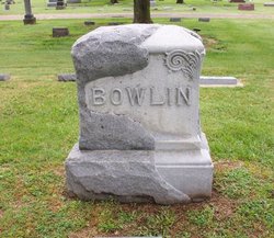
| Burial | : | Grant Evergreen Cemetery, Nemaha County, USA |
| Coordinate | : | 40.5065430, -96.0472250 |
| Description | : | Relationship: 1st cousin 3 times removed Charles was born in Lucas Co., Iowa the son of David M. Fudge & Eleanor Holmes Fudge Married Nettie Eleanor Blackwell Fudge in 1894. Obit - Tiller and Toiler, Larned, Kansas - Friday, March 31, 1961 Death of Chas. Fudge A Resident 58 Years Charles Robert E. Lee Fudge, 91, a resident of Larned 58 years, died yesterday afternoon in St. Joseph Memorial Hospital only a few hours after he was admitted. Mr. Fudge was born Jan 30, 1870, in Lucas County, Ill., came to Pawnee County 63 years ago. He was a carpenter.... Read More |
frequently asked questions (FAQ):
-
Where is Charles Robert Lee Fudge's memorial?
Charles Robert Lee Fudge's memorial is located at: Grant Evergreen Cemetery, Nemaha County, USA.
-
When did Charles Robert Lee Fudge death?
Charles Robert Lee Fudge death on 30 Mar 1961 in Larned, Pawnee County, Kansas, USA
-
Where are the coordinates of the Charles Robert Lee Fudge's memorial?
Latitude: 40.5065430
Longitude: -96.0472250
Family Members:
Parent
Spouse

Siblings
Children
Flowers:


Nearby Cemetories:
1. Grant Evergreen Cemetery
Nemaha County, USA
Coordinate: 40.5065430, -96.0472250
2. Fairview Cemetery
Talmage, Otoe County, USA
Coordinate: 40.5525017, -96.0102997
3. Saint Pauls Cemetery
Talmage, Otoe County, USA
Coordinate: 40.5448810, -95.9919480
4. Livingston Cemetery
Cook, Johnson County, USA
Coordinate: 40.5080986, -96.1235962
5. Mount Hope Church Cemetery
Cook, Johnson County, USA
Coordinate: 40.4775000, -96.1233000
6. Lafayette Cemetery
Brock, Nemaha County, USA
Coordinate: 40.5127983, -95.9543991
7. Schacht Cemetery
Otoe County, USA
Coordinate: 40.5447006, -96.1271973
8. Saint Johns Cemetery
Talmage, Otoe County, USA
Coordinate: 40.5820847, -96.0474625
9. Zion Lutheran Church Cemetery
Johnson, Nemaha County, USA
Coordinate: 40.4287000, -96.0099000
10. Saint Pauls Cemetery
Otoe County, USA
Coordinate: 40.5372330, -96.1524720
11. Johnson Cemetery
Johnson, Nemaha County, USA
Coordinate: 40.4142000, -96.0052300
12. Coryell Park Mausoleum
Johnson, Nemaha County, USA
Coordinate: 40.4371150, -95.9548690
13. Biggs Cemetery
Lorton, Otoe County, USA
Coordinate: 40.6025009, -96.0105972
14. Clifton Cemetery
Johnson, Nemaha County, USA
Coordinate: 40.4333000, -95.9563980
15. Cook Cemetery
Cook, Johnson County, USA
Coordinate: 40.5168991, -96.1797028
16. Grace Lutheran Church Cemetery
Cook, Johnson County, USA
Coordinate: 40.5178000, -96.1799500
17. Saint Matthews Lutheran Cemetery
Johnson, Nemaha County, USA
Coordinate: 40.4073060, -96.0086500
18. Saint Joseph Catholic Cemetery
Paul, Otoe County, USA
Coordinate: 40.5806530, -95.9339190
19. Spring Creek Cemetery
Johnson County, USA
Coordinate: 40.3992004, -96.1222000
20. Delaware Lutheran Cemetery
Otoe County, USA
Coordinate: 40.6244087, -96.0870438
21. Glenrock Cemetery
Glenrock, Nemaha County, USA
Coordinate: 40.4644012, -95.8764038
22. Linden Cemetery
Nemaha County, USA
Coordinate: 40.4216995, -95.9032974
23. Saint Frederick Cemetery
Johnson, Nemaha County, USA
Coordinate: 40.3671989, -96.0475006
24. Bloomingdale Cemetery
Otoe County, USA
Coordinate: 40.5685997, -95.8783035