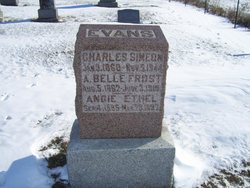
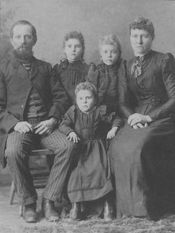
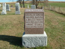
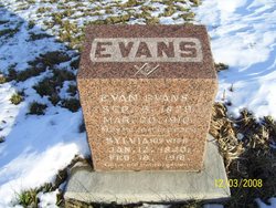
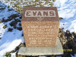
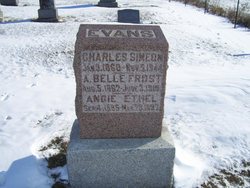
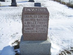
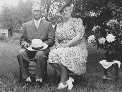
Charles Simeon Evans
| Birth | : | 3 Jan 1860 Iowa, USA |
| Death | : | 5 Nov 1944 Decatur County, Iowa, USA |
| Burial | : | St Mary the Virgin Churchyard, Deane, Metropolitan Borough of Bolton, England |
| Coordinate | : | 53.5688870, -2.4644850 |
| Plot | : | S9-12 |
| Description | : | In 1880 he and his parents, six siblings, and his paternal grandmother lived on a farm in Eden Township, Decatur County, IA. In 1900 he and his wife and their four children lived on a farm they owned, with a mortgage, in Center Township in the same county. In 1910 he and his wife and four children--all but Louise--lived there on the farm. Sylvia worked as a teacher in a country school. In 1920 he and three of his children, plus Eula's husband, lived on a farm they owned, mortgage free, in Garden Grove Township, Decatur County,... Read More |
frequently asked questions (FAQ):
-
Where is Charles Simeon Evans's memorial?
Charles Simeon Evans's memorial is located at: St Mary the Virgin Churchyard, Deane, Metropolitan Borough of Bolton, England.
-
When did Charles Simeon Evans death?
Charles Simeon Evans death on 5 Nov 1944 in Decatur County, Iowa, USA
-
Where are the coordinates of the Charles Simeon Evans's memorial?
Latitude: 53.5688870
Longitude: -2.4644850
Family Members:
Parent
Spouse
Children
Flowers:

Rest In Peace
Left by Anonymous on 04 Dec 2008
Left by Anonymous on 18 Jan 2021

May the Good Lord watch over you as you sleep on the clouds with Heavenly Angels
Left by Anonymous on 20 Apr 2021

Left by Anonymous on 24 May 2021

Rest In Peace
Left by Anonymous on 04 Dec 2008
Left by Anonymous on 18 Jan 2021

May the Good Lord watch over you as you sleep on the clouds with Heavenly Angels
Left by Anonymous on 20 Apr 2021

Left by Anonymous on 24 May 2021
Nearby Cemetories:
1. St Mary the Virgin Churchyard
Deane, Metropolitan Borough of Bolton, England
Coordinate: 53.5688870, -2.4644850
2. Heaton Cemetery
Bolton, Metropolitan Borough of Bolton, England
Coordinate: 53.5754163, -2.4577134
3. Overdale Crematorium
Bolton, Metropolitan Borough of Bolton, England
Coordinate: 53.5769730, -2.4636760
4. Emmanuel Churchyard
Bolton, Metropolitan Borough of Bolton, England
Coordinate: 53.5706840, -2.4423440
5. Christ Church Churchyard
Heaton, Metropolitan Borough of Bolton, England
Coordinate: 53.5803761, -2.4762482
6. Ebenezer Chapel Methodist New Connexion
Bolton, Metropolitan Borough of Bolton, England
Coordinate: 53.5740870, -2.4371760
7. Christ Church Cemetery
Bolton, Metropolitan Borough of Bolton, England
Coordinate: 53.5740218, -2.4370534
8. Refugees’ Chapel Chapelyard
Bolton, Metropolitan Borough of Bolton, England
Coordinate: 53.5775480, -2.4362800
9. St Peter's Churchyard
Halliwell, Metropolitan Borough of Bolton, England
Coordinate: 53.5912820, -2.4660020
10. Holy Trinity Churchyard
Bolton, Metropolitan Borough of Bolton, England
Coordinate: 53.5738021, -2.4267218
11. Ridgway Gates Wesleyan Methodist Chapel Chapelyard
Bolton, Metropolitan Borough of Bolton, England
Coordinate: 53.5805252, -2.4307708
12. Mawdsley Street Congregational Churchyard
Bolton, Metropolitan Borough of Bolton, England
Coordinate: 53.5766862, -2.4277304
13. St George Churchyard
Bolton, Metropolitan Borough of Bolton, England
Coordinate: 53.5821900, -2.4305880
14. Bridge Street Wesleyan Methodist Chapel
Bolton, Metropolitan Borough of Bolton, England
Coordinate: 53.5825197, -2.4285839
15. All Saints Churchyard
Bolton, Metropolitan Borough of Bolton, England
Coordinate: 53.5819700, -2.4271400
16. St Peter Churchyard
Bolton, Metropolitan Borough of Bolton, England
Coordinate: 53.5794060, -2.4235690
17. St. Paul's Churchyard
Halliwell, Metropolitan Borough of Bolton, England
Coordinate: 53.5955450, -2.4475770
18. Tonge Cemetery
Bolton, Metropolitan Borough of Bolton, England
Coordinate: 53.5782250, -2.4097050
19. Bolton Cemetery
Astley Bridge, Metropolitan Borough of Bolton, England
Coordinate: 53.5989150, -2.4370830
20. St. Michael Churchyard
Great Lever, Metropolitan Borough of Bolton, England
Coordinate: 53.5603730, -2.4082370
21. St Stephen and All Martyrs Churchyard
Bolton, Metropolitan Borough of Bolton, England
Coordinate: 53.5722100, -2.4049800
22. St Paul Churchyard
Astley Bridge, Metropolitan Borough of Bolton, England
Coordinate: 53.5996230, -2.4314330
23. St John the Evangelist Churchyard
Wingates, Metropolitan Borough of Bolton, England
Coordinate: 53.5616620, -2.5269400
24. Westhoughton Congregational Churchyard
Westhoughton, Metropolitan Borough of Bolton, England
Coordinate: 53.5474480, -2.5177360

