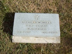
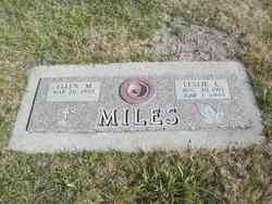
Charles W “Chick” Miles
| Birth | : | 7 Dec 1917 Elwood, Gosper County, Nebraska, USA |
| Death | : | 3 Aug 1995 Denver, Denver County, Colorado, USA |
| Burial | : | Sproat Cemetery, Dorr, Allegan County, USA |
| Coordinate | : | 42.7264060, -85.6822230 |
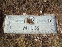
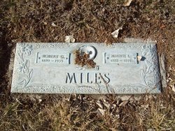
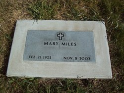
| Description | : | Charles "Chick" Miles, 77, of Fleming, died Thursday, Aug. 3, 1995, in Denver. Visitation will be from 2 to 5 p.m. Sunday, Aug. 6, at Chaney Walters Funeral Home. Funeral is 10:30 a.m., Monday, at Chaney Walters with the Revs. Mark Matney and Gary Miller officiating.. Graveside military rites will be conducted by Fleming VFW Post No. 7153 at Fleming Cemetery. Mr. Miles was born Dec. 7, 1917, to Robert and Minnie Roberts Miles in Elwood, Neb. He moved to Fleming in 1926 where he received his schooling. He graduated from Fleming High School in 1936. He married Mary Huss Sept. 18,... Read More |
frequently asked questions (FAQ):
-
Where is Charles W “Chick” Miles's memorial?
Charles W “Chick” Miles's memorial is located at: Sproat Cemetery, Dorr, Allegan County, USA.
-
When did Charles W “Chick” Miles death?
Charles W “Chick” Miles death on 3 Aug 1995 in Denver, Denver County, Colorado, USA
-
Where are the coordinates of the Charles W “Chick” Miles's memorial?
Latitude: 42.7264060
Longitude: -85.6822230
Family Members:
Parent
Spouse
Siblings
Flowers:
Nearby Cemetories:
1. Sproat Cemetery
Dorr, Allegan County, USA
Coordinate: 42.7264060, -85.6822230
2. Dorr Cemetery
Dorr, Allegan County, USA
Coordinate: 42.7253180, -85.7128210
3. Jones Cemetery
Dorr, Allegan County, USA
Coordinate: 42.7578011, -85.7130966
4. Saint Stanislaus Cemetery
Dorr, Allegan County, USA
Coordinate: 42.6818520, -85.7343220
5. Tanner Cemetery
Dorr, Allegan County, USA
Coordinate: 42.6955986, -85.7602997
6. Hooker Cemetery
Wayland, Allegan County, USA
Coordinate: 42.7061005, -85.5939026
7. Visitation Catholic Church Cemetery
Dorr Township, Allegan County, USA
Coordinate: 42.7678840, -85.7622740
8. Elmwood Cemetery
Wayland, Allegan County, USA
Coordinate: 42.6547012, -85.6427994
9. Weaver Cemetery
Byron Township, Kent County, USA
Coordinate: 42.8041992, -85.6828003
10. Saint Marys Catholic Church Cemetery of New Salem
Salem Township, Allegan County, USA
Coordinate: 42.7543900, -85.7883700
11. Gaines Cemetery
Cutlerville, Kent County, USA
Coordinate: 42.7976036, -85.6240311
12. Winegar Cemetery
Byron Center, Kent County, USA
Coordinate: 42.7933006, -85.7497025
13. Maplewood Cemetery
Hopkins, Allegan County, USA
Coordinate: 42.6394005, -85.7114029
14. Saint Sebastian Catholic Cemetery
Byron Center, Kent County, USA
Coordinate: 42.7944440, -85.7619440
15. Hill Cemetery
Wayland, Allegan County, USA
Coordinate: 42.6709750, -85.5833670
16. Barnes Burying Grounds
Wayland, Allegan County, USA
Coordinate: 42.6709700, -85.5833700
17. Lakeview Cemetery
Hopkins, Allegan County, USA
Coordinate: 42.6460991, -85.7608032
18. Winchester Cemetery
Byron Center, Kent County, USA
Coordinate: 42.8246994, -85.6980972
19. Saint Joseph Catholic Cemetery
Moline, Allegan County, USA
Coordinate: 42.7542130, -85.5466000
20. Kent Memorial Gardens
Byron Center, Kent County, USA
Coordinate: 42.8356018, -85.6883011
21. Round Andrews Cemetery
Hopkins, Allegan County, USA
Coordinate: 42.6163420, -85.6931110
22. Bradley Indian Mission Cemetery
Wayland, Allegan County, USA
Coordinate: 42.6203003, -85.6213989
23. Salem Township Cemetery
Burnips, Allegan County, USA
Coordinate: 42.7387910, -85.8390830
24. Saint Pauls Evangelical Lutheran Cemetery
Hopkins, Allegan County, USA
Coordinate: 42.6317960, -85.7805200

