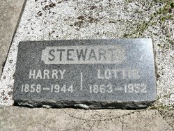
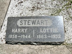
Charlotte “Lottie” Emerson Stewart
| Birth | : | 14 Jan 1863 California, USA |
| Death | : | 27 Mar 1952 San Joaquin County, California, USA |
| Burial | : | Root Prairie Lutheran Cemetery, Fountain, Fillmore County, USA |
| Coordinate | : | 43.7644386, -92.0861130 |
| Plot | : | Section 1 Row 12 Plot 06-C |
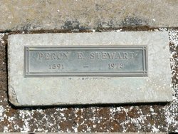
| Description | : | Mother of: * Percy Emerson Stewart 1891-1973 * William Noel Stewart 1900-1996 |
frequently asked questions (FAQ):
-
Where is Charlotte “Lottie” Emerson Stewart's memorial?
Charlotte “Lottie” Emerson Stewart's memorial is located at: Root Prairie Lutheran Cemetery, Fountain, Fillmore County, USA.
-
When did Charlotte “Lottie” Emerson Stewart death?
Charlotte “Lottie” Emerson Stewart death on 27 Mar 1952 in San Joaquin County, California, USA
-
Where are the coordinates of the Charlotte “Lottie” Emerson Stewart's memorial?
Latitude: 43.7644386
Longitude: -92.0861130
Family Members:
Spouse
Children
Flowers:
Nearby Cemetories:
1. Root Prairie Lutheran Cemetery
Fountain, Fillmore County, USA
Coordinate: 43.7644386, -92.0861130
2. Carrolton Cemetery
Fountain, Fillmore County, USA
Coordinate: 43.7322006, -92.0693970
3. Fountain Cemetery
Fountain, Fillmore County, USA
Coordinate: 43.7350006, -92.1196976
4. Gale Cemetery
Preston, Fillmore County, USA
Coordinate: 43.7008934, -92.1064606
5. Pilot Mound Cemetery
Pilot Mound, Fillmore County, USA
Coordinate: 43.8321991, -92.0400009
6. Winslow Methodist Episcopal Cemetery
Fountain, Fillmore County, USA
Coordinate: 43.7463989, -92.1877975
7. Saint Marys Cemetery
Chatfield, Fillmore County, USA
Coordinate: 43.8269005, -92.1493988
8. Pilot Mound Lutheran Cemetery
Pilot Mound, Fillmore County, USA
Coordinate: 43.8222656, -92.0144424
9. Bell Cemetery
Lanesboro, Fillmore County, USA
Coordinate: 43.7425003, -91.9811020
10. Saint Columbanus Cemetery
Preston, Fillmore County, USA
Coordinate: 43.6810000, -92.0749200
11. Watson Cemetery
Preston, Fillmore County, USA
Coordinate: 43.6885986, -92.1457977
12. Watson Creek Cemetery
Preston, Fillmore County, USA
Coordinate: 43.6880000, -92.1450000
13. Chatfield Cemetery
Chatfield, Fillmore County, USA
Coordinate: 43.8325005, -92.1714020
14. Minnesota State Veterans Cemetery
Preston, Fillmore County, USA
Coordinate: 43.6730200, -92.0666300
15. Calvary Cemetery
Chatfield, Fillmore County, USA
Coordinate: 43.8325005, -92.1735992
16. Saint Paul Lutheran Cemetery
Chatfield, Fillmore County, USA
Coordinate: 43.8339005, -92.1755981
17. Crown Hill Cemetery
Preston, Fillmore County, USA
Coordinate: 43.6669006, -92.0877991
18. Union Prairie Cemetery
Preston, Fillmore County, USA
Coordinate: 43.6805611, -92.0141678
19. Lanesboro Cemetery
Lanesboro, Fillmore County, USA
Coordinate: 43.7085991, -91.9713974
20. Saint Patricks Cemetery
Lanesboro, Fillmore County, USA
Coordinate: 43.7094383, -91.9697189
21. Greenwood Cemetery
Preston, Fillmore County, USA
Coordinate: 43.6638985, -92.0744019
22. Saint Pauls Norwegian Lutheran Cemetery
Preston, Fillmore County, USA
Coordinate: 43.6530200, -92.0796970
23. United Methodist Cemetery
Preston, Fillmore County, USA
Coordinate: 43.6525200, -92.0801160
24. Loughrey Cemetery
Fountain, Fillmore County, USA
Coordinate: 43.7757988, -92.2414017


