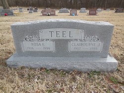
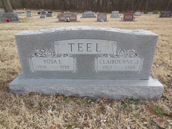
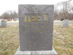
Claiborne Jackson Teel
| Birth | : | 3 Aug 1907 South West City, McDonald County, Missouri, USA |
| Death | : | 8 Nov 1985 Grove, Delaware County, Oklahoma, USA |
| Burial | : | Murrigal Cemetery, Murrigal, Cassowary Coast Region, Australia |
| Coordinate | : | -18.0636900, 145.9078100 |
| Description | : | The Joplin Globe, Sun., Nov 10, 1985 Claiborne Teel (Grove, Okla.)--Services for Claiborne Jackson "C.J." Teel, 78, who died Friday at his home in Rural Grove after an illness, will be at 1:30 p.m. Monday at the First Baptist Church. Officiating will be the Rev. Lewis Threeton, the Rev. Wayne Wall and the Rev. Dick Sanders. Burial will be in Southwest City (Mo.) Cemetery. Arrangements are under the direction of Worley Funeral Home. Grandsons will serve as pallbearers. Mr. Teel was born Aug. 3, 1907, near Southwest City. He was a member of the Whitewater Baptist Church, rural Grove.... Read More |
frequently asked questions (FAQ):
-
Where is Claiborne Jackson Teel's memorial?
Claiborne Jackson Teel's memorial is located at: Murrigal Cemetery, Murrigal, Cassowary Coast Region, Australia.
-
When did Claiborne Jackson Teel death?
Claiborne Jackson Teel death on 8 Nov 1985 in Grove, Delaware County, Oklahoma, USA
-
Where are the coordinates of the Claiborne Jackson Teel's memorial?
Latitude: -18.0636900
Longitude: 145.9078100
Family Members:
Parent
Spouse
Siblings
Children
Nearby Cemetories:
1. Murrigal Cemetery
Murrigal, Cassowary Coast Region, Australia
Coordinate: -18.0636900, 145.9078100
2. Tully Cemetery
Tully, Cassowary Coast Region, Australia
Coordinate: -17.9477480, 145.9189080
3. Tully New Lawn Cemetery
Tully, Cassowary Coast Region, Australia
Coordinate: -17.9462750, 145.9192930
4. Battle of the Coral Sea Memorial Park
Cardwell, Cassowary Coast Region, Australia
Coordinate: -18.2469620, 146.0149070
5. Cardwell Cemetery
Cardwell, Cassowary Coast Region, Australia
Coordinate: -18.2569140, 146.0115620
6. Bingil Bay Cutten Family Graves
Bingil Bay, Cassowary Coast Region, Australia
Coordinate: -17.8356410, 146.0984340
7. Garners Beach Burial Ground
Cassowary Coast Region, Australia
Coordinate: -17.8137000, 146.1016000
8. Cashmere Station Ruins and Cemetery
Kirrama, Tablelands Region, Australia
Coordinate: -18.1360174, 145.3409672
9. Innisfail Cemetery
Innisfail, Cassowary Coast Region, Australia
Coordinate: -17.5314390, 146.0275480
10. Ravenshoe General Cemetery
Ravenshoe, Tablelands Region, Australia
Coordinate: -17.6171470, 145.4737740
11. Johnson Family Cemetery
Trebonne, Hinchinbrook Shire, Australia
Coordinate: -18.6657193, 146.0157081
12. Millaa Millaa Cemetery
Millaa Millaa, Tablelands Region, Australia
Coordinate: -17.4970770, 145.6135390
13. Halifax Cemetery
Halifax, Hinchinbrook Shire, Australia
Coordinate: -18.5844780, 146.2876470
14. Old Ingham Cemetery
Ingham, Hinchinbrook Shire, Australia
Coordinate: -18.6682500, 146.1518800
15. Tumoulin Pioneer Cemetery
Tumoulin, Tablelands Region, Australia
Coordinate: -17.5771850, 145.4480840
16. New Ingham Cemetery
Ingham, Hinchinbrook Shire, Australia
Coordinate: -18.6707560, 146.1927830
17. Wairuna Homestead and Cemetery
Wairuna, Tablelands Region, Australia
Coordinate: -18.4469000, 145.3104000
18. Evelyn Cemetery
Ravenshoe, Tablelands Region, Australia
Coordinate: -17.4993310, 145.4494840
19. Gunnawarra Cemetery
Gunnawarra, Tablelands Region, Australia
Coordinate: -17.9366000, 145.1651000
20. Babinda Cemetery
Babinda, Cairns Region, Australia
Coordinate: -17.3256500, 145.9285280
21. Malanda Cemetery
Malanda, Tablelands Region, Australia
Coordinate: -17.3328840, 145.6398320
22. Coolgarra Cemetery
Tablelands Region, Australia
Coordinate: -17.5795780, 145.1990890
23. Mount Garnet Cemetery
Mount Garnet, Tablelands Region, Australia
Coordinate: -17.6841470, 145.1296110
24. Fantome Island Lazaret Cemetery
Fantome Island, Palm Island Shire, Australia
Coordinate: -18.6672600, 146.5132400

