Clair Daniel Boshart
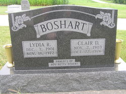
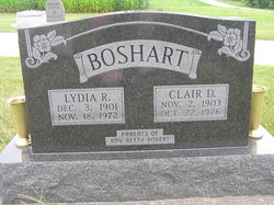
| Birth | : | 2 Nov 1903 Henry County, Iowa, USA |
| Death | : | Oct 1976 Maricopa County, Arizona, USA |
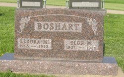
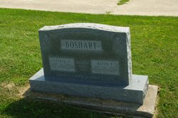
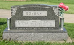
| Burial | : | Green Mound Cemetery, New Madison, Darke County, USA |
| Coordinate | : | 39.9627991, -84.7052994 |
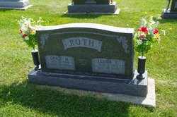
| Description | : | Gospel Herald - Volume 69, Number 45 - November 16, 1976; page 904 Boshart, Clair Daniel, son of Elmer T. and Martha (Nebel) Boshart, was born in Henry Co., Iowa, Nov. 2, 1903; died at his home at Mesa, Ariz.; aged 72 y. On Nov. 10, 1925, he was married to Lydia Ruth Wyse, who preceded him in death on Nov. 18, 1972. On Oct. 25, 1975, he was married to Freda Cossel, who survives. Also surviving are 2 sons (Roy William and Robert Dean), one daughter (Betty Lou ­ Mrs. Owen Roth), 3 brothers (Elon, Dennis, and Dillon), and... Read More |
frequently asked questions (FAQ):
-
Where is Clair Daniel Boshart's memorial?
Clair Daniel Boshart's memorial is located at: Green Mound Cemetery, New Madison, Darke County, USA.
-
When did Clair Daniel Boshart death?
Clair Daniel Boshart death on Oct 1976 in Maricopa County, Arizona, USA
-
Where are the coordinates of the Clair Daniel Boshart's memorial?
Latitude: 39.9627991
Longitude: -84.7052994
Family Members:
Parent
Spouse
Siblings
Children
Flowers:
Nearby Cemetories:
1. Green Mound Cemetery
New Madison, Darke County, USA
Coordinate: 39.9627991, -84.7052994
2. First Universalist Church Cemetery
New Madison, Darke County, USA
Coordinate: 39.9667280, -84.7058340
3. Harter Cemetery
New Madison, Darke County, USA
Coordinate: 39.9747009, -84.6949997
4. Wilt Cemetery
Darke County, USA
Coordinate: 39.9486008, -84.6992035
5. Yankeetown Cemetery
Yankeetown, Darke County, USA
Coordinate: 39.9356003, -84.7230988
6. Otterbein Cemetery
Otterbein, Darke County, USA
Coordinate: 39.9453270, -84.6705110
7. Mills Cemetery
New Madison, Darke County, USA
Coordinate: 39.9947014, -84.6797028
8. Providence Cemetery
Darke County, USA
Coordinate: 39.9347750, -84.7575290
9. Spencer Cemetery
New Madison, Darke County, USA
Coordinate: 39.9939600, -84.7616140
10. Clark Station Cemetery
Clark, Darke County, USA
Coordinate: 40.0147250, -84.7209360
11. Downing Cemetery
New Madison, Darke County, USA
Coordinate: 39.9915330, -84.7639610
12. Friendship Cemetery
Hollansburg, Darke County, USA
Coordinate: 39.9466667, -84.7783356
13. Cedar Grove Cemetery
Hollansburg, Darke County, USA
Coordinate: 39.9538879, -84.7874985
14. Wayne Lakes Cemetery
Fort Jefferson, Darke County, USA
Coordinate: 40.0156040, -84.6580110
15. Miller Homestead Gardens Cemetery
Hollansburg, Darke County, USA
Coordinate: 39.9524600, -84.7883640
16. Beech Grove Cemetery
Hollansburg, Darke County, USA
Coordinate: 40.0157000, -84.7570700
17. Old Castine Cemetery
Castine, Darke County, USA
Coordinate: 39.9383011, -84.6250000
18. Castine Cemetery
Castine, Darke County, USA
Coordinate: 39.9306050, -84.6210650
19. Beech Grove Cemetery
Arcanum, Darke County, USA
Coordinate: 39.9907800, -84.6180000
20. Oak Grove Cemetery
Fort Jefferson, Darke County, USA
Coordinate: 40.0233002, -84.6528015
21. Pioneer Cemetery
Fort Jefferson, Darke County, USA
Coordinate: 40.0272700, -84.6569000
22. Hollansburg Cemetery
Hollansburg, Darke County, USA
Coordinate: 39.9998398, -84.7895432
23. Railroad Cemetery
Castine, Darke County, USA
Coordinate: 39.9183410, -84.6244710
24. Saint John's Cemetery
Palestine, Darke County, USA
Coordinate: 40.0350000, -84.7447000

