
| Birth | : | Dec 1857 Wisconsin, USA |
| Death | : | 30 Jan 1930 Spokane, Spokane County, Washington, USA |
| Burial | : | Plains Cemetery, Plains, Sanders County, USA |
| Coordinate | : | 47.4728660, -114.8820000 |
| Plot | : | Section I2, Row 13, Grave 10 |
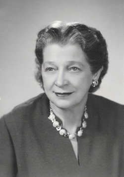
| Description | : | Clyde's Mother was Melissa A Crocker, daughter of Ezra & Sarah BLODGETT Crocker. Clarence Eugene "Clyde" Baker was born in Beaver Dam, Dodge County, Wisconsin in December 1857, and moved to Fremont, Dodge County, Nebraska, with his parents, Levi Baker Jr. and Melissa Crocker. In 1876, he and his brother, Frank, went to the Black Hills with a freight outfit. From there, he freighted through Wyoming, Idaho, and eastern Montana. In 1887, he moved to the Plains valley with his two brothers, Frank and James. In 1886, Clyde Baker married Clara Cole. Clara was born April... Read More |
frequently asked questions (FAQ):
-
Where is Clarence Eugene “Clyde” Baker's memorial?
Clarence Eugene “Clyde” Baker's memorial is located at: Plains Cemetery, Plains, Sanders County, USA.
-
When did Clarence Eugene “Clyde” Baker death?
Clarence Eugene “Clyde” Baker death on 30 Jan 1930 in Spokane, Spokane County, Washington, USA
-
Where are the coordinates of the Clarence Eugene “Clyde” Baker's memorial?
Latitude: 47.4728660
Longitude: -114.8820000
Family Members:
Parent

Spouse
Siblings
Children
Flowers:


Nearby Cemetories:
1. Plains Cemetery
Plains, Sanders County, USA
Coordinate: 47.4728660, -114.8820000
2. Lynch Family Cemetery
Plains, Sanders County, USA
Coordinate: 47.4560000, -114.8750000
3. Paradise Cemetery
Paradise, Sanders County, USA
Coordinate: 47.3864030, -114.7950910
4. Hominsto Cemetery
Sanders County, USA
Coordinate: 47.4623000, -114.6784000
5. Camas Prairie Cemetery
Sanders County, USA
Coordinate: 47.4319000, -114.6641998
6. Gingery Cemetery
Sanders County, USA
Coordinate: 47.3406000, -114.6917000
7. Maillet Cemetery
Hot Springs, Sanders County, USA
Coordinate: 47.6128006, -114.6772003
8. Markle Cemetery
Hot Springs, Sanders County, USA
Coordinate: 47.5732994, -114.6200027
9. Saint Regis Cemetery
Saint Regis, Mineral County, USA
Coordinate: 47.3058770, -115.0893880
10. Ventling Cemetery
Sanders County, USA
Coordinate: 47.6232986, -114.6466980
11. Superior Cemetery
Superior, Mineral County, USA
Coordinate: 47.2006410, -114.8899850
12. Murray Memorial Cemetery
Lonepine, Sanders County, USA
Coordinate: 47.7038994, -114.6335983
13. John Palmer Gravesite
Ninemile, Missoula County, USA
Coordinate: 47.2202210, -114.6454240
14. Thompson Falls Cemetery
Thompson Falls, Sanders County, USA
Coordinate: 47.5956950, -115.3271560
15. De Borgia Cemetery
De Borgia, Mineral County, USA
Coordinate: 47.3712650, -115.3386890
16. Fraternal Cemetery
Thompson Falls, Sanders County, USA
Coordinate: 47.5963000, -115.3365000
17. Wild Rose Cemetery
Thompson Falls, Sanders County, USA
Coordinate: 47.5964000, -115.3380000
18. Niarada Cemetery
Niarada, Flathead County, USA
Coordinate: 47.7895500, -114.6145560
19. McKay Cemetery
Sanders County, USA
Coordinate: 47.8013992, -114.6418991
20. Quartz Cemetery
Mineral County, USA
Coordinate: 47.0536040, -114.7771950
21. Dixon Cemetery
Dixon, Sanders County, USA
Coordinate: 47.3224983, -114.2913971
22. Saltese Cemetery
Saltese, Mineral County, USA
Coordinate: 47.4125000, -115.5152000
23. Messiah Cemetery
Tarkio, Mineral County, USA
Coordinate: 47.0532990, -114.6901016
24. Heller Gravesite
Shoshone County, USA
Coordinate: 47.0649986, -115.2174988