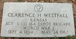
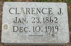
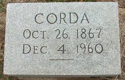
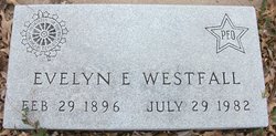
Clarence Howard Westfall
| Birth | : | 4 Sep 1894 Kansas, USA |
| Death | : | 24 May 1963 |
| Burial | : | Crown Hill Cemetery, Madison, Madison County, USA |
| Coordinate | : | 41.8171997, -97.4439011 |
| Inscription | : | Sgt. 1 Co. 164 Depot Brigade WWI |
| Description | : | Clarence H. Westfall and Evalyn (sic) E. Gillespie were married 20 Jul 1918 in Vancouver, Clark, WA. Source: Washington Marriage Records. |
frequently asked questions (FAQ):
-
Where is Clarence Howard Westfall's memorial?
Clarence Howard Westfall's memorial is located at: Crown Hill Cemetery, Madison, Madison County, USA.
-
When did Clarence Howard Westfall death?
Clarence Howard Westfall death on 24 May 1963 in
-
Where are the coordinates of the Clarence Howard Westfall's memorial?
Latitude: 41.8171997
Longitude: -97.4439011
Family Members:
Parent
Spouse
Siblings
Children
Flowers:
Nearby Cemetories:
1. Crown Hill Cemetery
Madison, Madison County, USA
Coordinate: 41.8171997, -97.4439011
2. Saint Leonards Cemetery
Madison, Madison County, USA
Coordinate: 41.8182983, -97.4464035
3. Barnes Reserve Cemetery
Madison, Madison County, USA
Coordinate: 41.8227500, -97.4582000
4. Pleasant Valley Cemetery
Madison County, USA
Coordinate: 41.8877983, -97.3972015
5. Tracy Valley Cemetery
Humphrey, Platte County, USA
Coordinate: 41.7214012, -97.4480972
6. Green Garden Cemetery
Madison County, USA
Coordinate: 41.8100014, -97.5796967
7. Zion Evangelical Cemetery
Madison, Madison County, USA
Coordinate: 41.8010000, -97.5793000
8. Fairview Cemetery
Madison County, USA
Coordinate: 41.8883018, -97.5622025
9. Fairview Cemetery
Creston, Platte County, USA
Coordinate: 41.7136002, -97.3506012
10. Humphrey Cemetery
Humphrey, Platte County, USA
Coordinate: 41.6963997, -97.4931030
11. Saint Francis Cemetery
Humphrey, Platte County, USA
Coordinate: 41.6921997, -97.4935989
12. Kalamazoo Cemetery
Madison County, USA
Coordinate: 41.7787000, -97.6195000
13. Norwegian Cemetery
Stanton, Stanton County, USA
Coordinate: 41.9171600, -97.2907160
14. Saint Pauls Lutheran Cemetery
Platte County, USA
Coordinate: 41.7425003, -97.6286011
15. Iowa Valley Cemetery
Madison County, USA
Coordinate: 41.8292007, -97.6588974
16. Sacred Heart Cemetery
Cornlea, Platte County, USA
Coordinate: 41.6808014, -97.5708008
17. Granville Cemetery
Cornlea, Platte County, USA
Coordinate: 41.6712450, -97.5542160
18. Allbery Cemetery
Norfolk, Madison County, USA
Coordinate: 41.9738998, -97.5246964
19. Osborn Cemetery
Madison County, USA
Coordinate: 41.8807983, -97.6528015
20. Creston Pioneer Cemetery
Platte County, USA
Coordinate: 41.6892014, -97.2917023
21. Saint Bernard Cemetery
Lindsay, Platte County, USA
Coordinate: 41.7155991, -97.6286011
22. Saint Mary of the Angels Cemetery
Humphrey, Platte County, USA
Coordinate: 41.6444000, -97.4584000
23. Erychleb Cemetery
Stanton County, USA
Coordinate: 41.8664017, -97.2138977
24. Evangelical Cemetery
Madison County, USA
Coordinate: 41.7625008, -97.6772003


