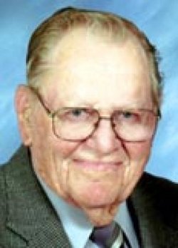
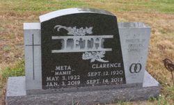
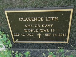
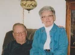
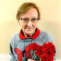
Clarence Leth
| Birth | : | 12 Sep 1920 Howard County, Nebraska, USA |
| Death | : | 14 Sep 2013 Saint Paul, Howard County, Nebraska, USA |
| Burial | : | Elmwood Cemetery, Saint Paul, Howard County, USA |
| Coordinate | : | 41.2002983, -98.4677963 |
| Description | : | Clarence Leth, died Saturday, Sept. 14, 2013, at Brookefield Park, St. Paul, Nebraska. Clarence was born September 12, 1920. Clarence was born on Sept. 12, 1920, in rural St. Paul, Nebraska the son of Christen Marius "Chris" and Selma (Hansen) Jorgensen Leth. Clarence was united in marriage to Meta F. "Mamie" Helzer, on June 6, 1942, at Glendale, California. Clarence attended Howard County (NE.) rural school District No. 55 and graduated from St. Paul (NE.) High School in 1936. He then worked for area farmers and with harvesting crews that traveled around to surrounding states. In 1941, he moved to California and... Read More |
frequently asked questions (FAQ):
-
Where is Clarence Leth's memorial?
Clarence Leth's memorial is located at: Elmwood Cemetery, Saint Paul, Howard County, USA.
-
When did Clarence Leth death?
Clarence Leth death on 14 Sep 2013 in Saint Paul, Howard County, Nebraska, USA
-
Where are the coordinates of the Clarence Leth's memorial?
Latitude: 41.2002983
Longitude: -98.4677963
Family Members:
Parent
Spouse
Siblings
Flowers:
Nearby Cemetories:
1. Elmwood Cemetery
Saint Paul, Howard County, USA
Coordinate: 41.2002983, -98.4677963
2. Warsaw Cemetery
Saint Paul, Howard County, USA
Coordinate: 41.1844400, -98.5575000
3. Canada Hill Methodist Episcopal Cemetery
Howard County, USA
Coordinate: 41.1843987, -98.5575027
4. Saint Wenceslaus Cemetery
Howard County, USA
Coordinate: 41.2056007, -98.5702972
5. Hamm Cemetery
Howard County, USA
Coordinate: 41.2933006, -98.4672012
6. Fairdale Cemetery
Howard County, USA
Coordinate: 41.2891998, -98.5152969
7. Elba Cemetery
Elba, Howard County, USA
Coordinate: 41.2764015, -98.5643997
8. Oak Ridge Cemetery
Dannebrog, Howard County, USA
Coordinate: 41.1138992, -98.5485992
9. Bohemian National Graveyard
Howard County, USA
Coordinate: 41.2492070, -98.5927620
10. Scotch Cemetery
Farwell, Howard County, USA
Coordinate: 41.1917000, -98.6130981
11. Czechoslovakia Cemetery
Farwell, Howard County, USA
Coordinate: 41.2132988, -98.6224976
12. Saint Josephs Cemetery
Elba, Howard County, USA
Coordinate: 41.2930984, -98.5746994
13. South Logan Cemetery
Howard County, USA
Coordinate: 41.3222100, -98.4352600
14. North Cemetery
Howard County, USA
Coordinate: 41.3222008, -98.4347000
15. Danish Lutheran Cemetery
Farwell, Howard County, USA
Coordinate: 41.2134660, -98.6336020
16. Nysted Cemetery
Nysted, Howard County, USA
Coordinate: 41.1307983, -98.6136017
17. Saint Anthony Catholic Cemetery
Farwell, Howard County, USA
Coordinate: 41.1845400, -98.6414700
18. Saint Libory Catholic Cemetery
Saint Libory, Howard County, USA
Coordinate: 41.0828700, -98.3569700
19. Spring Creek Cemetery
Cushing, Howard County, USA
Coordinate: 41.3314200, -98.3833300
20. Rose Hill Cemetery
Palmer, Merrick County, USA
Coordinate: 41.2256012, -98.2692032
21. Haggart Cemetery
Saint Libory, Howard County, USA
Coordinate: 41.0698500, -98.3547500
22. Kelso Cemetery
Howard County, USA
Coordinate: 41.1627998, -98.6707993
23. Fairdale Sunrise Cemetery
Elba, Howard County, USA
Coordinate: 41.3580000, -98.4887000
24. Swedish Pioneer Cemetery
Howard County, USA
Coordinate: 41.0910988, -98.6324997

