
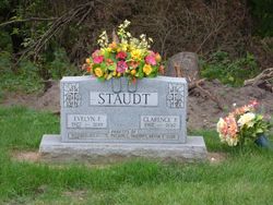
Clarence Peter Staudt
| Birth | : | 19 Dec 1912 |
| Death | : | 26 Aug 2012 Iowa, USA |
| Burial | : | Saint Marys Catholic Cemetery, Roseville, Floyd County, USA |
| Coordinate | : | 43.0090000, -92.8134000 |
| Description | : | Funeral Mass for Clarence Peter Staudt, 99, of Marble Rock, will be 10:30 a.m., Friday, August 31, 2012, at St. Mary's Catholic Church in Roseville with Rev. Msgr. Walter Brunkan presiding. Burial will be in the St. Mary's Catholic Cemetery, Roseville with Military Honors conducted by Straud-Gates Post 387 American Legion of Marble Rock. Friends may visit Thursday evening from 5-7 p.m. at St. Mary's school, Roseville, Rosary Service at 7 pm. Clarence, a long time resident of Marble Rock, was born on Dec. 19, 1912, to John and Anna (Yunk) Staudt and died peacefully Sunday evening, August 26, 2012, in his... Read More |
frequently asked questions (FAQ):
-
Where is Clarence Peter Staudt's memorial?
Clarence Peter Staudt's memorial is located at: Saint Marys Catholic Cemetery, Roseville, Floyd County, USA.
-
When did Clarence Peter Staudt death?
Clarence Peter Staudt death on 26 Aug 2012 in Iowa, USA
-
Where are the coordinates of the Clarence Peter Staudt's memorial?
Latitude: 43.0090000
Longitude: -92.8134000
Family Members:
Spouse

Flowers:


Nearby Cemetories:
1. Saint Marys Catholic Cemetery
Roseville, Floyd County, USA
Coordinate: 43.0090000, -92.8134000
2. Flood Creek Cemetery
Floyd County, USA
Coordinate: 43.0391998, -92.8538971
3. West Saint Charles United Methodist Cemetery
Floyd County, USA
Coordinate: 43.0580597, -92.7897186
4. Hillside Cemetery
Marble Rock, Floyd County, USA
Coordinate: 42.9583015, -92.8666992
5. Westside Cemetery
Marble Rock, Floyd County, USA
Coordinate: 42.9556007, -92.8739014
6. Pleasant Grove Cemetery
Powersville, Floyd County, USA
Coordinate: 42.9441986, -92.7446976
7. Ulsterville Cemetery
Ulster Township, Floyd County, USA
Coordinate: 43.0936012, -92.8842010
8. Riverside Cemetery
Rockford, Floyd County, USA
Coordinate: 43.0578003, -92.9464035
9. Riverside Cemetery
Charles City, Floyd County, USA
Coordinate: 43.0766983, -92.6881027
10. Calvary Cemetery
Charles City, Floyd County, USA
Coordinate: 43.0574989, -92.6594009
11. Sunnyside Memory Gardens
Charles City, Floyd County, USA
Coordinate: 43.0280991, -92.6457977
12. Oakwood Cemetery
Floyd, Floyd County, USA
Coordinate: 43.1178017, -92.7307968
13. Rose Hill Cemetery
Greene, Butler County, USA
Coordinate: 42.8843994, -92.7988968
14. Saint Marys Cemetery
Greene, Butler County, USA
Coordinate: 42.8827300, -92.7990200
15. Liggett Cemetery
Charles City, Floyd County, USA
Coordinate: 42.9583100, -92.6529700
16. Halls Grove Cemetery
Greene, Butler County, USA
Coordinate: 42.8840100, -92.8782300
17. Shannon Cemetery
Charles City, Floyd County, USA
Coordinate: 42.9366500, -92.6532000
18. Hardeman Cemetery
Greene, Butler County, USA
Coordinate: 42.8706017, -92.8013992
19. Brethren Cemetery
Greene, Butler County, USA
Coordinate: 42.8695500, -92.7909100
20. Rudd Evergreen Cemetery
Rudd, Floyd County, USA
Coordinate: 43.1417007, -92.9214020
21. Riverton Cemetery
Floyd County, USA
Coordinate: 42.9981003, -92.5994034
22. Nettleton Cemetery
Greene, Butler County, USA
Coordinate: 42.8438988, -92.7881012
23. Pleasant Hill Cemetery
Butler County, USA
Coordinate: 42.9067001, -92.6342010
24. Rock Grove Township Cemetery
Nora Springs, Floyd County, USA
Coordinate: 43.1227989, -92.9880981