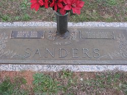
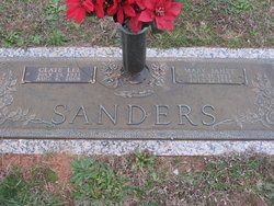
Clate Lee Sanders
| Birth | : | 29 Jul 1911 Anderson, Anderson County, South Carolina, USA |
| Death | : | 8 Aug 2008 Anderson, Anderson County, South Carolina, USA |
| Burial | : | South Burying Ground, Newton, Middlesex County, USA |
| Coordinate | : | 42.3173100, -71.2089500 |
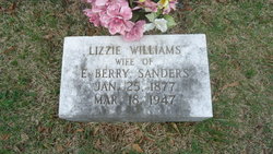
| Description | : | He was the son of the late Edward Berry Sanders and Lizzie Etta Williams Sanders. Widower of Mary Janet Jaynes Sanders. He was an associate of Orr Mills for many years and also worked with the Lowenstein Company, Lyman, SC in the Research and Development Department. He was a member of Orrville United Methodist Church where he served as Lay Leader, Church Steward, Sunday School Teacher for the Men's Bible Class and was a member of the Church Choir. With his wife, he had also served as the Church Custodian. He was former Scout Master of Boy Scout Troop No. 80. He... Read More |
frequently asked questions (FAQ):
-
Where is Clate Lee Sanders's memorial?
Clate Lee Sanders's memorial is located at: South Burying Ground, Newton, Middlesex County, USA.
-
When did Clate Lee Sanders death?
Clate Lee Sanders death on 8 Aug 2008 in Anderson, Anderson County, South Carolina, USA
-
Where are the coordinates of the Clate Lee Sanders's memorial?
Latitude: 42.3173100
Longitude: -71.2089500
Family Members:
Parent
Spouse
Siblings
Flowers:
Nearby Cemetories:
1. South Burying Ground
Newton, Middlesex County, USA
Coordinate: 42.3173100, -71.2089500
2. Newton Cemetery
Newton, Middlesex County, USA
Coordinate: 42.3333015, -71.2142029
3. East Parish Burying Ground
Newton, Middlesex County, USA
Coordinate: 42.3415200, -71.1920100
4. Saint Mary's Cemetery
Needham, Norfolk County, USA
Coordinate: 42.3075420, -71.2443850
5. Holyhood Cemetery
Brookline, Norfolk County, USA
Coordinate: 42.3215600, -71.1652400
6. Church of the Redeemer Memorial Garden
Chestnut Hill, Middlesex County, USA
Coordinate: 42.3298180, -71.1681010
7. New Palestine Cemetery
West Roxbury, Suffolk County, USA
Coordinate: 42.2907700, -71.1814500
8. Puritan Cemetery
West Roxbury, Suffolk County, USA
Coordinate: 42.2916900, -71.1798900
9. Kopaigorod Cemetery
West Roxbury, Suffolk County, USA
Coordinate: 42.2920200, -71.1793300
10. Shara Tfilo Cemetery
West Roxbury, Suffolk County, USA
Coordinate: 42.2921400, -71.1791400
11. Vilno Cemetery
West Roxbury, Suffolk County, USA
Coordinate: 42.2910500, -71.1803900
12. Crawford Street Memorial Park
West Roxbury, Suffolk County, USA
Coordinate: 42.2924000, -71.1780300
13. Mohliver Cemetery
West Roxbury, Suffolk County, USA
Coordinate: 42.2907200, -71.1806600
14. Temple Emeth Memorial Park
West Roxbury, Suffolk County, USA
Coordinate: 42.2907000, -71.1804700
15. Mount Lebanon Cemetery
West Roxbury, Suffolk County, USA
Coordinate: 42.2933830, -71.1763860
16. Lawrence Avenue Cemetery
West Roxbury, Suffolk County, USA
Coordinate: 42.2903800, -71.1809900
17. Beth El Cemetery
West Roxbury, Suffolk County, USA
Coordinate: 42.2928700, -71.1769800
18. Anshei Sfard Cemetery
West Roxbury, Suffolk County, USA
Coordinate: 42.2900400, -71.1814300
19. Imas-Roxbury Lodge Cemetery
West Roxbury, Suffolk County, USA
Coordinate: 42.2901500, -71.1812200
20. Or Emet Cemetery
West Roxbury, Suffolk County, USA
Coordinate: 42.2901600, -71.1810000
21. Hebrew Rehabilitation Center for Aged Cemetery
West Roxbury, Suffolk County, USA
Coordinate: 42.2901100, -71.1810800
22. Independent Workmens Circle Cemetery
West Roxbury, Suffolk County, USA
Coordinate: 42.2896800, -71.1818600
23. Staro Konstantinov Cemetery
West Roxbury, Suffolk County, USA
Coordinate: 42.2897900, -71.1815200
24. Quincy Hebrew Cemetery
West Roxbury, Suffolk County, USA
Coordinate: 42.2897300, -71.1816000

